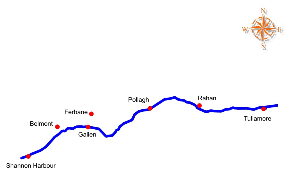
The line from Tullamore to the Shannon is known as the Brosna route. Last week we looked at it from the terminus at Shannon Harbour and followed Donal Boland’s well illustrated trip from the Shannon to Tullamore. The canal had reached Daingean in 1797 and Tullamore in 1798. It was then the terminus for six years with trade opened to Shannon Harbour in 1804 and fully in 1805. During that period the directors of the Grand Canal Company had considered three options for completing the canal to the Shannon:
1. To lock down into the River Brosna and continue as a river navigation.
2. To construct a canal alongside the Brosna.
3. To continue the canal on the same level to the south, with the possibility of an extension to Birr and the lock down steeply into the Shannon at Banagher.
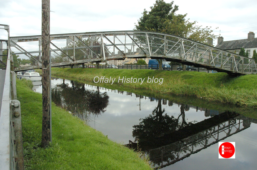
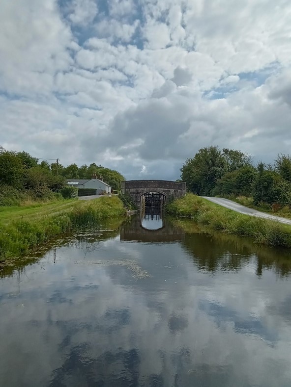
The commencement of the Brosna line at Tullamore was east of the Kilbeggan bridgeand close to the first canal warehouse on Bury Quay close by this footbridge of the 1930s to 2013.(more…)
The pioneering travel book on the Irish canals was Green and Silver (London, 1949) by L.T.C. Rolt. Tom Rolt made his voyage of discovery by motor cruiser in 1946 along the course of the Grand Canal, the Royal Canal and the Shannon navigation from Boyne to Limerick. The Delanys writing in 1966, considered Rolt’s book to be the most comprehensive dealing with the inland waterways of Ireland. [1] In this extract Banagher gets a severe press very unlike the optimism of the 1890-1914 period and again in the 1960s. Banagher also got a severe jolt post 2008. Things are now improving with sunlit uplands breaking through.
Moving off to Shannon Harbour Rolt got sight of the many arched bridges at Shannon Bridge and passed beneath the swinging span. See last week’s blog by Donal Boland covering the same trip in 2023 as far as Tullamore.
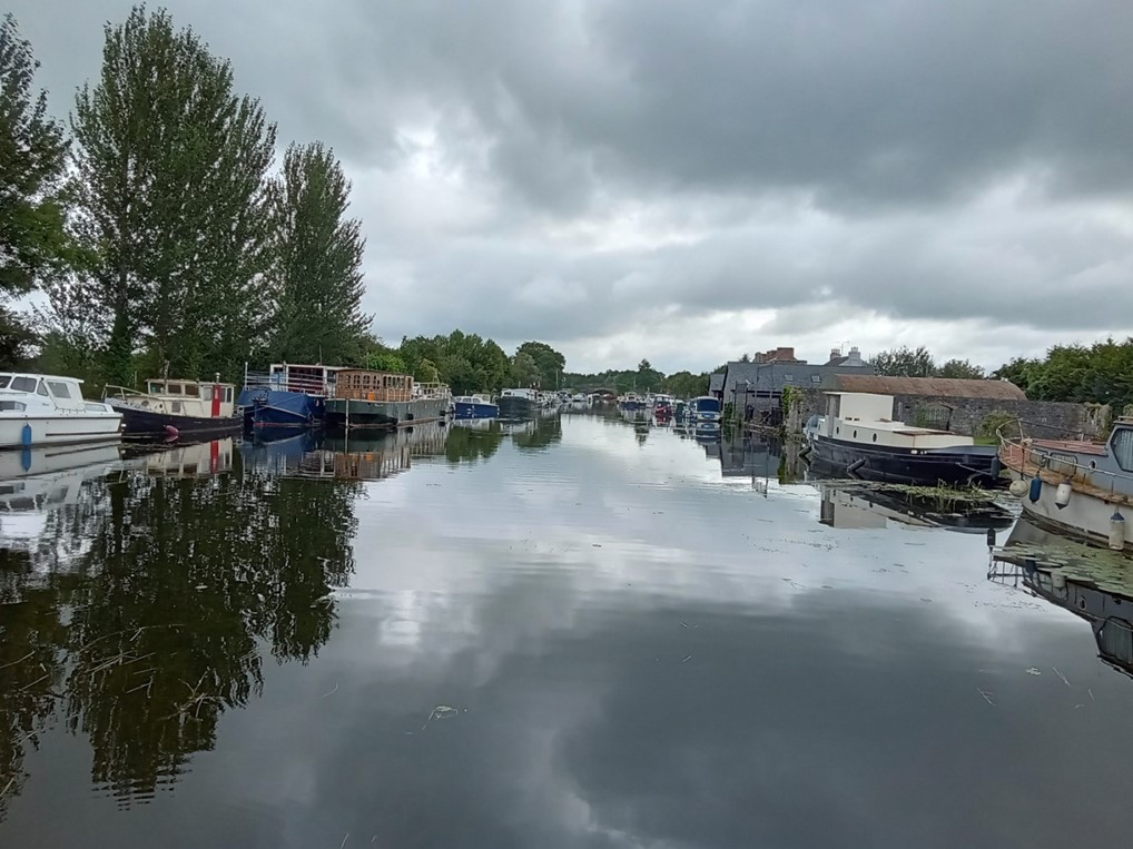
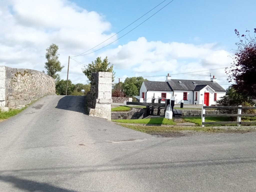
Shannon Harbour with the police barracks and the collector’s/agent’s house.
“Just below, was the Grand Canal depot with a canal boat lying alongside the quay. Opposite, and commanding the bridge was a gloomy fortress backed by a defensive wall of formidable proportions which extended westward like a grey comb along the crest of yet another of the green esker ridges. It was a symbol of the more peaceful times that have now come to the Shannon that, according to the signs displayed, part of the fortress had now become a village shop and bar.”[2]
A singlehanded trip from the River Shannon to the town of Tullamore along the western section of the Grand Canal was conducted by the writer over seven days in August, 2023. The trip was conducted aboard the heritage vessel Bomb Scow a converted thirty-three foot Royal Navy seaplane tender. Our thanks to Donal Boland for this comprehensive overview of the Brosna Line, Shannon Harbour to Tullamore which is better presented as one extensive with its helpful picture coverage. This comprises articles 6 to 10 in the series on Grand Canal Offaly.
Content
Overview
Entrance from the River Shannon
First Lock Number 36
Lock 36 to 35
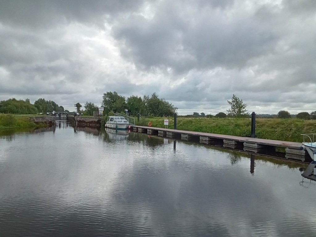
Lock 35 to 34 Shannon harbour
Lock 34 to 33 Clonony Barracks
Lock 33 Belmont…
Belmont to Tullamore
Memories
Appendix 1: Hull and Spoke Concept
Appendix 2: The Napoleonic Aspect
1. Overview
A singlehanded trip from the River Shannon to the town of Tullamore along the western section of the Grand Canal was conducted by the writer over seven days in August, 2023. The trip was conducted aboard the heritage vessel Bomb Scow a converted thirty-three foot Royal Navy seaplane tender.
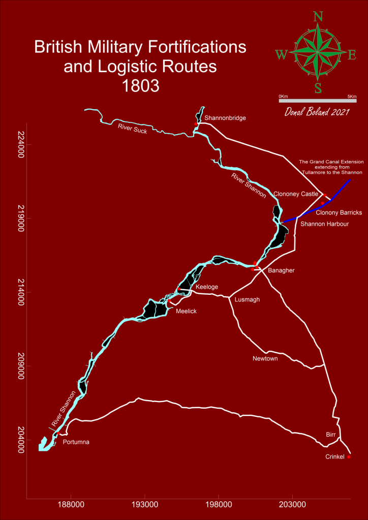
The trip, was a fact-finding event to record the on-water experience as part of an initiative to highlight the possibility of attracting more visitors to this section of the canal. Described here as The Grand Extension, previous research had revealed its construction was later than the eastern section of the canal and forming part of the British Militaries Napoleonic defensive network.
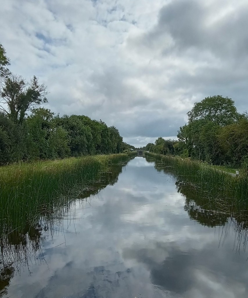
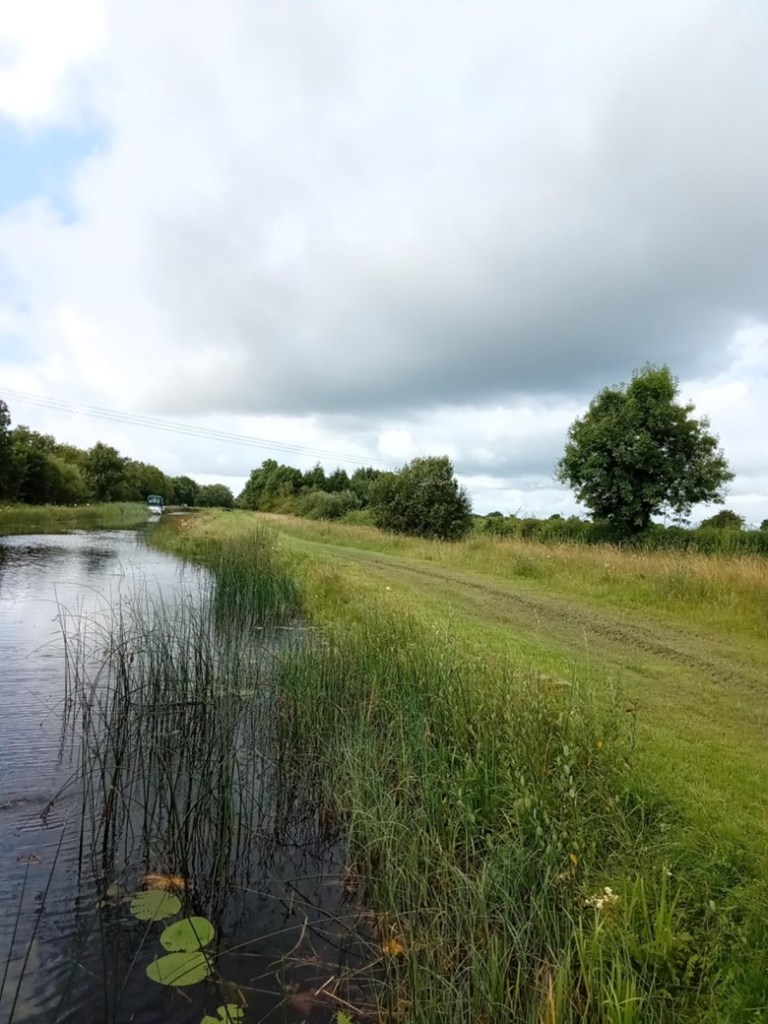
The route commenced in the west on the callow fringed landscape of the River Shannon, travelling through boglands on a raised section of the canal and terminating to the east in an Esker dominated upland landscape, encountering the villages of Shannon Harbour, Belmont, Ferbane, Pollagh, Rahan and the town of Tullamore.
The Stllwater Navigation extending for a distance of twenty two miles and rising some ninty feet is comprised historically of the waterway, ten locks, twenty bridges, eighteen aquaducts, four feeders and four spillways. Presently the waterway is managed by four lock keepers or waterway patrollers with overlapping areas of responsibility, who operate the lock systems and control the sections water levels.
The Grand Extension, Town and Villages The heritage vessel Bomb Scow moored on The Grand Extension
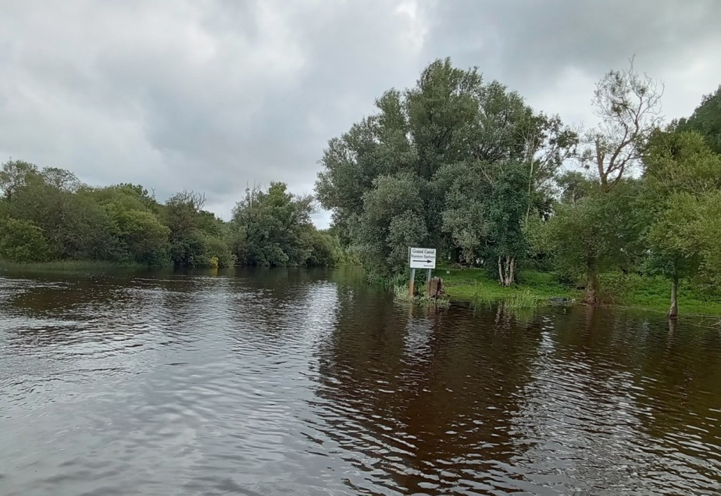
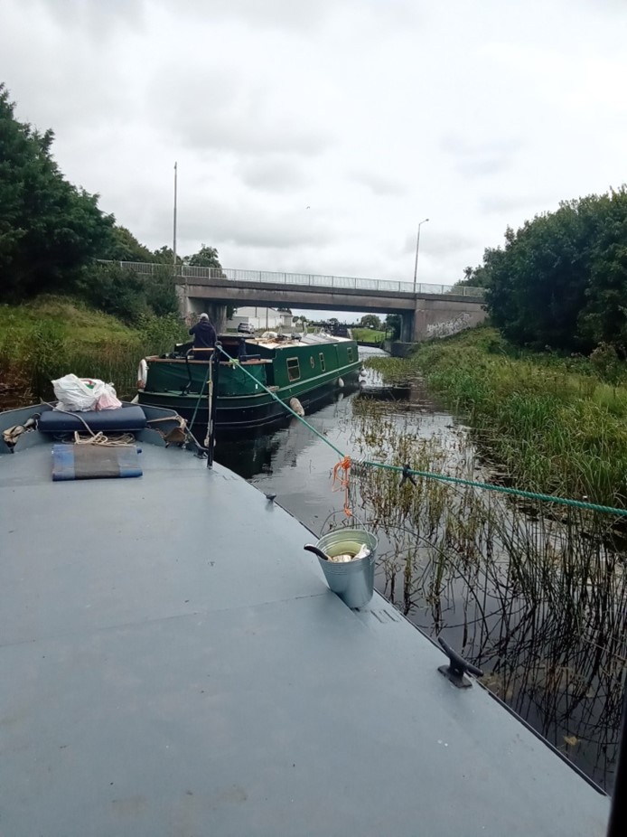
2. Entrance from the River Shannon
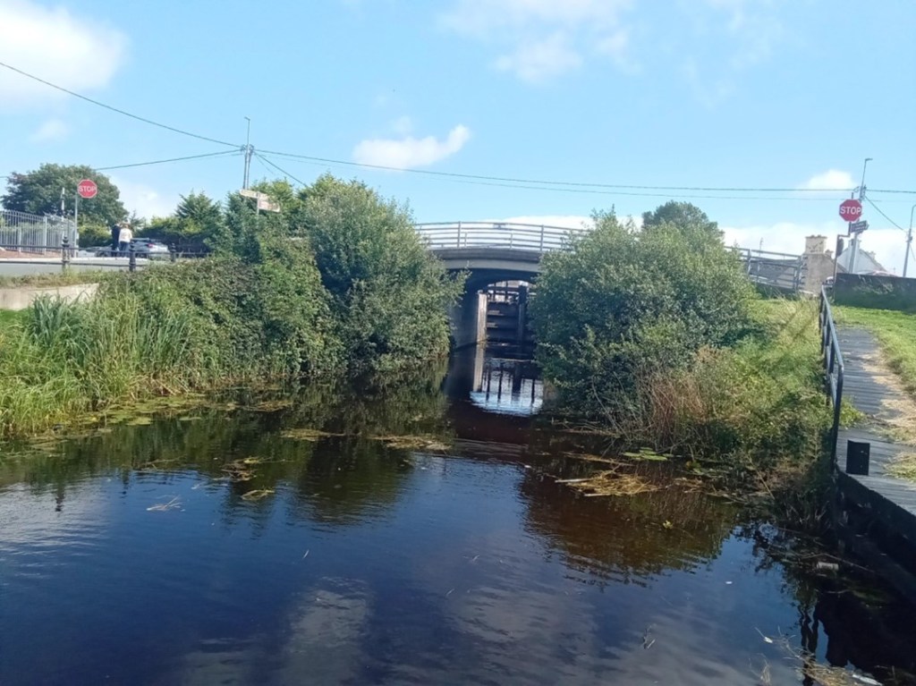
The Stillwater navigation of The Grand Extension is accessed from the River Shannon by way of the Brosna River and its confluence with the Shannon. This entrance is characterised by magnificent over-hanging foliage to the north and earthen banks associated with the canal’s construction to the south. An isolated, derelict bridge-keeper’s cottage that stands on Bullock Island is passed as you enter the River Brosna waterway.
The confluence of the River Brosna waterway with the River Shannon
The River Brosna waterway
The confluence of the River Brosna Waterway and The Grand Extension
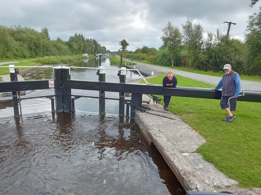
3. Lock Number 36
Lock 36 is the final, lowest lock on the Grand Canal system and the first lock you meet when arriving from the River Shannon. A long, floating jetty stands on the southern bank immediately below the lock, providing access to land by way of a large sloping ramp. The lock constructed of cut-stone is entered via wooden balanced, hanging gates that incorporate water control sluices, operated by the lock keeper utilising a rack and pinion mechanism mounted on the gates topside. The gates are opened and closed by way of the long balance beam that extends from each gate.
An engraved stone plaque mounted on the north wall of the lock, details the construction and features of the extension.
The entrance to Lock 36 and its large waiting jetty
The empty cut-stone lock chamber and wooden gates
The full lock chamber and upper-gates
The upper lock gates opened and the ever-attendant lock keeper
4. Lock 36 to 35
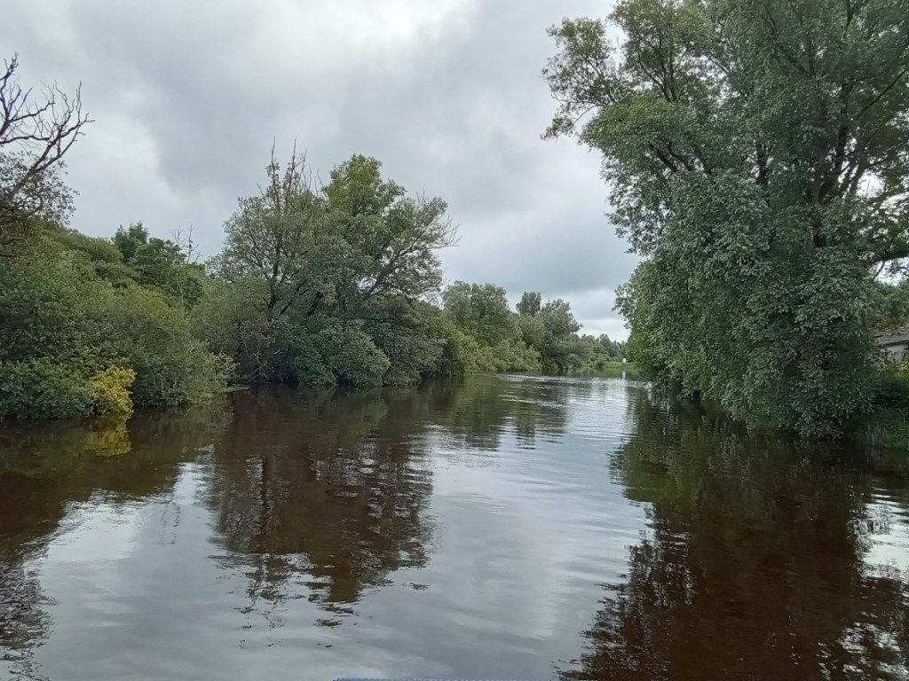
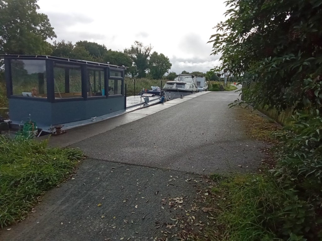
This short section of the canal provides an initial experience and understanding of the Stillwater navigation. It is many times narrower than the River Shannon with a defined navigation path bordered by moored vessels to the north and a rich reed-based ecosystem to the south.
Entering the first section of The Grand Extension
The short canal section extending from Lock 36 to Lock 35
Lock 35
5. Lock 35 to 34
The second, Lock 35 on the system, provides access from the first level up to the second level which is comprised of Shannon Harbour, Griffith and Clonony bridges and a section of canal extending to the thirty fourth lock that contains numerous moored vessels for most of its length The waterway beyond the moored vessels starts to provide an understanding of the true characteristics of this Stillwater navigation.
A feature of this canal is the construction of bridges and locks immediately adjacent to one another, this allowed for the transfer of horses (which were originally employed to pull barges along the navigation) from one towpath to the other.
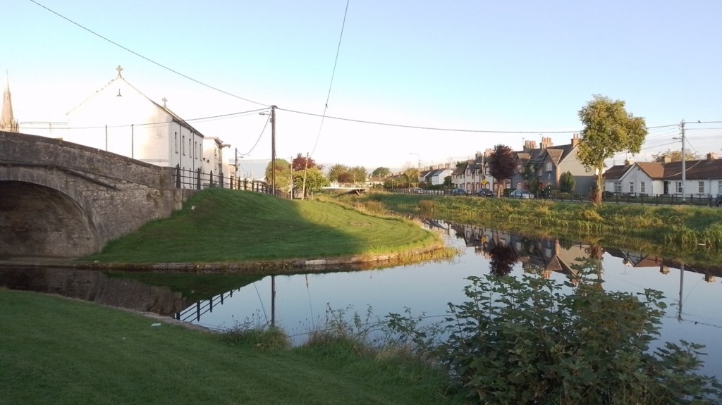
Entering Shannon Harbour
Shannon Harbour
The canal extending to Clonony Bridge and Lock 34
Clonony Bridge and Lock 34
6. Lock 34 to 33
The section of canal east of Lock 34 is best described as the military section as along its northern bank lies the remains of Clonony Military Barracks – most likely the military destination of the canal and the reason it was constructed swiftly. The military grounds are defined to the west by a wooden fence and metal gate and to the east by a long roadside timber fence. The towpath within the military grounds is substantially wider encompassing a lay-by or mooring area. Immediately east of the military grounds lies L’Estrange Bridge and Quay which was utilised by the L’Estrange family for commercial purposes possibly associated with the barracks.
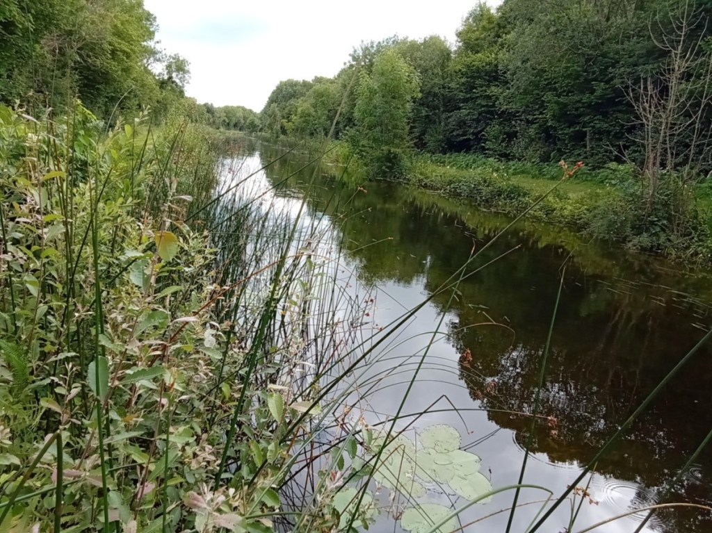
The canal beyond L’Estrange Bridge and Quay displays its mature natural character as a tranquil linear still-waterway navigation mostly devoid of habitation and humanity broken only by the arrival of Belmont Mill.
The Eastern and Western boundaries of the Military Lands
The lay-by and broader towpath within the Military Grounds
L’Estrange Bridge / Quay and Belmont Store
The magnificent natural features of The Grand Extension
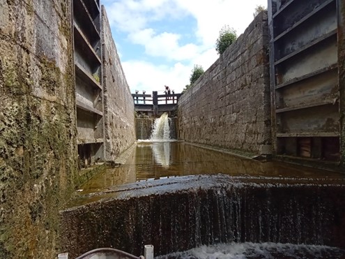
7. Lock 33
Lock 33 or Belmont Lock is the only double lock on the Grand Extension. A double lock is constructed when a high lift is required at a location. The standard lift for locks on the canal is circa eight feet while the lift a Belmont Lock is some fifteen feet. Transiting this lock is a delightful experience hard to describe and best experienced.
Belmont Mill and Lock
Lock 33 at Belmont
Filling the lower level
Filling and emerging from the upper level 8.Belmont to Tullamore
The canal extending east from Belmont Lock to Tullamore is best described as isolated continuous delightful for some and a horror for others. The mind may transition into a relaxed static state imbibing the natural landscape and the activities of inhabiting creatures or one may be bored to insanity. The architecture of the locks, bridges and associated buildings coupled with the relatively unchanged landscape propels one back in time to the period of the canal’s construction in the early eighteen hundreds. This relaxation is interspersed by interludes of surprise and delight when a bridge is encountered and frantic activity when locking from one level to another. The villages of Gallen/Ferbane, Pollagh and Rahan when encountered are a connection with present times providing basic mooring facilities. The town of Tullamore provides an opportunity for the replenishment of supplies and the possibility of fresh water. The facilities available to the canal traveller are sparse and presently reflect the industrial era of canal usage.
A simple water tap
The continuous Stillwater Navigation
A canal bridge endowed with generations of growth
Bell’s Bridge and Lock 32
Gallen Village, bridge and rest area
Gallen Village bankside mooring area
Pollagh Village and Canal-Side facilities
Lock 31
Lock 30 and the canal manager’s house.
The canal-side facilities at Rahan Village and the Thatch pub – a former Williams branch shop
Ballycowan Castle of 1626 and beside it the Huband aqueduct dated to 1803. Huband was a barrister and a director of the Canal Company from 1777 for most of the years to 1835.
Srah Castle, Bridge and and the railway bridge
Sragh Bridge and Lock 28
Entering Tullamore at the Clara Road Lock 29
The spur from the canal main line to Tullamore Harbour
The canal side facilities in Tullamore Town
9. Memories
Memories of this trip are especially positive
The waterway was weed free with a good water level
The courtesy and efficiency of the water patrollers was first class
The lock landings were in a good condition
The lock operating systems all worked well
The lock surrounds were neat and well maintained
The lock keeper’s cottages were a joy to behold
Canal-side moorings and services were adequate and of their time
The pioneering travel book on the Irish canals was Green and Silver (London, 1949) by L.T.C. Rolt (1910–74). Tom Rolt made his voyage of discovery by motor cruiser in 1946 along the course of the Grand Canal, the Royal Canal (fully open from Mullingar to the Shannon, until 1955 and thereafter from 2010), and the Shannon navigation from Boyne to Limerick (happily now navigable up to Lough Erne). The Delanys writing in 1966, considered Rolt’s book to be the most comprehensive dealing with the inland waterways of Ireland.[1]
During the 1940s, and up to the early 1970s the canal candle was flickering but was kept burning by enthusiasts in England and in Ireland. Among these were the late Vincent Delany and Ruth Delany whose book on the Irish Canals in 1966 was a seminal work. As pointed out in the Irish Times in November 1993 Ruth Delany is the most prolific author on the subject of the Irish canals and herself acknowledges that Green and Silver had a profound influence on her. Other writers were Hugh Malet and Colonel Harry Rice – the latter largely founded the Inland Waterways Association. In 1973 Ruth Delany extended the 1966 book with a full-scale study of the Grand Canal which was reissued in 1995 with an update on the previous twenty years.
Tom Rolt was born in Chester in 1910 and after working in engineering and with vintage cars he became a full-time writer in 1939. Some of his many books are shown in the attached illustrations while ‘his biographies of great engineers, such as Isambard Kingdom Brunel (1806-1859), are still highly regarded. As a campaigner, activist and champion of industrial heritage Rolt is best known for his involvement with the Inland Waterways Association, the Talyllyn Railway Preservation Society, the Newcomen Society, and the Association of Industrial Archaeology.’[2] On his marriage in 1939 to Angela Orred, daughter of a retired army major. They went to live on his house boat Cressy and in 1944 published Narrow Boat, a passionate evocation of the British canals and those who worked on them. His wife left him in 1951 to join the Billy Smart circus. Two very focused people.
This week we look at the background to the Vallancey report on the Offaly towns carried out in 1771 to facilitate the construction of the new Grand Canal line from Dublin to the Shannon. Vallancey was then a young engineer, employed to report to the Commissioners of Inland Navigation and his findings were published in a little known and very scarce pamphlet, AReport on the Grand Canal or Southern Line (Dublin 1771).[2] This report is useful as a window on some of the north King’s County (hereafter generally referred to as Offaly) towns and villages and all the more so because of the scarcity of published accounts of the midland towns prior to 1800.[3] The report was published in the same year as that of John Trail who was at the time employed by Dublin Corporation.[4] Vallancey was writing with a mission. He was being paid to spin the story of the benefits that would come from inland navigation and to highlight the difficulties with road transport and its adverse impact on competition and pricing of commodities so as to bolster the arguments in favour of canal construction and satisfy those who were paying his consultancy fees.
Why not contribute to our series of blog articles on the Grand Canal in Offaly – info@offalyhistory.com.
This month we begin a series of articles on the history and heritage of the Grand Canal in County Offaly that will run to upwards of 50 blog articles in 2024 and have its own platform on our website, http://www.offalyhistory.com. Our aim is to document the story of the course of the canal from the county boundary east of Edenderry to Shannon Harbour in the west. Today the Grand Canal is one of the greatest amenities that County Offaly possesses and we want to tell the story, and for readers to contribute by way of information and pictures. All the material will be open to be used on our website and the format will allow for editing to improve and to receive additional information from you the reader, which will be acknowledged. So Buen Camino as we make our journey through a quiet and well-watered land. The year 2024 marks the 120th anniversary of the completion of the Shannon Line at Shannon Harbour and may also see the completion of the canal greenway in this county.