Ireland’s peatlands have long been a defining feature of the country’s landscape and identity—vast, open expanses that have shaped communities, powered homes, and inspired generations. But in recent years, these peatlands have entered a new chapter. TRANSITION, a striking new photographic book, captures this moment of profound change with sensitivity and depth.
In 2019, a High Court ruling mandated that commercial peat harvesting on bogs over 30 hectares would now require planning permission. This shift accelerated the decline of industrial peat extraction, a process already underway as awareness grew of the ecological importance of peatlands. These landscapes, once seen primarily as fuel sources, are now recognised as vital carbon sinks and havens for biodiversity.
TRANSITION captures this story through objects in time – each one a tangible link to the past, a marker of the present, or a symbol of the future. Structured in a unique A–Z format, the book presents a curated collection of items that reflect the evolving relationship between people and peatlands. These objects are thoughtfully juxtaposed to highlight the dramatic changes in land use, environmental values, and cultural identity. Each item occupies a liminal space, bridging the industrial legacy of peat harvesting with the emerging ecological renewal.
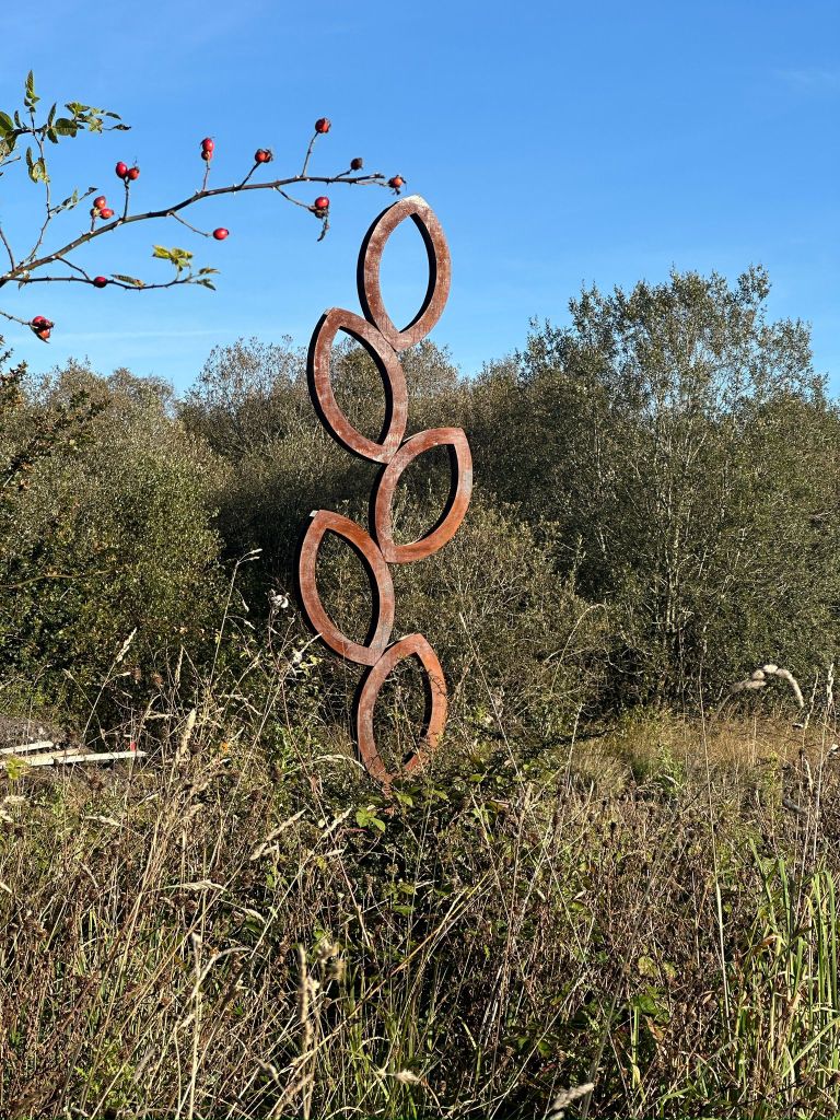
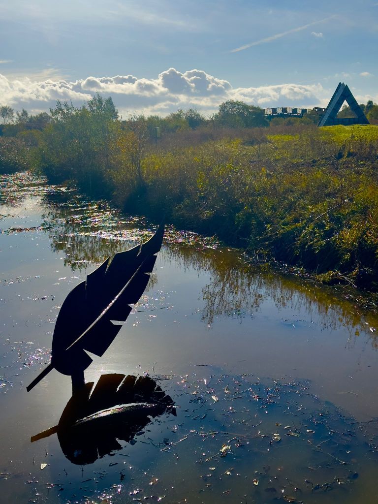
Two new sculptural works by artist Kevin O’Dwyer have been officially launched at Lough Boora Discovery Park, marking the first major additions to the park’s sculpture collection in over a decade. The works, titled Regeneration and Light as a Feather, reflect the park’s evolving story of transformation from industrial peatlands to a landscape of ecological restoration, culture and public enjoyment.
Regeneration draws inspiration from the seed as a symbol of renewal, growth, and cyclical change. Rising vertically from the ground, the work acknowledges the industrial history of the site while pointing toward its continued regeneration.
Light as a Feather offers a contrasting visual language — a suspended, airy form that engages with space, balance, stillness and the quiet expansiveness of Boora’s open horizon.
“Lough Boora is a place shaped by change, resilience and imagination,” said Kevin O’Dwyer. “These works are rooted in the landscape’s capacity to hold memory while continually becoming something new. O’Dwyer says it has been an honour to contribute to this next chapter in the park’s cultural and environmental renewal.”
News of a temporary exhibition at NLI Kildare Street, Dublin for February only
A new temporary exhibition at the National Library of Ireland explores the history of the Irish Bogs Commission and how its 19th-century maps are now shaping the future of Ireland’s peatlands.
Peatlands are among the world’s most vital carbon stores and play a crucial role in climate regulation. But when they’re drained, they lose their carbon sink potential and unique biodiversity and contribute to climate change. In Ireland, peatland drainage for agriculture and industry has shaped the landscape for centuries. Now, as part of national efforts to combat climate change, restoration of these ecosystems is a top priority.
Memories of Offaly can best be described as opening a diary into life in Co Offaly, over the last 50 or 60 years. The author of the book is Aidan Grennan, from Killina, Rahan. Aidan is to be congratulated on his second book. Both books are available from Offaly History Centre and online at http://www.offalyhistory.com
‘It is a nostalgic glimpse into the people and events in the county within my own life-time’ said Aidan. He commented: ‘I think it’s important now and then, to take a look-back over the years. I love nostalgia’, though we have to live in the present.
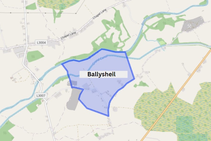
Ballysheil is in the Electoral Division of Gallen, in Civil Parish of Gallen, in the Barony of Garrycastle, in the County of Offaly. The Irish name for Ballysheil is Baile Uí Shiail meaning the town of O Siail.
In this area we come to two smaller bridges, not far part from each other. Glyn and Judge’s Bridge. You will find the remains of the old Ballysheil house, once a beautiful tall building that stood out for its unique stone work and design. Where it once called home to noble guests, where it saw a number of events over its time, which would have had servants pacing back and forth doing the bidding of lord and lady of the house[1]. You will also find a bawn here this property was owned by the Sheil family, well known for their medical skills. The house and bawn exchanged hands to new owners when the Sheil family were forcibly transplanted to Galway in the mid17th century. If looking around this area along the way, you may also find evidence of a corner tower[2].
Pollagh also spelt as Pullough, is located in a small village in County Offaly, it is in the Civil Parish of Lemanaghan. A small parish, it extends from Ballycumber to Ferbane. Pollagh village can be found on the north side of the canal. The Parish lies in the territory of Dealbhna Eathra of the MacCoghlans – an ancient people. It has a rich heritage in its archaeology including the important monastic site, churches, and ringforts and the famous castles.
One of The townlands that we come along as we work our way down the line is Pollagh, the name in Irish is Pollach, meaning Place full of Holes.
Townland
Area
Pop in 1841
Pop in 1851
No. of Houses in 1841
No. of Houses in 1851
Pop in 1871
Pop in 1911
No. of Houses in 1871
No. of Houses in 1911
Pollagh
907
267
168
43
33
282
223
42
50
An interesting profile in the fall and rise of the population due one assumes to the successful brick industry.
Rahan, Civil Parish is situated in the ancient O’Molloy territory of Fear Ceall meaning Men of the Woods or Men of the Churches. It is bounded on its north west side by the Brosna River. Its bedrock is Limestone and it has deposits of brick and clay along the Grand Canal.
The townlands from Ballydrohid, Tullamore to CornalaurBallindrinan Townland/ Image Source Townlands.ie
Its best know archaeological site is the Rahan Monastic Centre which was an area of great importance in the early Christian Period.
Townland: Ballindrinan is in the Electoral Division of Rahan, in Civil Parish of Rahan, in the Barony of Ballycowan, in the County of Offaly.
The Irish name for Ballindrinan is Baile an Draighneáin meaning land of the blackthorns.
There is an open invitation to all those interested in the River Brosna to come to the book launch on Friday 22 March at 7.30pm in The Star (GAA hall) River Street, Clara hosted by Clara Heritage Society.
John Feehan has dedicated much of his life to studying and communicating the evolution of the landscape and how we have lived in and changed it – his previous Offaly publications have included books on the Slieve Blooms, Croghan Hill, the Landscape of Clonmacnoise, An Atlas of Birr and more recently Killaun Bog and the Camcor River. This new publication focuses on the River Brosna and its catchment.
The River Brosna is one of Ireland’s hidden rivers, glimpsed over bridges and for short stretches as it travels through Mullingar, Ballinagore, Kilbeggan, Clara, Ballycumber and Ferbane on its journey from Lough Owel to ShannonHarbour. Until now very little has been written about it yet few rivers have a more fascinating and varied story to tell. In this beautifully illustrated book John Feehan brings his long experience as an environmental scientist and historian to bear on all aspects of the natural, cultural and industrial heritage of the river and its catchment. Successive chapters review geological origins, the biodiversity of the river and its tributaries as well as the great area of bogland it drains. The history of the mills along the course of the river, and of the two great arterial schemes that so altered the river are reviewed and particular attention is devoted to the extraordinary stories of Mesolithic Lough Boora and the Bronze Age Dowris hoard.
This article looks at the north Offaly towns featured in Major (later general) Vallancey’s report carried out in 1771 and designed to support the construction of the new Grand Canal line to Tullamore and the Shannon. Vallancey was then a young engineer, employed to report to the Commissioners of Inland Navigation and his findings were published in, AReport on the Grand Canal or Southern Line (Dublin 1771).[1] This report is useful as a window on some of the north King’s County (hereafter generally referred to as Offaly) towns and villages.[2]
A singlehanded trip from the River Shannon to the town of Tullamore along the western section of the Grand Canal was conducted by the writer over seven days in August, 2023. The trip was conducted aboard the heritage vessel Bomb Scow a converted thirty-three foot Royal Navy seaplane tender. Our thanks to Donal Boland for this comprehensive overview of the Brosna Line, Shannon Harbour to Tullamore which is better presented as one extensive with its helpful picture coverage. This comprises articles 6 to 10 in the series on Grand Canal Offaly.
Content
Overview
Entrance from the River Shannon
First Lock Number 36
Lock 36 to 35
Lock 35 to 34 Shannon harbour
Lock 34 to 33 Clonony Barracks
Lock 33 Belmont…
Belmont to Tullamore
Memories
Appendix 1: Hull and Spoke Concept
Appendix 2: The Napoleonic Aspect
1. Overview
A singlehanded trip from the River Shannon to the town of Tullamore along the western section of the Grand Canal was conducted by the writer over seven days in August, 2023. The trip was conducted aboard the heritage vessel Bomb Scow a converted thirty-three foot Royal Navy seaplane tender.
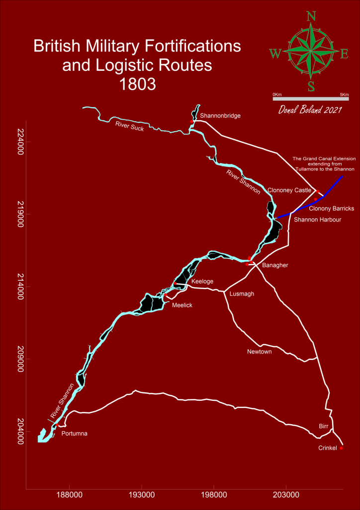
The trip, was a fact-finding event to record the on-water experience as part of an initiative to highlight the possibility of attracting more visitors to this section of the canal. Described here as The Grand Extension, previous research had revealed its construction was later than the eastern section of the canal and forming part of the British Militaries Napoleonic defensive network.
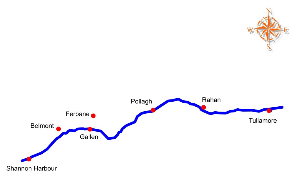
The route commenced in the west on the callow fringed landscape of the River Shannon, travelling through boglands on a raised section of the canal and terminating to the east in an Esker dominated upland landscape, encountering the villages of Shannon Harbour, Belmont, Ferbane, Pollagh, Rahan and the town of Tullamore.
The Stllwater Navigation extending for a distance of twenty two miles and rising some ninty feet is comprised historically of the waterway, ten locks, twenty bridges, eighteen aquaducts, four feeders and four spillways. Presently the waterway is managed by four lock keepers or waterway patrollers with overlapping areas of responsibility, who operate the lock systems and control the sections water levels.
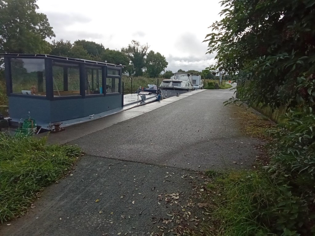
The Grand Extension, Town and Villages The heritage vessel Bomb Scow moored on The Grand Extension
2. Entrance from the River Shannon
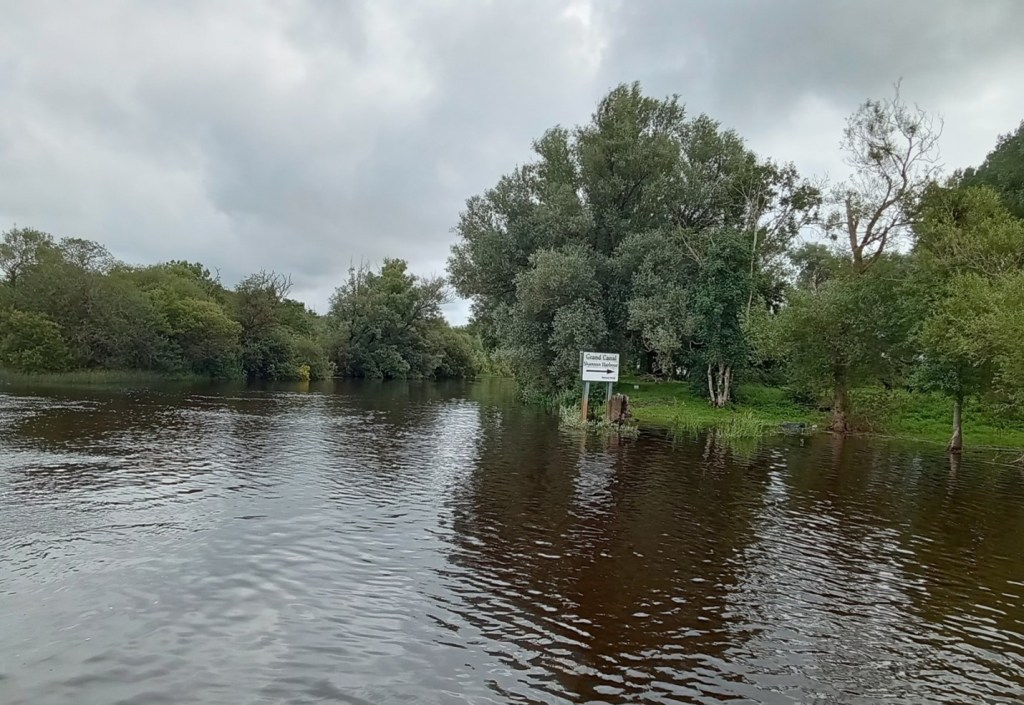
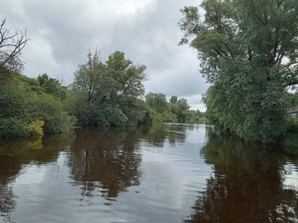
The Stillwater navigation of The Grand Extension is accessed from the River Shannon by way of the Brosna River and its confluence with the Shannon. This entrance is characterised by magnificent over-hanging foliage to the north and earthen banks associated with the canal’s construction to the south. An isolated, derelict bridge-keeper’s cottage that stands on Bullock Island is passed as you enter the River Brosna waterway.
The confluence of the River Brosna waterway with the River Shannon
The River Brosna waterway
The confluence of the River Brosna Waterway and The Grand Extension
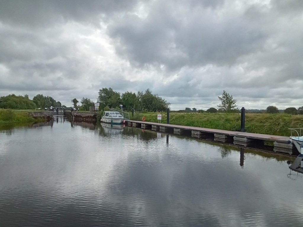
3. Lock Number 36
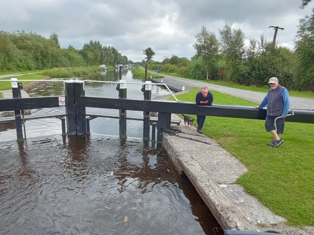
Lock 36 is the final, lowest lock on the Grand Canal system and the first lock you meet when arriving from the River Shannon. A long, floating jetty stands on the southern bank immediately below the lock, providing access to land by way of a large sloping ramp. The lock constructed of cut-stone is entered via wooden balanced, hanging gates that incorporate water control sluices, operated by the lock keeper utilising a rack and pinion mechanism mounted on the gates topside. The gates are opened and closed by way of the long balance beam that extends from each gate.
An engraved stone plaque mounted on the north wall of the lock, details the construction and features of the extension.
The entrance to Lock 36 and its large waiting jetty
The empty cut-stone lock chamber and wooden gates
The full lock chamber and upper-gates
The upper lock gates opened and the ever-attendant lock keeper
4. Lock 36 to 35
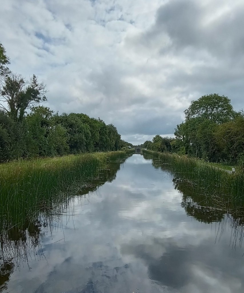
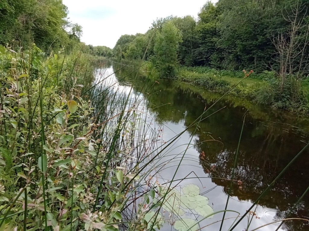
This short section of the canal provides an initial experience and understanding of the Stillwater navigation. It is many times narrower than the River Shannon with a defined navigation path bordered by moored vessels to the north and a rich reed-based ecosystem to the south.
Entering the first section of The Grand Extension
The short canal section extending from Lock 36 to Lock 35
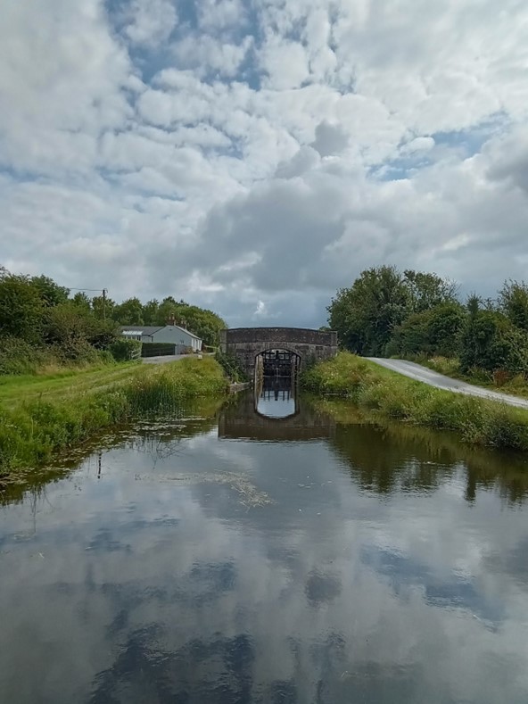
Lock 35
5. Lock 35 to 34
The second, Lock 35 on the system, provides access from the first level up to the second level which is comprised of Shannon Harbour, Griffith and Clonony bridges and a section of canal extending to the thirty fourth lock that contains numerous moored vessels for most of its length The waterway beyond the moored vessels starts to provide an understanding of the true characteristics of this Stillwater navigation.
A feature of this canal is the construction of bridges and locks immediately adjacent to one another, this allowed for the transfer of horses (which were originally employed to pull barges along the navigation) from one towpath to the other.
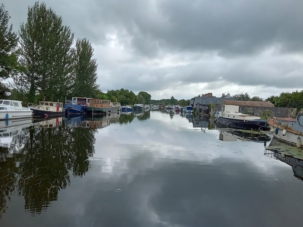
Entering Shannon Harbour
Shannon Harbour
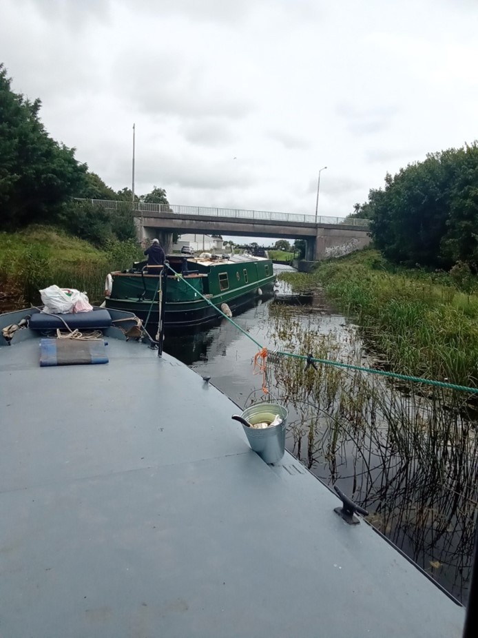
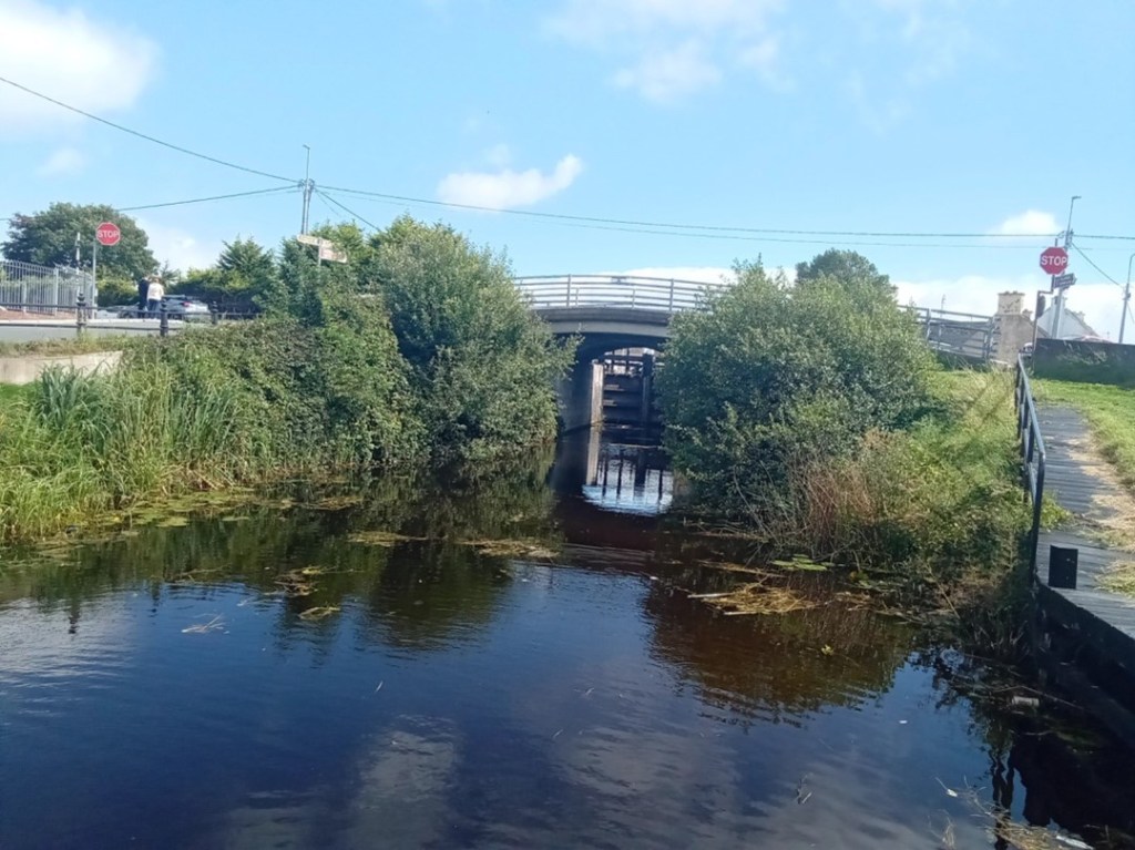
The canal extending to Clonony Bridge and Lock 34
Clonony Bridge and Lock 34
6. Lock 34 to 33
The section of canal east of Lock 34 is best described as the military section as along its northern bank lies the remains of Clonony Military Barracks – most likely the military destination of the canal and the reason it was constructed swiftly. The military grounds are defined to the west by a wooden fence and metal gate and to the east by a long roadside timber fence. The towpath within the military grounds is substantially wider encompassing a lay-by or mooring area. Immediately east of the military grounds lies L’Estrange Bridge and Quay which was utilised by the L’Estrange family for commercial purposes possibly associated with the barracks.
The canal beyond L’Estrange Bridge and Quay displays its mature natural character as a tranquil linear still-waterway navigation mostly devoid of habitation and humanity broken only by the arrival of Belmont Mill.
The Eastern and Western boundaries of the Military Lands
The lay-by and broader towpath within the Military Grounds
L’Estrange Bridge / Quay and Belmont Store
The magnificent natural features of The Grand Extension
7. Lock 33
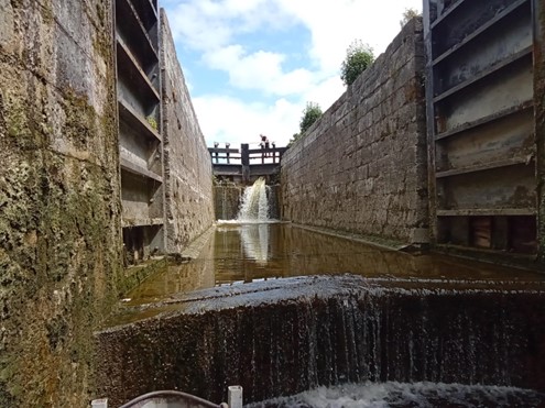
Lock 33 or Belmont Lock is the only double lock on the Grand Extension. A double lock is constructed when a high lift is required at a location. The standard lift for locks on the canal is circa eight feet while the lift a Belmont Lock is some fifteen feet. Transiting this lock is a delightful experience hard to describe and best experienced.
Belmont Mill and Lock
Lock 33 at Belmont
Filling the lower level
Filling and emerging from the upper level 8.Belmont to Tullamore
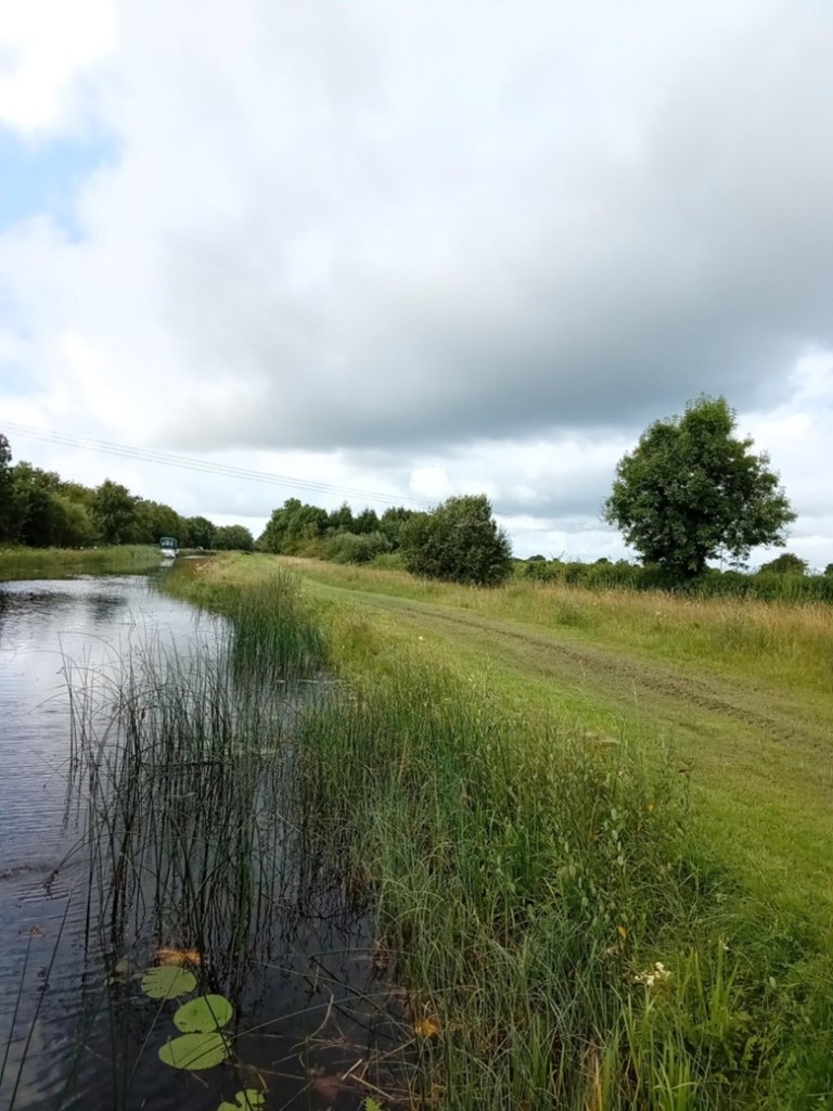
The canal extending east from Belmont Lock to Tullamore is best described as isolated continuous delightful for some and a horror for others. The mind may transition into a relaxed static state imbibing the natural landscape and the activities of inhabiting creatures or one may be bored to insanity. The architecture of the locks, bridges and associated buildings coupled with the relatively unchanged landscape propels one back in time to the period of the canal’s construction in the early eighteen hundreds. This relaxation is interspersed by interludes of surprise and delight when a bridge is encountered and frantic activity when locking from one level to another. The villages of Gallen/Ferbane, Pollagh and Rahan when encountered are a connection with present times providing basic mooring facilities. The town of Tullamore provides an opportunity for the replenishment of supplies and the possibility of fresh water. The facilities available to the canal traveller are sparse and presently reflect the industrial era of canal usage.
A simple water tap
The continuous Stillwater Navigation
A canal bridge endowed with generations of growth
Bell’s Bridge and Lock 32
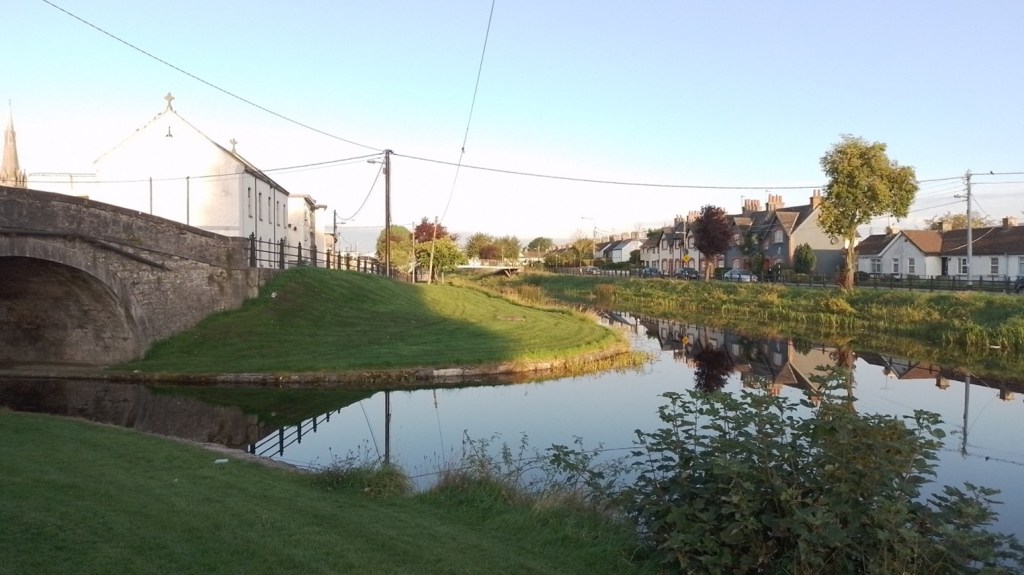
Gallen Village, bridge and rest area
Gallen Village bankside mooring area
Pollagh Village and Canal-Side facilities
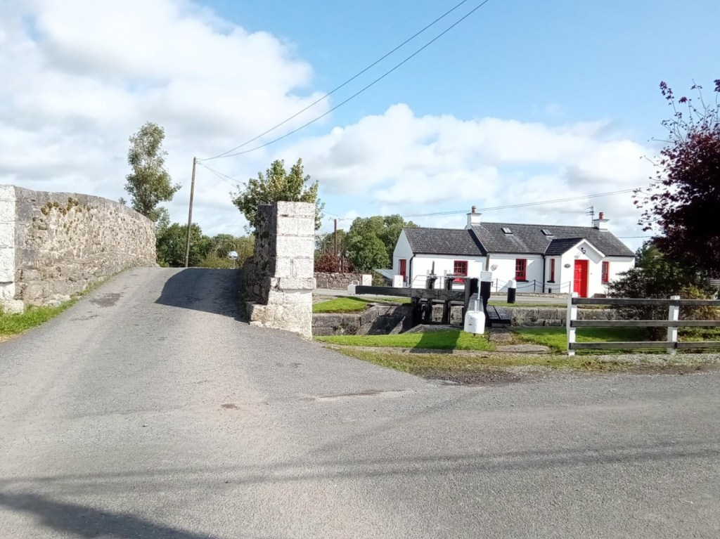
Lock 31
Lock 30 and the canal manager’s house.
The canal-side facilities at Rahan Village and the Thatch pub – a former Williams branch shop
Ballycowan Castle of 1626 and beside it the Huband aqueduct dated to 1803. Huband was a barrister and a director of the Canal Company from 1777 for most of the years to 1835.
Srah Castle, Bridge and and the railway bridge
Sragh Bridge and Lock 28
Entering Tullamore at the Clara Road Lock 29
The spur from the canal main line to Tullamore Harbour
The canal side facilities in Tullamore Town
9. Memories
Memories of this trip are especially positive
The waterway was weed free with a good water level
The courtesy and efficiency of the water patrollers was first class
The lock landings were in a good condition
The lock operating systems all worked well
The lock surrounds were neat and well maintained
The lock keeper’s cottages were a joy to behold
Canal-side moorings and services were adequate and of their time