Why has there been so little public interest in the conservation of the architectural heritage of Tullamore?
Sharing a pot of tea in the Brewery Tap in the early 1980s with a well-known local builder, I remarked that demolition and redevelopment rather than conservation and reuse always seemed to be the first choice option. His reply, which I have never forgotten, was that new buildings which responded to modern needs were always preferable because ‘Tullamore is a good business town’. Change had always brought benefits and the future held more attraction than the past.
I understand that sentiment. Unlike Birr or even Edenderry, Tullamore has always been seen to be go ahead and dynamic; looking forward always and never backwards. That progressive approach was sustained by active business organisations and extended to the areas of arts, culture and local history also. It created a vibrant, attractive and always interesting atmosphere.
Nonetheless, little concern was ever publicly expressed for the protection of the town’s architectural heritage and the role it might play in its advancement. This derived partly, I believe, from a perception that since there were no buildings earlier than the mid 18th century, the fabric of the town was relatively new and was therefore of little or no artistic interest or value. This attitude was reflected in the non-existence, even to the present day, of any local civic group or architectural preservation society or even an Offaly branch of An Taisce. Birr might have its Chapter of the Irish Georgian Society, Tullamore despite its large inventory of 18th c. buildings, didn’t follow.
Rathrobin is a book that keeps on giving. Its 250 Biddulph photographs from the 1870s to 1920s, all carefully captioned, depict the two Irelands – unionist and nationalist, Catholic and Protestant, landed and cabbage garden. What is interesting about the photographs taken by Colonel Biddulph (1849-1926, of Rathrobin near Mountbolus) are the nuances. He was of the lesser gentry, was a tenant of the Petty Lansdownes, and was keenly aware of the plantations of the 1550s to the 1650s. He appreciated the needs of the farm labourers and was decent to his own tenants, indoor staff and farm workers. His entire estate was not much more than 1,000 acres. Biddulph’s circle was also the lesser gentry and those who served it such as land agents, bankers and clergy. The Catholic Protestant divide was strong but landed Catholic families did mix in Biddulph’s set, but not merchants or traders (even if very rich). Biddulph had an empathy with his farm workers and their families and sought their advancement. Many local families were photographed, together with the farming activities of his own employees.
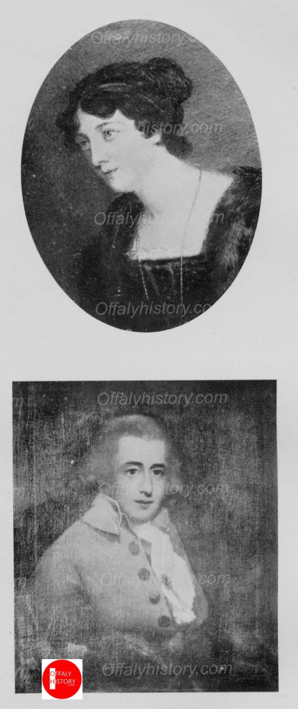
Warner Francis John Plantagenet Hastings was born on 8 July 1868 at 54, St Stephen’s Green Place, Dublin. He was the son of Francis Power Plantagent Hastings, 14th Earl of Huntingdon, and Mary Anne Wilmot Westenra. The title of Earl of Huntingdon was an English peerage title originally created in 1065, the current title is its seventh incarnation which was created in 1529.
The 14th Earl married Mary Anne Wilmot Westenra 15 August 1867, who was the only daughter of Colonel Honourable John Craven Westenra, of Sharavogue, King’s County – a member of the Irish Whig party.
The family acquired lands in Waterford and King’s County. In the latter they lived in Sharavogue House. The house was originally built in the 1820s and was described as containing drawing and dining rooms of the finest proportion, a library, seven bedrooms, servant apartments, stables, coach houses and offices. A walled garden and 100 acres of land. Later additions to the house were made by notable Irish architect Sir Thomas Deane.
One could only marvel at the grandness of the shopfront, its curved plate glass display windows, its fine chiselled limestone three-story edifice, as well as the coming and goings of customers. This was what was on view to the townsfolk and visitors to Tullamore when coming across the shop owned and operated by proprietor Malachy Scally of Kilbeggan. In 1901, for his thirty first birthday he visited London and picked up retailing insights, ideas on cash handling systems, and street facing window placings from the likes of Selfridges and Harrods retail establishments.1 He completed the magnificent frontage, between 1912 and 1914 at a cost of £5,000-.
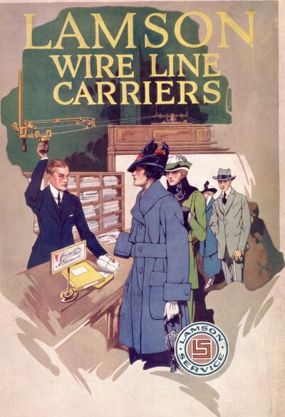
In the 1960s, I remember putting my back against Noel O’Brien’s shop on the opposite side of the street and watched the same comings and goings to the famed shop under new owners, the Melville group. The most intriguing sight was seen from within, the mesmerising swishing sound and rapid movement of the railway wire line carriers with its overhead mechanical system. It was just fascinating to watch. (Mrs Jo. Morris and her sons Philip and Kenneth, had a similar but smaller version, at their family shop, J Morris draper on Church Street).
Fig 1. The magnificent edifice of Malachy Scally’s drapery on Columcille Street (Pound Street), Tullamore. Designed by architect T F McNamara (who also designed the Church of the Assumption, Tullamore), it was completed between 1912 and 1914. Courtesy NLI and set here in the jacket of Maurice Egan’s new book to be published in mid-December by Offaly History.
While my mother bought her items from the various departments, she chatted at length to the attendants, I was only too happy to sit all day and watch the mechanics of the ‘rapid wire’ system. In fact, I recall pleading with her to buy each item for cash, so I could observe the railway workings in detail. The Lamson ‘rapid wire’ system was developed in 1888 and consisted of a cylindrical wooden cup with screw-on base which was projected by a catapult mechanism along a taut wire, travelling on grooved wheels suspending the cup from the wire. These cups would travel a good distance, including around corners, without the need of gravity by incline.2 At Malachy Scally’s this system would travel to and from the ground floor centrally located, elevated cash office.
Fig 2. The Lamson Store Service Fig 3. From Anscombe’s in the UK, the cashier returning the customers change along the ‘rapid wire’ system.
The Scallysof Rahugh, Kilbeggan and Tullamore
The Tullamore drapery store Scallys were originally farmers who hailed from Attyconnor, Rahugh, close to the Westmeath/Offaly border. The farm is still owned and worked by the family and lies between Kilbeggan and Tullamore.
Loughlin Scally (b c 1808, d 16 October 1896) and his wife Rose (b c 1809 d 21 August 1885) had three sons and one daughter that we know of: James, Patrick, Daniel, and Clara Scally. James Scally (b c 1841 d 8 December 1903) was a Kilbeggan merchant and licenced premise owner based on Main Street Upper, Kilbeggan, and was a leading local member of the Land League. He married Clara Christina Horan (b c 1846 d 13 January 1917), a prosperous farmers daughter from Muiniagh, Tullamore. They were married at Durrow church on 17 January 1868 by Tullamore curate Fr Joseph Flood C C. The bridesmaid was Clara Scally. They had ten children. James was an enterprising entrepreneur and with the assistance of his father-in-law, Mathew Horan, James expanded his business to Tullamore. Luke Horan, second eldest son of Mathew (b c 1841 m Bedelia Clavin of Clara on 18 April 1866, b c 1846 d 4 November 1896), was a merchant tailor by trade, and was set up in business on Tullamore’s Colmcille Street (Pound Street) in a shop leased to him by his father. They had one son Mathew Joseph Horan who died of TB in early childhood (b 16 September 1867 d 24 March 1871). Sadly, Luke did not escape the ravages of TB, and suffered from its effects for many years.
_________________________________________________________________________________Footnote: Muiniagh is the townland (218a) that extends from Tullamore’s Axis business park north to the Silver River and includes a portion of the residential estate called, Norbury Woods.
It is believed James Scally, his brother-in-law, took over the lease of the Horan shop and established it as James Scally draper in 1876.3 Luke died at the Whitworth Hospital in Drumcondra (a hospital for the chronically ill) on 30 November 1879. He was 38 years of age. His bereft widow Bedelia moved to Castletown, Clara to live with her two brothers.
Fig 4. Extract from the last will and testament of Mathew Horan 1880. Courtesy NLI.
Fig 5. Will and testament of Mathew Horan 1880. Courtesy NLI.
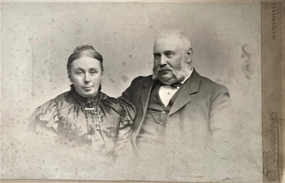
Fig 6. Clara (née Horan) and James Scally. Courtesy Malachy Scally.
Established in 1876, this became the start of a great trot for the Scally drapery business, which was to continue for an uninterrupted eighty-five years. It is believed that James and Clara Scally lived at Bank House (alias Step House), on Main Street Upper North, Kilbeggan since around 1868. They later resided at their fine hardware, grocery, provision, and licenced merchant house which continued as Scally’s for over sixty years until 1928. Malachy, their eldest son was born 8 April 1870. They had ten children, five boys and five girls. James now a successful businessperson, continued to grow his business and leased lands, some known as Towns Park, as well as property, including the Crescent store and Market Square store, Kilbeggan.
Fig 7. James Scally, grocer, provisions merchant and licenced premises, Main St, Kilbeggan. Their residence ‘Step House’ was six doors up the street to the right of picture. Courtesy the NLI.
Unbearable tragedy was not too far around the corner for James and Clara Scally. In 1884, in the space of just nineteen days they lost six (four daughters and two sons) of their ten children to scarlet fever and typhoid.
Malachy Scally
Malachy Scally (b 8 April 1870 d 3 October 1935) married Mary Anne Fitzgibbon (25 June 1874 d 9 May 1935), at St Michaels church, Kingstown (Dun Laoghaire). She was daughter of well-known M P in the House of Commons for Castlerea County Roscommon, John Fitzgibbon and his wife Marion, née O’Carroll. John Fitzgibbon (1845–1919) was also a merchant draper in Castlerea. John was a supporter of Home Rule and unity with Britain, as well as a member of the Gaelic League. He started his working life in his father’s drapery business in Castlerea. Seen as a spokesperson for the tenant, Fitzgibbon exercised his powers of persuasion and oratory at meetings across Roscommon. His political life spanned 30 years, from the land war to the ranch war.4 Mary Anne’s brother Michael Fitzgibbon (b 2 August 1886 d 15 August 1915, was an apprentice at the solicitors’ firm, Hoey & Denning, Tullamore) joined the British army during the First World War as a second lieut with the 7th Dublin Fusiliers. In July 1915 he was promoted to the rank of Captain and the regiment was shipped to the Dardanelles. One week into the disastrous Allied Gallipoli campaign, the popular twenty-nine-year-old Capt Fitzgibbon was killed in action on Turkish soil.
__________________________________________________________________________________Footnote: The ten children of James and Clara Scally were: Rose Mary (b 3 April 1869 d 25 September 1919 of TB, m 15 September 1892 Peter Joseph Joyce of Leenane Galway b 1859, a commercial traveller from Edgeworthstown and Longford d 9 September 1926), Malachy (b 8 April 1870 d 3 October 1935 m 19 June 1895 Mary Anne Teresa Fitzgibbon of Castlerea b 25 June 1874 d 9 May 1935), Joseph (b 29 September 1873), Mathew James Scally (b 20 July 1875 d 31 October 1884), John Frances Scally (b 4 December 1877 d 1 March 1907 m 1906 Annie White, daughter of P J White of Clara, widowed she later married James Kelly 17 June 1912), Bridget Christina (b 21 December 1878 d 3 November 1884), Mary Joseph (b 29 February 1880 d 24 October 1884), James Scally jnr (b 20 July 1881 d 24 October 1884), Agnes Scally (b 28 January 1883 d 11 November 1884), Clara Christina (b 18 July 1884 d 4 November 1884).5
Malachy was deemed an astute and quick learner, and was schooled at the Christian Brothers, Tullamore and later at Navan. He finished his schooling at Rockwell College. He quickly learned the drapery business and was constantly looking out for new ideas in the world of fashion and retailing. He and Mary Anne had eleven children, the three eldest were born above the drapery store on William Street (todays Colmcille Street) . The businesses in both Kilbeggan and Tullamore were thriving, and he took out a lease on the architecturally impressive residential property Moore Hall on Earl Street (O’Moore St, Tullamore) in 1900. He learned much on his travels and brought back and implemented new ideas from a 1901 trip to visit Selfridges and Harrods, London. Malachy formally took over the running of the family business when his father James died in 1903.
In April 1902, as his business expanded he took over the lease of the former Bradley boot and shoe warehouse next door (today’s AIB bank). Malachy Scally, grandson of Malachy snr recalls: ‘Around 1903, Malachy took a lease on number 2 and 3 Colmcille Street from Lady Emily Alfred Julia Howard Bury of Charleville Forest. Earlier, it was called William Street after Charles William Bury First Earl of Charleville.
In 1912 he commissioned the office of architect William Hague (1836-1899) to design the magnificent shop and façade for 2 and 3 Colmcille Street. His daughter Philomena (Phlo) also had an input in the design. While accompanying her father on a buying trip to Brussels, she made sketches of shop fronts, which influenced the outcome. After Hague’s death, his wife took over the firm’s partnership with their managing assistant, the renowned architect T F McNamara (1867-1947) who had worked on the Church of the Assumption, Grand Central Cinema, and the Co-Operative Society premises in Tullamore. The shop was completed in 1914.’
Ever the moderniser with a keen interest in mechanics, he was the first to install the mesmerising Lamson overhead cash wire carriers in the town. He was fascinated with aeroplanes and encouraged his sons Manco and Frank in their pursuit to become qualified pilots.
He continued to run the original family business on Main Street, Kilbeggan, and employed his first cousin Patrick Scally of Attyconner and later Moyvore, as an assistant shop hand. He thereafter put his son Manco in charge of the Kilbeggan store from around 1920. James A Scally the eldest son, worked with and was trained in the retail trade by his father, having completed his schooling at Clongowes. Together they introduced a new sales incentive at Scally’s drapery where paying customers were entered into Scally’s draw for their unique prize scheme. Uncollected monetary prizes were donated to charity. Increasingly James A was taking over more of the running of the business, assisted by his youngest brother Brendan and youngest sister Eithne Scally.
Manco decided to spend more and more time engaged as a professional aviator, spending considerable time in Coventry, England. In 1928 Malachy decided to sell the old established Kilbeggan business inherited from his father James Scally. It was advertised for auction by the Kelly Brothers, Auctioneers at Kilbeggan on the 29 September that year.
The free-spirited Manco had planned a huge adventurous solo flight from Ireland to Ceylon (Sri Lanka) via Baghdad. It would be the first private individual flying out of the new Irish Free State. His tiny plane (EI AAL) he called ‘Shamrocket’ and flew via Paris and then onto Marseilles. He was tragically killed while trying to land at nearby Berre on 21 February 1932.
We need 100 carefully researched stories for 2022. If you have one contact us info@offalyhistory.com. With thanks to all who have contributed the 330 so far and to you the readers of which we had 100,000 views so far this year. 120,000 is our target for 2021 so spread the word. We have published 83 on the Decade of Centenaries period.
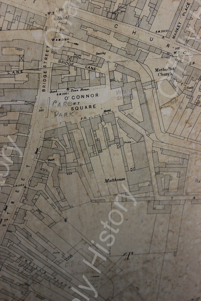
Amongst the recently announced projects for the rejuvenation of the centre of Tullamore is the long promised opening of the ‘Hidden Bridge’ behind the County Library and the linking across it of O’Connor Square and Church Street by a new public park. Though the age and function of the bridge are obscure, clues may be found which shed light on not just its genesis but also those of Tullamore itself.
Settlement Types
As humans began to leave the forests and gather together for trade and security, three distinct models of settlement began to emerge. One was the elongated village street which developed along a well travelled trail. Another was the crossroads ie. a meeting of four trails creating a junction around which housing and businesses clustered.The third was the village green form, where several trails came together around an open marketplace.
In Offaly the best examples of the first are Banagher, Shannonbridge, Daingean or Edenderry with their long main streets. Ferbane is a good example of the second type. Killeigh, Cloneygowan, Geashill and Clara which share the same feature of a triangular fair green, are good examples of the last.
Into which category therefore does Tullamore fall?
Tullamore 1838
Early Maps
The Cotton map of the mid to late 16 th century shows the central Midlands as mainly woods, trackless plains and bogs. Apart from ‘Dinian’ (Daingean), Killeigh is the only settlement noted
Tullamore first appears as a distinct settlement on the Moll Atlas of 1728 which shows the Tyrellspass to Birr road as the main route from Westmeath to Tipperary and crossing the Ballycowen River river just south of a hamlet noted as ‘Tullymore’. No other roads into this village are shown.
The first map which shows the layout of the town of Tullamore itself is Taylor and Skinner’s 1777 volume which describes the routes of all the main roads traversing Ireland at that time, but does not purport to be a reliable guide to the streets or form of the towns through which they pass. The guide shows the north -south Kilbeggan to Birr road crossing the river and intersected by the east-west Philipstown (Daingean) to Clara road at a point just south of the present canal bridge. A small chapel is shown on Church Street and a nobleman’s seat close by. The Tyrellspass to Birr road is shown entering the town from the north east and meeting the Philipstown/Clara road at a T-junction, but does not continue further southwards. Were it to continue in a straight line however, it would arrive at the river at precisely the location of the ‘Hidden Bridge’ at the rear of the Library which suggests that this was once its destination.
William Larkin’s Survey of 1809 is a little more detailed and shows seven roads radiating out into the countryside from a central point- again presumably the river crossing. The arrival of the Grand Canal in 1798 had interrupted this road pattern north of the river.
Larkin 1809
Some indication of the age of these radial roads may be drawn from an examination of the first really reliable map of Tullamore-the Ordnance Survey of 1838. Field boundaries which are not continuous across road lines suggest land ownerships of some antiquity and therefore longer established routes. The clearest example of newer roads interrupting established field boundaries is visible in Bachelors Walk, laid out in 1815 while the relatively recent vintage of Tanyard Lane and the road to Geashill are evident also. However, the Killeigh, Kilbeggan, Rahan and Charleville radial roads which have differing boundaries on either side, are clearly much older.
The North Eastern Radial
Of particular interest however is the north eastern entry to the town from the Tyrrellspass direction and the former direct route to Birr according to Moll. Having cut through the esker at Derrygolan, the road takes a direct and straight line to enter Tullamore at Puttaghan along a route formerly known locally as Rapparee Alley; at which point (according to Taylor and Skinner) it suddenly meets the east-west Philipstown-Clara road and proceeds no further. The discontinuous boundaries on either side northwards of this junction suggests a route of some antiquity. We can only speculate as to why it does not continue further to its projected and natural destination point -the river crossing suggested by Moll’s map.
Roads evolve along desire lines of movement and historically the focus of all the other radial roads entering Tullamore was the river crossing. As there were no physical obstacles to interrupt the original line of the Puttaghan Road, we can only surmise as to the reasons for its discontinuance or abandonment.
Combining the Moll Atlas and Taylor and Skinner’s Map it would appear that the road originally ran past the ruined castle recorded in 1620 as being in the ownership of Sir John Moore and which was located somewhere in the Church Street/O’Carroll Street area. Indeed the castle may have originally been built to ensure the security of that ancient road.
In 1710 Sir John moved the family seat of the O’Moores from Croghan to Tullamore and built a new house somewhere near the old castle. It is possible but conjectural that some years later the Puttaghan road was decommissioned by Sir John to increase and protect the pleasure grounds around his new residence. Traffic from the north east would now meet a T-junction at the northern edge of his estate and travel westwards along the Philipstown- Clara road to meet with what was by then, the main Kilbeggan-Birr road and then proceed southwards along it to ford the river.
Though this diversion might have inconvenienced travellers, it should be noted that in 1786 Sir John’s successors rerouted the Tullamore- Birr road around their new demesne at Charleville for this very reason.
Tullamore c. 1912
The Old Bridge
What then was the function of the bridge between O’Connor Square and Church Street and which has been hidden out of sight for many years? The sharp cutting of the stonework of its central abutment suggests that it is not an ancient structure, but we have no precise information as to when it was erected; in particular we don’t know if it predates or succeeds the bridge to the west which was provided on the site of the former ford sometime around 1775.
The eminent chronicler of the history of the town, Dr. William Moran conjectures that ‘It was probably about the time (early 18c.) the fair green and the cornmarket were opened, that the first bridge over the river was built to enable farmers from the south side of the river to bring their produce to market’. He then goes on to surmise that ‘Two short stretches of road, one each side of the river, connected this bridge with the already existing Philipstown-Birr road.The inconvenience of having to make this little detour, in order to cross the river by the bridge was soon felt; and the present bridge was built to replace the old one’
The provision of the western bridge to replace the ford at present day Bridge Street does not explain why the eastern bridge should have been enclosed and abandoned. It would still have been the more direct route between the two market places of the town and of greater convenience to cattle drovers and wheeled traffic.
The other eminent chronicler of the history of Tullamore Michael Byrne, suggests that property records indicate that the eastern bridge is of a later date than 1775 and was a private facility and an internal link within a single business premises-as was common in the other brewing, tanning and distilling businesses of the town that utilised the river as a source of water or for the discharge of effluent.
I think it is possible to argue that neither Dr. Moran nor Michael Byrne have fully explained the genesis of the bridge and that we have to go back to an earlier date to understand the reason for its location; whatever about the date of its construction.
I believe that, as in the case of its companion to the west, the natural extension of the radial line of the approach roads into Tullamore suggests that it may have been built on the site of an earlier ford-indeed that the entire river between both bridges may have originally been shallow enough to have been fordable. The drainage scheme of the early 1950s deepened this section of the river between Church Street and Bridge Street by removing the rocky outcrop which facilitated the fording of the river at this point.
If this earlier crossing point existed, it is probable that prior to the construction by Sir John Moore of his new house in 1710, all of the radial roads met together at a point to the south of the river. If I am correct in this, a triangular fair green with the fordable river running through and surrounded by houses on the three sides (Church Street being its northern side) would have been the most likely original urban form.
The neighbouring villages, Killeigh, Clonygowan, Geashill and Clara, display such triangular layouts. As may be seen from comparative plans, the form and dimensions of their central village greens are almost identical to each other. (illus.). The village green which I submit may have been the form of Tullamore up to the end of the 17th c. would have been similar to them in scale and shape.
It is possible also that Frankford (Kilcormac) originally formed around a Fair Green of similar scale though the triangular block is now much compromised by infill housing.
A New Theory
As ‘Tullymore’, Geashill, Killeigh, Clonygowan and Clara appear on Moll’s map of 1728 it is possible therefore that all five or even six villages all formed in the mid to late 16th c, as the plantation of Leix-Offaly began to transform the economy and settlement pattern of this particular area of the Midlands.
It is also possible that some time in the early 18th c. the direct route into Tullamore from the north east and which crossed the river to culminate in the fair green of Tullamore-today O’Connor Square- was enclosed into the estate of Sir John Moore and the connection discontinued.
Over the years, the triangular form of the original village green evolved into ‘The Market Place’ and later into Charleville Square. From 1740 onwards it was reduced in scale and became more rectangular and formal. Eventually the land on its northern side, between it and the river was enclosed to build the Market Hall in 1789.
Meanwhile, the lands on either side of the river at the location of the former crossing had come into the ownership of the Quaker Thomas Wilson, who together with his partner Thomas Pim conducted a wool combing and tannery business at the rear, backing on to the river. The lands then passed through the hands of Gideon Tabuteau and on to Joseph Manly who operated a brewery and maltings. They were later acquired by the Tarletons who operated a milling business. It is possible that any of these commercial families may have erected the private stone cut bridge.
I suggest therefore that the bridge behind the County Library is relatively new but that it is located on an earlier crossing point of the river which existed up to the end of the 17 th. century and which gave direct access from the farming hinterland on the north east to the central marketplace of Tullamore.
If I am right, the long promised and eagerly awaited opening to the public of the ‘Hidden Bridge’ will reestablish part of an ancient route which was once an integral part of the original village of ‘Tullymore’.
The records of the Valuation Office stretch all the way back to the 1830s and are an invaluable source for the genealogist or local historian. They allow a researcher to trace the occupiers of land and buildings for decades. Just as importantly they give us insight into our ancestors’ lives in Ireland long ago. The enormous collection – thousands of ‘books’ and maps – cover every house and garden, field and townland, village and town in the country. These records have survived when so much of our heritage was lost. The majority of the collection was kept, organised logically, catalogued and safely stored. The records are now held in three repositories: The National Archives of Ireland, The Valuation Office of Ireland and the Public Records Office of Northern Ireland, and are generally accessible for researchers. Some of the records are available free online, with plans to add more. [Laura Price will give a lecture via Zoom on this topic on Monday 1 November to Offaly History. Get the link by emailing us at info@offalyhistory.com. You do not have to be a member and you are welcome.]
A two-page feature on Birr and its new telescope (s) was featured in the Illustrated London News of 9 September 1843. It was the first such international treatment for Birr and was combined with valuable illustrations of the town. It was also the first treatment by a national or international publisher promoting ‘Offaly Tourism’. It was the third earl of Rosse who organised the publicity for Birr and was now on the UK stage himself with his presidency of the British Association for the Advancement of Science.
The window on Birr would be the first of many arising from the completion of the larger telescope in 1845. Birr town was the principal settlement in Offaly since the 1650s and was the premier shopping town, as is clear from the Pigot directory of 1824. Cooke would go on to write of the town’s significant history in his 1826 book – a first in the midlands and just six years after Hardiman’s Galway. What is interesting about the article of 1843 was the active role given to Mary Rosse in her work in the demesne and the town of Birr.
The county grand jury system will be the subject of much focus from mid-2022 with the uploading of links to the county archives records throughout Ireland by way of the Beyond 2022:Virtual Record Treasury Project. The first thing to say is that a useful and well-illustrated booklet People, Place and Power: the grand jury system in Ireland (Brian Gurrin with David Brown, Peter Crooks and Ciarán Wallace, online 2021) can now be downloaded from the Beyond 2022 website as well as useful material from the county archives in Offaly, Wicklow and Donegal. Furthermore, Brian Gurrin has published online an interim listing of the records held in each county. The scope of the records is well illustrated and draws on more detailed catalogues for counties such as Offaly and Donegal where listings are available on the online catalogues from the county archives. For more on Offaly material see the blog and presentation by Lisa Shortall now on YouTube and as a video on the Offaly History Decade of Centenaries platform on http://www.offalyhistory.com.
In summary the access position to these records will be revolutionised within the year and will greatly facilitate family historians, those interested in the workings of local government and how local elites interacted. What elite families provided the power brokers and controlled local patronage? All were men, most were landowners, representative of the county families, and, of course, most were Protestant from the early 1700s and the enactment of the Penal Laws. It was not until the Catholic Relief Act of 1793 that Catholics were admitted, and being a select club were scarce until the 1830s.
…..The soft and dreary midlands, with their tame canals,
Wallow between sea and sea, remote from adventure….’
‘Dublin Made Me’ Donagh MacDonagh
Lumcloon
Once a month, my uncle Billy Holohan who was the Assistant County Engineer for West Offaly, would come to Tullamore to report to his superior, the County Engineer Tom Duggan, in the courthouse.
After the meeting he would sometimes pick me up from my mother’s house in Clonminch and bring me to stay with himself and his wife Nell in Gallen Lodge in Ferbane. The highlight of the journey, for both of us, was an inspection of the progress on the construction of the two cooling towers of Lumcloon Power Station.
We watched as immense rings of slim, angled columns emerged and were tied together by large circular bands to form the base from which the structures would rise. Over the next few years we marvelled at the gradual ascent of the elegantly modulated shapes, first curving inwards and then subtly outwards to form a lip. Billy tried to explain to me the structural engineering concepts behind the design, but as a small boy I could only marvel at the height and sheer scale of the undertaking.
An impression of the proposed mills at Leamanaghan. Very high and very prolific. Our thanks to Kenneth Smyth for this picture.
Leamanaghan Castle
Unusually for an engineer, Billy had a deep interest in history. He brought me along on his site inspections and introduced me to Clonmacnoise and Sier Kieran. His favourite stop on our return journey to Tullamore was Leamanaghan where we roamed amongst the remains of the Monastery. He delighted in showing me the hoof mark inside the gate of the school which marked the passage of St Manchan’s stolen cow and then brought me over the fields to St Mella’s Kell which I still believe is one of the most romantic spots in Ireland.
Lemanaghan Castle, top left. This was where the Annals of Clonmacnoise was completed. The castle was demolished in the 1950s as was Kilcolgan nearby to provide filler. Courtesy of Offaly Archives
Then in 1959, in an act which was deeply symbolic of Ireland in that peculiar time between economic stagnation and rapid growth, Leamanaghan Castle was bulldozed to provide hardcore for works at Lumcloon Power Station. The Castle, which was derelict but still substantial, had been the ancestral home of the Mac Coghlans. Cardinal Rinuccini had stayed there (or more likely nearby Kilcolgan, also demolished) during his time as Papal Nuncio to the Confederation of Kilkenny and the Annals of Clonmacnoise were translated into English in the house. I was dumbfounded but hadn’t the courage to ask Billy whether it was the ESB or the County Council who were responsible.
Cooling towers of the old economy, so succesful for Offaly from the 1950s to the 2000s in regard to employment.
The Cooling Towers
The cooling towers were completed and over the years, became part of the public perception of the Midland landscape.
Driving westwards you knew you were approaching Kildare and Offaly when the Allenwood towers became visible, then Portarlington and Rhode emerged with Lumcloon in the far distance. Their harmonic shapes complemented Croghan, Endrim and Bellair hills and provided points of vertical interest in an otherwise soft and dreary plain. The bogs, which had been perceived for centuries as profitless and impassable were now a proud testimony to national energy self-sufficiency and local technological advance.
However, with the passage of time, what was originally considered a solution, became a problem and peat extraction began to be wound down with grievous personal and economic consequences which are still being felt. The Power Stations were closed, their towers and buildings demolished and their sites converted to other uses.
Portarlington was the second last to go. At 10.30 on the morning of the 4th of April 1997, the cooling tower that had taken three years to build and stood for forty seven years, vanished in three seconds at the hands of an English demolition expert who already had many redundant cooling towers on his c.v..
Futile last minute efforts to save it were led by the Heritage Council and a local preservation group organised by Progressive Democrat Senator, Cathy Honan. Architect Gerard Carty of Clonbullogue, now a director of the world famous Grafton Architects, wrote in protest that the Power Station was ‘A monument to those visionaries who grafted a semi-industrial outlook onto the principally agricultural psyche of the Midlands’. Their protests crumbled in the face of the ESB’s assertion that ’ It was built for power generation and that function is over’.
The crowds watching the spectacle of the demolition were serenaded by local accordionist Louis Melia who played his composition ’The Tower I Loved So Well’ during the countdown to the explosion.
An era had ended and the advent of wind power was at hand.
Wind Turbines
Because of the absence of nearby dwellings but with existing connections to the national grid, the Midland bogs were identified very early on as first choice locations for large scale wind energy generation. But, whatever about their ecological impacts, the visual impacts of turbines can be a lot more substantial than those of cooling towers.
Unlike one or two isolated towers, turbines spread haphazardly over large areas of the landscape. Though man-made, their scale and large array results in their being read as part of the natural landscape itself- which can be visually disturbing. As the blades rotate in different cycles, they can often cause visual irritation, even from very far away. The scale of the turbines can be incongruous and though they are generally no higher than the former cooling towers, there are a lot more of them. All in all, their visual impacts are significant and often unassimilable. But then, maybe the cooling towers were also, but in the 1950s any development was welcome, while today’s affluence allows us to make choices.
But whether it is cooling towers or turbines, the greatest sensitivity should always be shown when their development impinges on historic sites. Leamonaghan paid a price for the construction of Lumcloon and shouldn’t be put in the firing line a second time.
The old world that was partly destroyed in the 1950s.But the shrine at Lemanaghan survived in its original locus. A remarkable survival in its locale. Ballycumber castle was used for filler as was Kilcolgan. So much for heritage in 1920s to 1960s Ireland. Heritage was in a linguistic form only and divorced from real life.So much empty platitudes.
A Flashpoint
With the imminent lodgement by Bord na Mona of its proposal for a 17-turbine wind farm with blade heights of up to 220 m, the bogland island of Leamanaghan with its ancient monastery and graveyard will be in the forefront of the conflict between architectural heritage and power generation. Preliminary images show turbines dominating its surrounding landscape on its northern side.
However, just as in the 1950s, the likelihood is that national energy needs will trump all other considerations- particularly in the light of the recent correspondence from the Office of the Planning Regulator directing the Council to dramatically increase Offaly’s megawatt production.
This should not mean that the vulnerable character of Leamanaghan be disregarded, but that the most careful consideration needs to be given to the interface between it and the future wind farm. As one of the most sensitive locations in Offaly (and also to make restitution for the shameful razing of the Castle) the balance of the argument should favour the protection of its history and beauty.
The windmills of the past or a message of hope. Lemanaghan 120 years ago before the data centres and when most things were in the head of the local person and not in the Cloud.Courtesy of Offaly Archives
A Return to Profitless Bog?
As wind replaces peat extraction, it is not unthinkable that it may in turn be replaced by a less visually obtrusive or ecologically harmful form of energy production.Turbines last for about twenty years before they need replacement and a point may come when this is no longer economical.
In March of this year the United Nations Economic Commission for Europe declared that ‘Nuclear energy can be a critical component of a decarbonised energy system for those member states that choose to consider it as a part of their sustainable development and climate change strategy’. It will be interesting to see how other European countries respond to the technological advances which are now delivering safer nuclear energy.
I wonder if in seventy- or eighty-years’ time, as the last of the turbines come down and the land gently recedes back into its ancient role of profitless bog abounding in nesting snipe, will a small and nostalgic group emerge to campaign for the preservation of the remaining few of these iconic structures?
‘Catherine Maria Bury and the design of Charleville Castle’ is the title of an online lecture via Zoom provided by Offaly History for Mondy 20 September at 7. 30 p.m. Our speaker is Dr Judith Hill. She has kindly provided this note for Offalyhistoryblog readers on her forthcoming lecture.
When I started researching my PhD on Gothic revival architecture in Ireland after the Union I had no idea that Charleville Castle, one of the first and most impressive of the castles of this period, owed its inspiration to a woman. I wanted to compare the castles at Birr and Charleville, and was very much aware that their (male) owners had voted on different sides for the Union and that they came from different political traditions. Would this play any part in the designs for the castles that they built, or in the case of Sir Laurence Parsons, remodelled in the very first years of the nineteenth century?
Women at that time played no direct role in politics. They are also relatively (though not entirely) invisible in the historical record. It is only when you can look at family papers that you might find some evidence of what a woman might have done. Catherine Maria Bury’s letters have survived; some of these were published in 1937. They tell us about Catherine (later Lady Charleville) as a person, her friends, her interest in literature. They are tell us that she was close Charles William Bury, and that when he (for it was he) went to see how the building of the castle was progressing he would send detailed descriptions to her. Although he does not ask her directly for her advice, it is clear that when they were together they discussed the project.
Catherine Maria Bury and Charles William Bury(more…)