As we make our way along we start to make the journey to Ballycommon, we come to Townparks townland, in the Electoral Division of Daingean, in Civil Parish of Killaderry, in the Barony of Lower Philipstown, in the County of Offaly. The Irish name for Townparks is Páirceanna an Bhaile. Townparks townland in Daingean has the site of Fort Governor which was built in 1547 on the site of an O’Connor Castle stronghold.
along this line we come to one of the gems along this way, the Bord Na Mona lifting Bridge, It’s an interesting spot and a great location to get the camera out. From the late 18th century, the canal was used as a way to transport turf from different cutting points along the line. As trading long the canal was increasing rapidly and was even more encouraged when charges were abandoned, the one that was always a difficult trade to control was the “Turf”[1].
03. The half-inch of c. 1910 from Philipstown to Ballycommon and Cappancur Offaly History Centre. Showing also the Kilbeggan Line of the 1830s.
A few incidents along the line was reported, before the construction of the Circular line, including situations where turf traders, held up and demanded change to the dispatching and the price of turf. After a standoff with an angry crowd, that were armed with swords and guns. The canal company, compromised with the people and ordered that all boats display a clear sign with the price of their turf.
During this time quays were used along the canal to unload turf and an inspector was appointed to see the overall control of the Turf trade. By the early 19th century, a steady flow of boats travelled up and down the line, with up to 33,000 tons every year arriving for dispatch. G- Boats were the main boat used when transporting product and with a fixed toll now applied to all traders, this encouraged the use of greater loads.
Along our Grand Canal Journey from Edenderry to Shannon Harbour we come to Rathmore, a small townlands, on the south side of the canal. Rathmore is in the Electoral Division of Edenderry Rural, in Civil Parish of Monasteroris, in the Barony of Coolestown, in the County of Offaly.
The Irish name for Rathmore is An Ráth Mór meaning great, big ring-fort.
Here we can find the site of a possible Enclosure, it can be seen in outline from aerial photos. Enclosures are one of the most common sites found in Co. Offaly, with over hundred found all over the county. They are often similar to other types of enclosures defined either by a bank or a fosse, such as the Ringforts.
They are identified from other enclosures by being either very large or small and without an entrance. Many are only known as cropmarks, visible only from aerial view, they have no original dates but some may be from the Iron Age.
Part two of this presentation looks at the Charleville and Macartney aqueducts west of Tullamore and the Silver River aqueduct halfway between Ballycommon and Kilbeggan.
THE CHARLEVILLE AQUEDUCT
The Clodiagh River rises in Knockachoora Mountain in Sliabh Bloom and flows swiftly through Clonaslee and on under Gorteen, Clonad and Mucklagh bridges into Charleville Demesne before passing under the Charleville Aqueduct, just before its confluence with the Tullamore River at Kilgortin in Rahan. Less than half a mile upstream on the canal stands the Huband Aqueduct overlooked by the imposing Ballycowan Castle.
The Charleville Aqueduct is called after Charles William Bury who had become Viscount Charleville in December 1800 and it was as such, he was recorded in the lists of attendees of the Court of Directors of the Grand Canal Company during the years the canal was being constructed from Tullamore to Shannon Harbour, 1801-04.
Image 1.excerpt from the minutes
An excerpt from the minutes of a meeting of the canal company held 24th February 1801 where Lord Charleville’s request for the use of one of the company’s boats for the purpose of conveying Lady Charleville to town was accommodated. The memo further states that his wife was in a precarious state of health, most likely an allusion to her being in the advanced stages of pregnancy as her son Charles William Bury was born nine weeks later, on 29th April 1801. (Courtesy of National Archives of Ireland, Dublin)
Image 2. Charles William Bury, 2nd earl
Charles William Bury, 2nd Earl of Charleville, born late April 1801, seated in red cloak before a curtain, portrait by Henry Pierce Bone, 1835.
C. J. Woods’s entry for the first earl of Charleville, (1764-1835), in Dictionary of Irish Biography, R. I. A., (2009), gives a concise résumé of his adult life:
Bury was MP for Kilmallock in 1789–90 and 1791–7, becoming Baron Tullamore on 26 November 1797, Viscount Charleville on 29 December 1800, and 1st earl of Charleville (of the second creation) on 16 February 1806. He was an Irish representative peer from 1801 until his death. With Johnston he designed and built a Gothic castle on his demesne, Charleville Forest, 3 km south-west of Tullamore. Begun by November 1800, it was completed in 1808, to which a terrace, lawns, artificial lake, grotto, and 1,500 acres of woodland were added. Elected a fellow of the Royal Society in 1803 and a fellow of the Society of Arts in 1814, Charleville had ‘wide intellectual interests which never came to fruition’. The earl of Charleville died 31 October 1835 in his lodgings at Dover and was buried at Charleville.
Fred Hammond’s great survey of the bridges in Offaly (2005) gives the following description of the building:
Triple-span masonry bridge carries Grand Canal over Clodiagh River. Abutments, piers and cutwaters are of dressed limestone blocks, regularly laid. The cutwaters are of triangular profile and rise to arch spring level at both ends of the piers. The arches are of segmental profile and each spans 3.07m; their voussoirs are of finely dressed stone. The soffits are very slightly dipped towards their centres to accommodate the bed of the canal. Dressed string course over arch crowns. Parapets are of random rubble, coped with dressed masonry blocks. The parapets are spaced at 10.08m and terminate in out-projecting dressed stone piers. The east end of the south parapet has been rebuilt. The canal narrows to 4.50m, with tow paths either side. The sides are stone lined at this point and there are timber stop slots at the east end of the aqueduct.
Hammond considered the edifice worthy of regional heritage importance.
THE MACARTNEY AQUEDUCT
Image 3.Detail of William Ashford’s painting
Detail of William Ashford’s painting of the crowded scenes at the opening of the Ringsend Docks, Dublin, 23 April 1796, showing Lord Camden, the Lord Lieutenant of Ireland, conferring a knighthood on Mr. John Macartney with the Westmoreland, Buckingham and Camden Locks in the background. Macartney can be seen in a genuflected position on the right-hand quay wall beneath a billowing British naval flag. (Courtesy of the National Gallery of Ireland)
This is the western-most aqueduct in Offaly straddling the townlands of Falsk and Derrycarney, south of Ferbane. The structure is named after Sir John Macartney, one of the more influential directors of the Grand Canal Company. As alluded to above he was knighted by the Lord Lieutenant at the opening of the Grand Canal Docks in 1796, “in consequence of his energetic exertions in the promotion of the inland navigation of Ireland.” Like Huband’s Aqueduct at Ballycowan, it has two commemorative plaques dating it to 1803.
Image 4. Commemorative plaque dated 1803
Commemorative plaque dated 1803 on the south parapet wall of the Macartney Aqueduct.
Fred Hammond’s appraisal of the building says it all:
This is the largest aqueduct on the Grand Canal in Co. Offaly and second only to the Leinster Aqueduct (Co. Kildare) in size on this canal. It is of high-quality construction and has been sympathetically refurbished. It is of historical interest due to attested date and link with Grand Canal Co. Also, a substantial landscape feature hereabouts. Of national heritage significance, meriting inclusion in Record of Protected Structures.
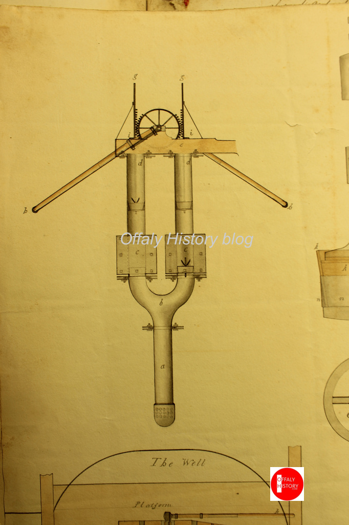
Image 5. A delightful drawing by Israel Rhodes
A delightful drawing by Israel Rhodes, dated to March 1802, showing details of the steam-powered pump that was used during the construction of the Macartney Aqueduct over the Silver River. This is from the minute books of the Grand Canal Company where such visual representations are very rare. The depiction is signed by Rhodes as engineer and by Arthur Chichester Macartney, then an influential director of the canal company. (Courtesy of National Archives of Ireland, Dublin)
The aqueduct crosses the fast-flowing Silver River after it has meandered over twenty-miles from the slopes of Wolftrap Mountain high up in Sliabh Bloom The river’s course takes it through Cadamstown, Ballyboy, Kilcormac and Lumcloon before joining with the Brosna half a mile downstream of the aqueduct.
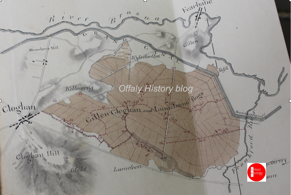
Image 6. Map by John Longfield c.1810
Map by John Longfield c.1810 showing the Grand Canal turning sharply to the north-west just downstream of the Macartney Aqueduct and thus avoiding the Gallen, Cloghan and Lumcloon complex of bogs before meandering (almost) from Gallen to Belmont, always in close proximity to the River Brosna. The Silver River is depicted as the Frankford River in deference to the old name for Kilcormac, the last town it passes through before its confluence with the Brosna. (Courtesy of The National Library of Ireland)
SILVER RIVER AQUEDUCT ON THE KILBEGGAN BRANCH
To avoid confusion with the other Silver River crossed by the Macartney Aqueduct, this aqueduct straddles the Silver River which separates the counties of Offaly and Westmeath between the townlands of Bracklin Little and Lowertown. The river rises upstream of New Mill Bridge, in Rahugh, in Westmeath. In Offaly it flows via Derrygolan, Acantha, Gormagh, Ballyduff, Aharney, Coleraine, Coolnahely and Aghananagh before joining the Clodiagh at Aghadonagh, in Rahan. The 1838 six-inch map shows five mills on this relatively short river. The earliest of these mills is probably that at Ballynasrah or Tinnycross as it is shown on John Gwin’s map of the Barony of Ballycowan which was drawn c.1625, almost four hundred years ago.
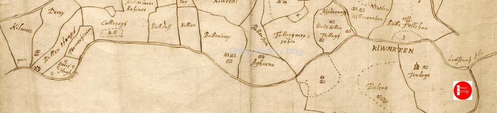
Image 7. Detail of John Gwin’s map showing Silver River
Detail of John Gwin’s map of the barony of Ballycowan which shows the Silver River flowing from Ballynasrah in the bottom left-hand corner to its confluence the Clodiagh at Aghadonagh on the right- hand side, passing Ballyduff, Aharney and Tullymorerahan. The mill is indicated by a mill-wheel symbol. The map is part of a set of twenty-eight important maps of various parts of Offaly drawn four hundred years ago in the Mathew De Renzy papers in the National Archives in London.
KILBEGGAN BRANCH
As early as 1806 the Grand Canal Company’s engineer John Killaly had prepared a detailed map for a proposed branch from Ballycommon on the main canal to Kilbeggan. This line was closely adhered to when work finally begun twenty-four years later in 1830. An application for funding was made in 1825 and despite strenuous objections from the Royal Canal Company a loan was approved in 1828. In March 1829 Killaly had completed the plans and specifications for the line. A month later William Dargan’s proposal to build the line for £12,850 was accepted.
Image 8 William Dargan
William Dargan, (1799-1867)
From the outset work was slow due to continuous wrangling between the contactor and the company. Dargan had taken his own levels, but the canal company insisted he use those of Killaly. Even when progress was made recurring problems with staunching the huge embankments at Bracklin Little and Lowertown delayed construction. Allied to this was the major distraction of Dargan’s involvement with the building of Ireland’s first railway line.
Image 9. Bracklin Little and Lowertown townlands on the1912
Bracklin Little and Lowertown townlands on the1912 Ordnance Survey six-inch map, showing the meandering Silver River and the dense hachuring between Lowertown and Murphy’s bridges. This represents the steep slopes of the embankments which carry the aqueduct high above the surrounding landscape. Note the overflow at south end of the aqueduct. This was to prevent the level of the canal rising to a height where it would overflow the banks and lead to a major breach. Just like at the Blundell Aqueduct there were twenty-six miles of canal without a lock which would have poured out at this point if a burst occurred, leading to much destruction and a long-term closure of the navigation.
Dargan’s chief biographer Fergus Mulligan describes this episode in Dargan’s life in the Royal Irish Academy’s Dictionary of Irish Biography:
Ireland’s first railway line, the Dublin & Kingstown, opened in 1834 and Dargan was fortunate to win the contract to build it against six competitors. Working under another Telford pupil, Charles Vignoles (qv), as engineer, Dargan began work near Salthill in April 1833, and although he was six months late finishing the line (which opened on 17 December 1834) the penalty clauses in his detailed contract were not enforced. The successful completion of this line gave Dargan a springboard to winning a substantial share of Irish railway construction contracts on offer in the 1840s and 1850s.
Again, we are greatly indebted to Fred Hammond’s monumental survey of all 407 bridges in Offaly in 2005 for a detailed description of this aqueduct:
A tall arched masonry bridge carries the disused Kilbeggan Branch of the Grand Canal over the Silver River at the county boundary. The abutments are of dressed limestone blocks, regularly laid and with finely dressed quoins. The arch is of semi-circular profile, with finely dressed radial voussoirs and dressed stone soffit blocks; it spans 3.59m. The arch is embellished with finely dressed string courses around the tops of the quoins and across the crown. Over the top of the upper string course are four regular courses of dressed stone blocks. They are surmounted by a slightly inset random rubble parapet. The sloping wing walls are detailed as the abutments and are coped with stone flags.
A case can be made for declaring that the Grand Canal in Offaly is the county’s greatest building. No other structure has contributed so much to the economic development of so many of its towns and villages over the last 230 years. In addition, it has supported the recreational wellbeing of local citizens for a hundred years or more and seems set to do so exponentially in the decades ahead. It also preserves a relatively undisturbed wildlife corridor for many of our threatened flora and fauna species. The canal has its own rich cultural identity, much celebrated in literature and music. Its components, listed below, still combine to create an architectural entity that is almost fully operational although in a fashion undreamt of when it was first conceived in 1715, well over 300 years ago.
Combining the Shannon or Main Line (1793–1804) and the Kilbeggan Branch (1830–35), the stretches of the canal in Offaly and Westmeath took just over fifteen years to build. As it flows forty-four miles from Cloncannon, south-east of Edenderry, to Bunbrosna and Minus, downstream of Shannon Harbour, and eight miles along the Kilbeggan Line, its architectural components present a staggering list: it tumbles through sixteen locks; crosses five large aqueducts; supports and reflects forty or so ancient and modern bridges; funnels into its own channel an array of supplies or feeders, kept in control by a strategically placed system of overflows or overspills; conducts scores of unwanted streams, syphoned and otherwise, through scores of tunnels or culverts, under its non-porous bed to nearby rivers and gently glides along between a hundred miles of well-staunched towpaths and embankments to a seamless confluence with the brimming Brosna and the Lordly Shannon.
A singlehanded trip from the River Shannon to the town of Tullamore along the western section of the Grand Canal was conducted by the writer over seven days in August, 2023. The trip was conducted aboard the heritage vessel Bomb Scow a converted thirty-three foot Royal Navy seaplane tender. Our thanks to Donal Boland for this comprehensive overview of the Brosna Line, Shannon Harbour to Tullamore which is better presented as one extensive with its helpful picture coverage. This comprises articles 6 to 10 in the series on Grand Canal Offaly.
Content
Overview
Entrance from the River Shannon
First Lock Number 36
Lock 36 to 35
Lock 35 to 34 Shannon harbour
Lock 34 to 33 Clonony Barracks
Lock 33 Belmont…
Belmont to Tullamore
Memories
Appendix 1: Hull and Spoke Concept
Appendix 2: The Napoleonic Aspect
1. Overview
A singlehanded trip from the River Shannon to the town of Tullamore along the western section of the Grand Canal was conducted by the writer over seven days in August, 2023. The trip was conducted aboard the heritage vessel Bomb Scow a converted thirty-three foot Royal Navy seaplane tender.
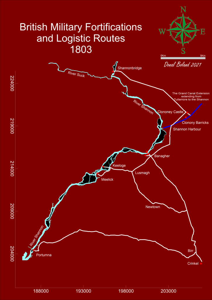
The trip, was a fact-finding event to record the on-water experience as part of an initiative to highlight the possibility of attracting more visitors to this section of the canal. Described here as The Grand Extension, previous research had revealed its construction was later than the eastern section of the canal and forming part of the British Militaries Napoleonic defensive network.
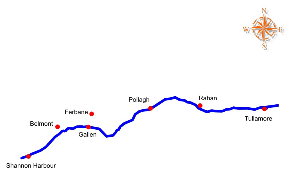
The route commenced in the west on the callow fringed landscape of the River Shannon, travelling through boglands on a raised section of the canal and terminating to the east in an Esker dominated upland landscape, encountering the villages of Shannon Harbour, Belmont, Ferbane, Pollagh, Rahan and the town of Tullamore.
The Stllwater Navigation extending for a distance of twenty two miles and rising some ninty feet is comprised historically of the waterway, ten locks, twenty bridges, eighteen aquaducts, four feeders and four spillways. Presently the waterway is managed by four lock keepers or waterway patrollers with overlapping areas of responsibility, who operate the lock systems and control the sections water levels.
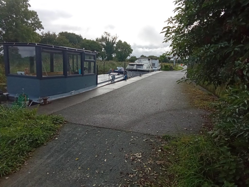
The Grand Extension, Town and Villages The heritage vessel Bomb Scow moored on The Grand Extension
2. Entrance from the River Shannon
The Stillwater navigation of The Grand Extension is accessed from the River Shannon by way of the Brosna River and its confluence with the Shannon. This entrance is characterised by magnificent over-hanging foliage to the north and earthen banks associated with the canal’s construction to the south. An isolated, derelict bridge-keeper’s cottage that stands on Bullock Island is passed as you enter the River Brosna waterway.
The confluence of the River Brosna waterway with the River Shannon
The River Brosna waterway
The confluence of the River Brosna Waterway and The Grand Extension
3. Lock Number 36
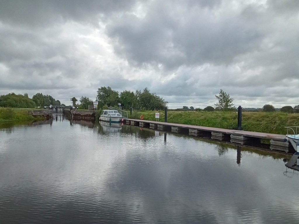
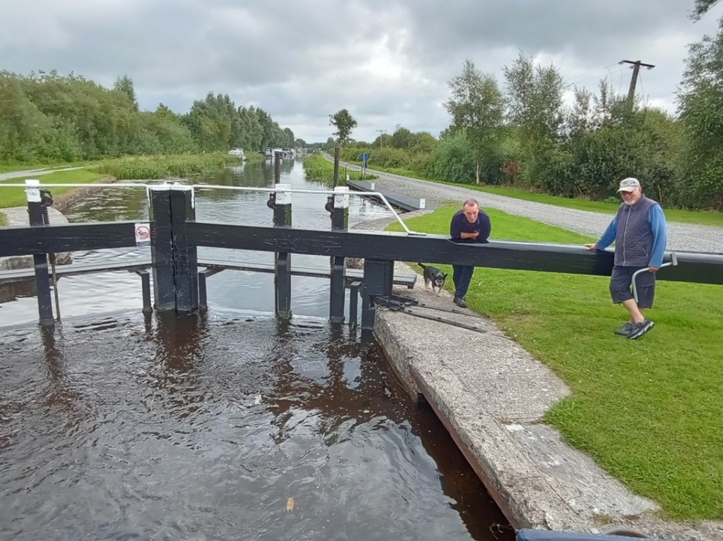
Lock 36 is the final, lowest lock on the Grand Canal system and the first lock you meet when arriving from the River Shannon. A long, floating jetty stands on the southern bank immediately below the lock, providing access to land by way of a large sloping ramp. The lock constructed of cut-stone is entered via wooden balanced, hanging gates that incorporate water control sluices, operated by the lock keeper utilising a rack and pinion mechanism mounted on the gates topside. The gates are opened and closed by way of the long balance beam that extends from each gate.
An engraved stone plaque mounted on the north wall of the lock, details the construction and features of the extension.
The entrance to Lock 36 and its large waiting jetty
The empty cut-stone lock chamber and wooden gates
The full lock chamber and upper-gates
The upper lock gates opened and the ever-attendant lock keeper
4. Lock 36 to 35
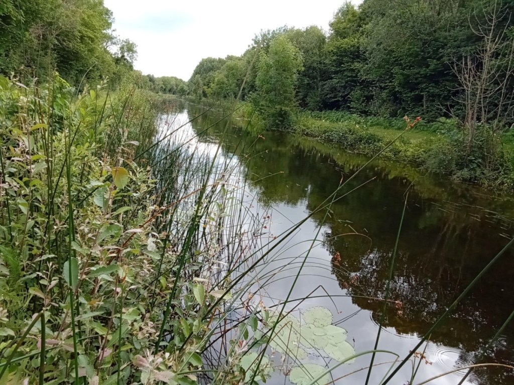
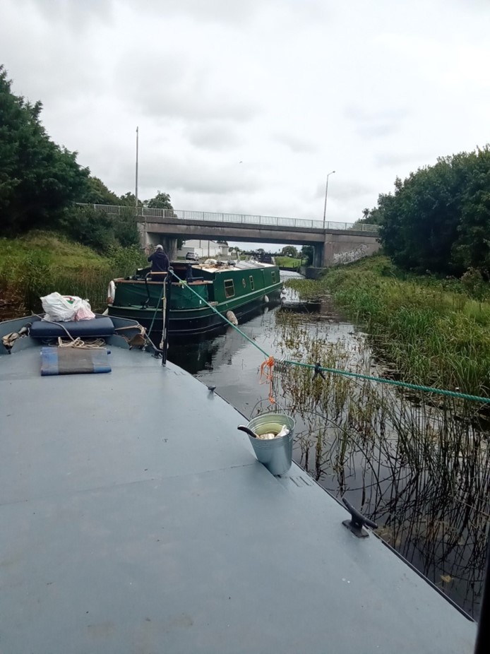
This short section of the canal provides an initial experience and understanding of the Stillwater navigation. It is many times narrower than the River Shannon with a defined navigation path bordered by moored vessels to the north and a rich reed-based ecosystem to the south.
Entering the first section of The Grand Extension
The short canal section extending from Lock 36 to Lock 35
Lock 35
5. Lock 35 to 34
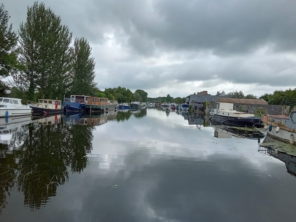
The second, Lock 35 on the system, provides access from the first level up to the second level which is comprised of Shannon Harbour, Griffith and Clonony bridges and a section of canal extending to the thirty fourth lock that contains numerous moored vessels for most of its length The waterway beyond the moored vessels starts to provide an understanding of the true characteristics of this Stillwater navigation.
A feature of this canal is the construction of bridges and locks immediately adjacent to one another, this allowed for the transfer of horses (which were originally employed to pull barges along the navigation) from one towpath to the other.
Entering Shannon Harbour
Shannon Harbour
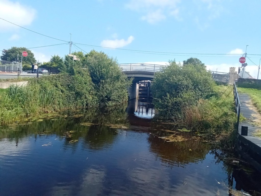
The canal extending to Clonony Bridge and Lock 34
Clonony Bridge and Lock 34
6. Lock 34 to 33
The section of canal east of Lock 34 is best described as the military section as along its northern bank lies the remains of Clonony Military Barracks – most likely the military destination of the canal and the reason it was constructed swiftly. The military grounds are defined to the west by a wooden fence and metal gate and to the east by a long roadside timber fence. The towpath within the military grounds is substantially wider encompassing a lay-by or mooring area. Immediately east of the military grounds lies L’Estrange Bridge and Quay which was utilised by the L’Estrange family for commercial purposes possibly associated with the barracks.
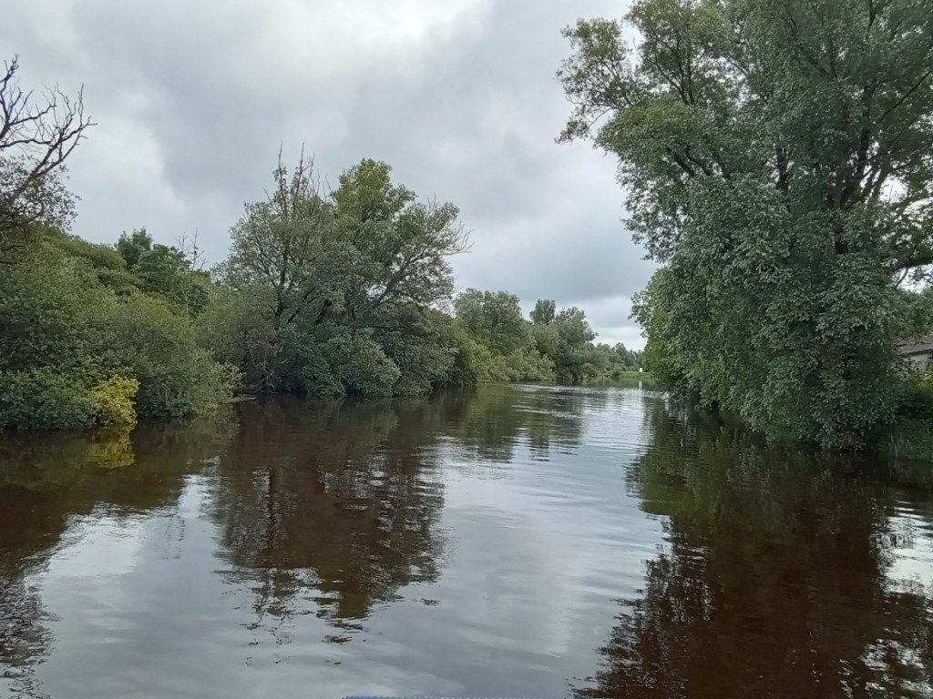
The canal beyond L’Estrange Bridge and Quay displays its mature natural character as a tranquil linear still-waterway navigation mostly devoid of habitation and humanity broken only by the arrival of Belmont Mill.
The Eastern and Western boundaries of the Military Lands
The lay-by and broader towpath within the Military Grounds
L’Estrange Bridge / Quay and Belmont Store
The magnificent natural features of The Grand Extension
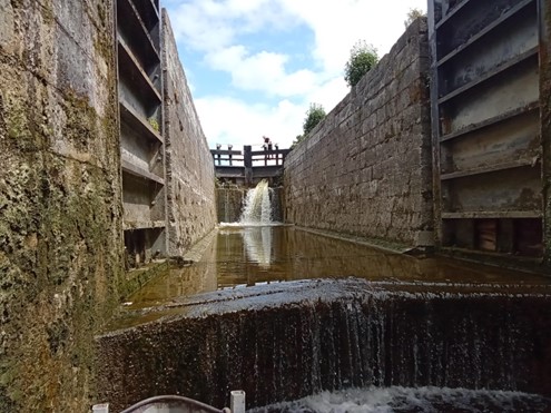
7. Lock 33
Lock 33 or Belmont Lock is the only double lock on the Grand Extension. A double lock is constructed when a high lift is required at a location. The standard lift for locks on the canal is circa eight feet while the lift a Belmont Lock is some fifteen feet. Transiting this lock is a delightful experience hard to describe and best experienced.
Belmont Mill and Lock
Lock 33 at Belmont
Filling the lower level
Filling and emerging from the upper level 8.Belmont to Tullamore
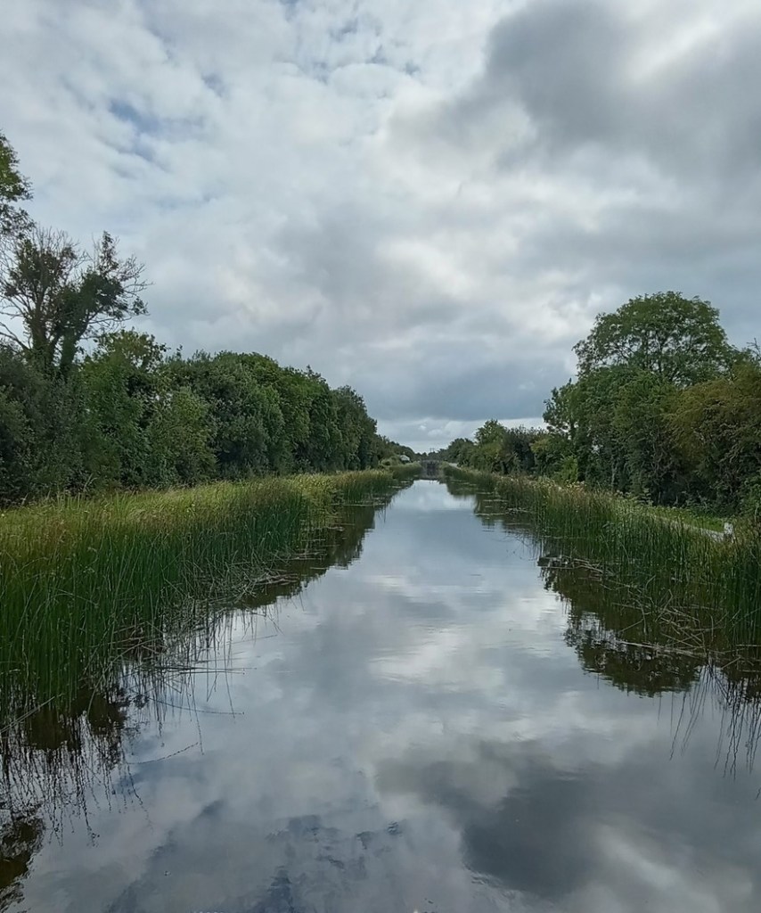
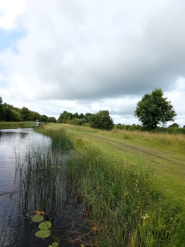
The canal extending east from Belmont Lock to Tullamore is best described as isolated continuous delightful for some and a horror for others. The mind may transition into a relaxed static state imbibing the natural landscape and the activities of inhabiting creatures or one may be bored to insanity. The architecture of the locks, bridges and associated buildings coupled with the relatively unchanged landscape propels one back in time to the period of the canal’s construction in the early eighteen hundreds. This relaxation is interspersed by interludes of surprise and delight when a bridge is encountered and frantic activity when locking from one level to another. The villages of Gallen/Ferbane, Pollagh and Rahan when encountered are a connection with present times providing basic mooring facilities. The town of Tullamore provides an opportunity for the replenishment of supplies and the possibility of fresh water. The facilities available to the canal traveller are sparse and presently reflect the industrial era of canal usage.
A simple water tap
The continuous Stillwater Navigation
A canal bridge endowed with generations of growth
Bell’s Bridge and Lock 32
Gallen Village, bridge and rest area
Gallen Village bankside mooring area
Pollagh Village and Canal-Side facilities
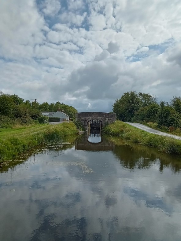
Lock 31
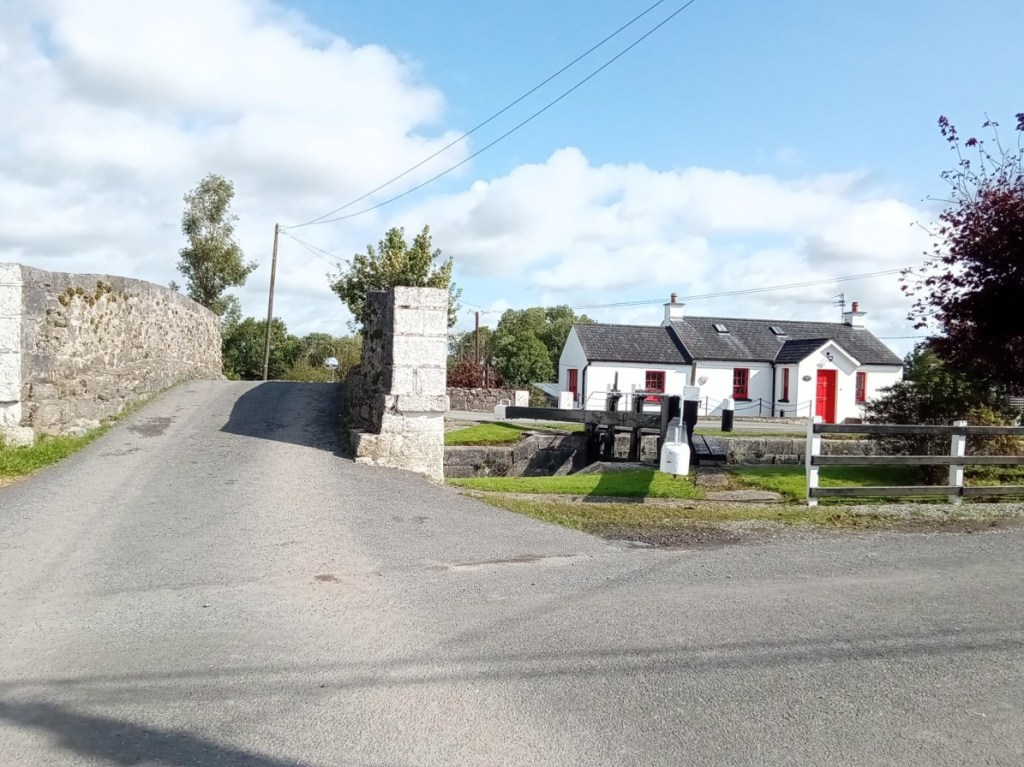
Lock 30 and the canal manager’s house.
The canal-side facilities at Rahan Village and the Thatch pub – a former Williams branch shop
Ballycowan Castle of 1626 and beside it the Huband aqueduct dated to 1803. Huband was a barrister and a director of the Canal Company from 1777 for most of the years to 1835.
Srah Castle, Bridge and and the railway bridge
Sragh Bridge and Lock 28
Entering Tullamore at the Clara Road Lock 29
The spur from the canal main line to Tullamore Harbour
The canal side facilities in Tullamore Town
9. Memories
Memories of this trip are especially positive
The waterway was weed free with a good water level
The courtesy and efficiency of the water patrollers was first class
The lock landings were in a good condition
The lock operating systems all worked well
The lock surrounds were neat and well maintained
The lock keeper’s cottages were a joy to behold
Canal-side moorings and services were adequate and of their time
Would you like to know more about public sculptures in Birr and Offaly? Who commissioned them and what do they tell us? Author, Architect and Town Planner Fergal McCabe will focus on the sculptures in and around Birr town, The Maid of Erin, The Column in Emmet Square, the Hurler, the third Earl and the Tullamore Road entrance piece ‘Looking to the Future’ with some other examples from the county. He will be joined by photographer Paul Moore who documented the sculptures in 2023 and he will talk about his experience of how the images were photographed and the story behind each sculpture. This illustrated talk will be on Monday 15 January 2024 at 8 p.m. in County Arms Hotel, Birr. Signed copies of the new book Faithful Images will be available on the night for €20.00. All are welcome.
For those who believe that the setting of public art is the key to its artistic success or failure, Birr offers five of the very best examples.
The pioneering travel book on the Irish canals was Green and Silver (London, 1949) by L.T.C. Rolt (1910–74). Tom Rolt made his voyage of discovery by motor cruiser in 1946 along the course of the Grand Canal, the Royal Canal (fully open from Mullingar to the Shannon, until 1955 and thereafter from 2010), and the Shannon navigation from Boyne to Limerick (happily now navigable up to Lough Erne). The Delanys writing in 1966, considered Rolt’s book to be the most comprehensive dealing with the inland waterways of Ireland.[1]
During the 1940s, and up to the early 1970s the canal candle was flickering but was kept burning by enthusiasts in England and in Ireland. Among these were the late Vincent Delany and Ruth Delany whose book on the Irish Canals in 1966 was a seminal work. As pointed out in the Irish Times in November 1993 Ruth Delany is the most prolific author on the subject of the Irish canals and herself acknowledges that Green and Silver had a profound influence on her. Other writers were Hugh Malet and Colonel Harry Rice – the latter largely founded the Inland Waterways Association. In 1973 Ruth Delany extended the 1966 book with a full-scale study of the Grand Canal which was reissued in 1995 with an update on the previous twenty years.
Tom Rolt was born in Chester in 1910 and after working in engineering and with vintage cars he became a full-time writer in 1939. Some of his many books are shown in the attached illustrations while ‘his biographies of great engineers, such as Isambard Kingdom Brunel (1806-1859), are still highly regarded. As a campaigner, activist and champion of industrial heritage Rolt is best known for his involvement with the Inland Waterways Association, the Talyllyn Railway Preservation Society, the Newcomen Society, and the Association of Industrial Archaeology.’[2] On his marriage in 1939 to Angela Orred, daughter of a retired army major. They went to live on his house boat Cressy and in 1944 published Narrow Boat, a passionate evocation of the British canals and those who worked on them. His wife left him in 1951 to join the Billy Smart circus. Two very focused people.
The recent demolition of all the former Irish Mist liqueur warehouses in Tullamore and the upcoming demolition of the great oats store of D.E. Williams have prompted this lookback at the site that may have been intended for the first canal harbour or docking point in Tullamore close to Pound Street, later called William Street and now Columcille Street and Bury Quay – where the Old Warehouse (‘Shane Lowry’s’) is now located. The newly cleared site is intended for a 1,644 sq. metre Aldi retail store and associated parking. The bonded warehouse or now Old Warehouse and the oats store south of it were built close to the canal as part of a strategic acquisition by the distiller, maltster and merchant Daniel E. Williams and at a time when the Grand Canal provided a commercial transport artery for smooth access to Dublin and Limerick. This article is no. 3 in the series on the impact of the Grand Canal on Offal
If you would like to contribute contact us info@offalyhistory.com
This week we look at the background to the Vallancey report on the Offaly towns carried out in 1771 to facilitate the construction of the new Grand Canal line from Dublin to the Shannon. Vallancey was then a young engineer, employed to report to the Commissioners of Inland Navigation and his findings were published in a little known and very scarce pamphlet, AReport on the Grand Canal or Southern Line (Dublin 1771).[2] This report is useful as a window on some of the north King’s County (hereafter generally referred to as Offaly) towns and villages and all the more so because of the scarcity of published accounts of the midland towns prior to 1800.[3] The report was published in the same year as that of John Trail who was at the time employed by Dublin Corporation.[4] Vallancey was writing with a mission. He was being paid to spin the story of the benefits that would come from inland navigation and to highlight the difficulties with road transport and its adverse impact on competition and pricing of commodities so as to bolster the arguments in favour of canal construction and satisfy those who were paying his consultancy fees.
Why not contribute to our series of blog articles on the Grand Canal in Offaly – info@offalyhistory.com.
The square proper never had a public house until that in GV 5 in recent times, while the Brewery Tap on the western side at GV 3 High Street has served the public for well over 100 years. It was only in 2018 that a new public house and night club was opened at GV 5, now known as The Phoenix. The great garage of G.N. Walshe (GV 1 High Street) replaced the Goodbody hardware store which was in business from the 1840s to 1930 and with a tobacco factory at the rear until 1886.