Rahan, Civil Parish is situated in the ancient O’Molloy territory of Fear Ceall meaning Men of the Woods or Men of the Churches. It is bounded on its north west side by the Brosna River. Its bedrock is Limestone and it has deposits of brick and clay along the Grand Canal.
The townlands from Ballydrohid, Tullamore to CornalaurBallindrinan Townland/ Image Source Townlands.ie
Its best know archaeological site is the Rahan Monastic Centre which was an area of great importance in the early Christian Period.
Townland: Ballindrinan is in the Electoral Division of Rahan, in Civil Parish of Rahan, in the Barony of Ballycowan, in the County of Offaly.
The Irish name for Ballindrinan is Baile an Draighneáin meaning land of the blackthorns.
Coming into Carton West, a small townland east of Tullamore that can be found in the Kilbride civil parish, this parish following the division of the original parish, is distinct from a second civil parish of the same name (Clara). The landscape in this area is mainly woodland, with a bedrock of dark Limestone, as in in the Ballyduff Quarries, this was used in the 19th century Tullamore buildings.
Ballycowan castle in view, about 1958.
This parish lies in the ancient O’Molloy territory of Fir Ceall or Men of the Churches or Men of the Woods. Here you will find many archaeological sites, which some have been destroyed or taken back by nature.
Carton West is in the Electoral Division of Silverbrook, in Civil Parish of Kilbride, in the Barony of Ballycowan, in the County of Offaly The Irish name for Carton West is An Cartrún Thiar meaning the West Carton (land Measure). This is an old measure of land.
Tullamore is the county town of Co Offaly, it lies on the Grand Canal. It is a large and thriving place that has seen great development over the years. In this article, have a look back with a picturesque timeline through from 1798 when the canal reached Tullamore. We will return to Tullamore stories of the canal when the east west tour is completed.
Kilbride Parish: Seven Miles from East to West. The Parish lies in the ancient O’Molloy territory of Fir Ceall, or Men of the Church. It contains main archaeological sites some of which have sadly been destroyed or taken back by nature.
Tullamore is in the Electoral Division of Tullamore Urban, in Civil Parish of Kilbride, in the Barony ofBallycowan, in the County of Offaly. The Irish name for Tullamore is Tulach Mhór meaning Great Hill. The rising ground in Tullamore leads to the hill at High Street – Cormac Street.
The Civil Parish of Geashill is the largest Parish in Offaly, and contains 74 townlands. As well as fine fields and bog land – dark, shale and lime mudstone, are just some of the materials you will find in its bedrocks.
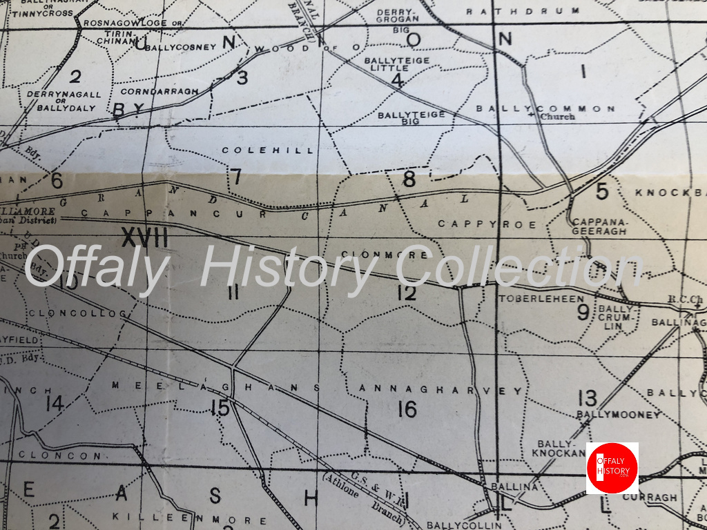
The Parish is part of the ancient territory of “Ui Failghe of the O’Connor chiefs”. It contains some of the oldest remains of castles and is rich in history. From ancient sites such as Enclosures and Ringforts. Sadly many of them have been lost due to nature elements and neglect. It contains the town land of Cappyroe which borders the Grand Canal line, it is the 293rd largest townland in Co. Offaly and in Irish is Ceapach Aodha Rua, translation meaning Plot of Land[2].
Map of the townlands from Ballycommon to Tullamore. There are over 1,000 townlands in Offaly. See townlands.ie for more.Your walk along the canal from Ballycommon will see you visit Cappyroe, Clonmore and Cappancur
In 1911 Cappyroe had one of the lowest concentration of houses in the area, during this period the household returns and ancillary, shows us that the population decreased from 106 in 1841 to 21 in 1911. There were 6 houses on record, all of all of Private Dwelling, with all inhabited, with classes of houses between 1st and 2nd . Age of occupiers ranging from 1-80. Here are the families that occupied these buildings during this time:
As we make our way along the line, we come to lock 22nd, which was previously mentioned in the last series of “East to West”. The 23rd Lock is followed close behind. A smooth and clear pathway can be found, making it easy to walk or cycle along the way. Coming up we see the 24th Lock. This lock is located near the former Celtic Canal Cruisers. We are preparing an article on this canal attraction, 1974-2004.
(08. Celtic Canal Cruisers / Image Source/ Offaly History). We are preparing a blog on this important cruise line. Can you help with material?
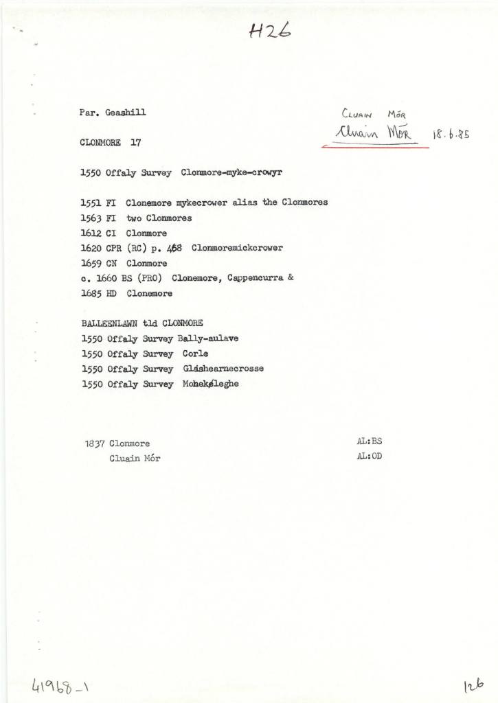
Clonmore (Cappancur), in the Civil Parish of Geashill, in the Barony of Geashill, in the County of Offaly. The Irish name for Clonmore is Cluain Mór meaning Great Field.
Clonmore is the site of a few known churches the Balleenlawn Church that stood until the early 19th century. Its Foundation, was discovered in 1942. It also contained an old graveyard that is still intact today[3].
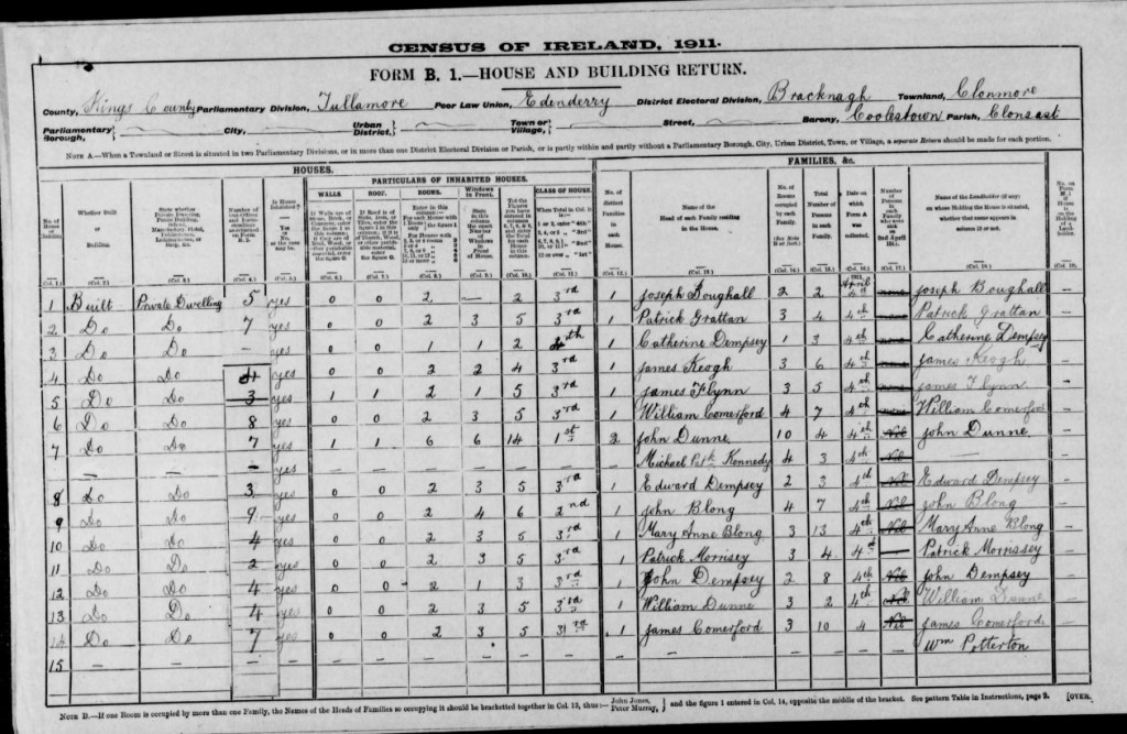
In 1911 Clonmore had 26 houses in the area, during this period the household returns and ancillary, shows us that the population decreased from 220 in 1841 to 101 in 1911. There was 26 houses show on record all of all of Private Dwelling, with all inhabited, with classes of houses between 1st, 2nd and 3rd. Age ranging from 1-80. Here are some of the families that occupied these buildings during this time:
(15.Coachman, source Travel and Transport in Ireland, Edited by Kevin B.Nowlan)
With the construction of the Grand Canal it provided a better connection to reach different townlands around the country. With many place still not connected by waterway, the coach services provided that connect for passengers to reach their final destinations.
As we make our way out of the Geashill Civil Parish, we reach the 25th Lock and Just at Digby Bridge, here we can see just the spire of Tullamore’s Catholic church. Close by is the 26th lock, the barony bridge with its passage under the canal and on to Tullamore. More on Wednesday.
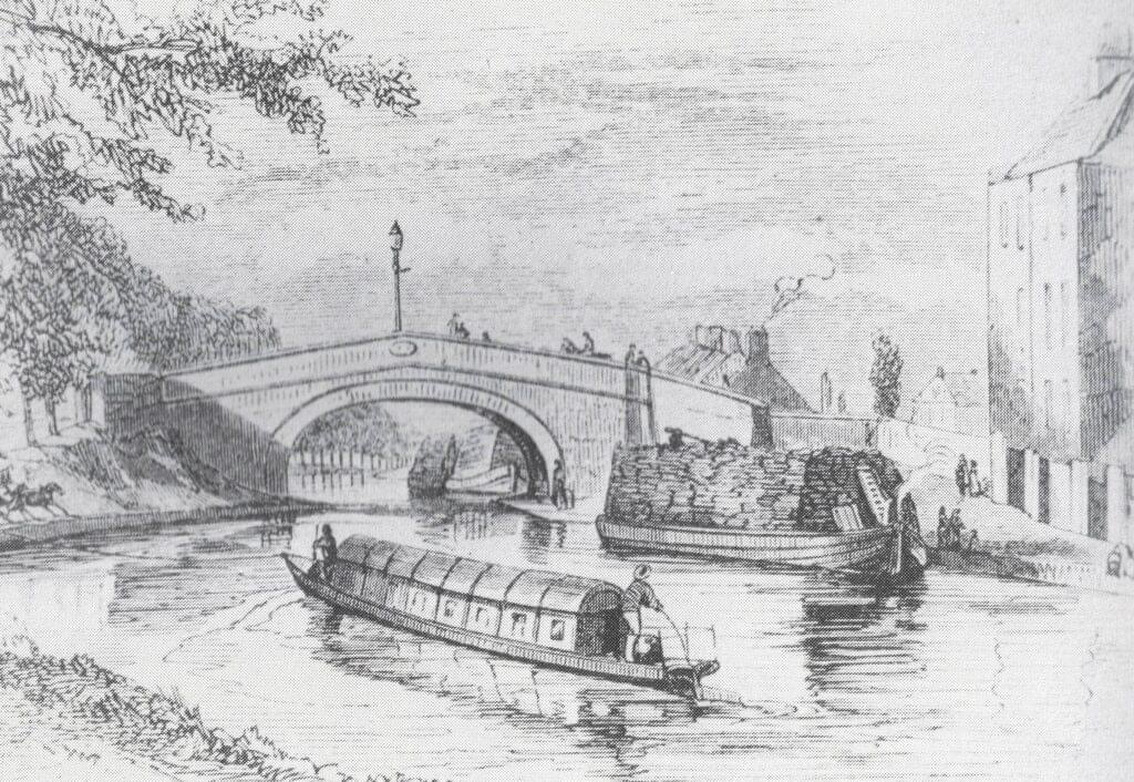
Flyboats on the canal in the 1830s, similar to the later design of the Celtic Cruisers fleet of the 1970s
[1] See “Safe Harbour, The Grand Canal at Edenderry” Mairead Evans & Therese Abbott” Topic Newsppapers Ltd, P22-23
[2] Offaly thought Time & Its Townlands. Thomas Lee. Pub: Ottait Publishing p173
[3] Offaly thought Time & Its Townlands. Thomas Lee. Pub: Ottait Publishing p173
There is an open invitation to all those interested in the River Brosna to come to the book launch on Friday 22 March at 7.30pm in The Star (GAA hall) River Street, Clara hosted by Clara Heritage Society.
John Feehan has dedicated much of his life to studying and communicating the evolution of the landscape and how we have lived in and changed it – his previous Offaly publications have included books on the Slieve Blooms, Croghan Hill, the Landscape of Clonmacnoise, An Atlas of Birr and more recently Killaun Bog and the Camcor River. This new publication focuses on the River Brosna and its catchment.
The River Brosna is one of Ireland’s hidden rivers, glimpsed over bridges and for short stretches as it travels through Mullingar, Ballinagore, Kilbeggan, Clara, Ballycumber and Ferbane on its journey from Lough Owel to ShannonHarbour. Until now very little has been written about it yet few rivers have a more fascinating and varied story to tell. In this beautifully illustrated book John Feehan brings his long experience as an environmental scientist and historian to bear on all aspects of the natural, cultural and industrial heritage of the river and its catchment. Successive chapters review geological origins, the biodiversity of the river and its tributaries as well as the great area of bogland it drains. The history of the mills along the course of the river, and of the two great arterial schemes that so altered the river are reviewed and particular attention is devoted to the extraordinary stories of Mesolithic Lough Boora and the Bronze Age Dowris hoard.
As we make our way along we start to make the journey to Ballycommon, we come to Townparks townland, in the Electoral Division of Daingean, in Civil Parish of Killaderry, in the Barony of Lower Philipstown, in the County of Offaly. The Irish name for Townparks is Páirceanna an Bhaile. Townparks townland in Daingean has the site of Fort Governor which was built in 1547 on the site of an O’Connor Castle stronghold.
along this line we come to one of the gems along this way, the Bord Na Mona lifting Bridge, It’s an interesting spot and a great location to get the camera out. From the late 18th century, the canal was used as a way to transport turf from different cutting points along the line. As trading long the canal was increasing rapidly and was even more encouraged when charges were abandoned, the one that was always a difficult trade to control was the “Turf”[1].
03. The half-inch of c. 1910 from Philipstown to Ballycommon and Cappancur Offaly History Centre. Showing also the Kilbeggan Line of the 1830s.
A few incidents along the line was reported, before the construction of the Circular line, including situations where turf traders, held up and demanded change to the dispatching and the price of turf. After a standoff with an angry crowd, that were armed with swords and guns. The canal company, compromised with the people and ordered that all boats display a clear sign with the price of their turf.
During this time quays were used along the canal to unload turf and an inspector was appointed to see the overall control of the Turf trade. By the early 19th century, a steady flow of boats travelled up and down the line, with up to 33,000 tons every year arriving for dispatch. G- Boats were the main boat used when transporting product and with a fixed toll now applied to all traders, this encouraged the use of greater loads.
Along our Grand Canal Journey from Edenderry to Shannon Harbour we come to Rogerstown, a small townland, in the Electoral Division of Monasteroris, in the Civil Parish of Monasteroris, in the Barony of Coolestown, in the County of Offaly.
The Irish name for Rogerstown is Baile Risteird meaning Richard’s/land.
(01.Monasteroris civil parish from the Index map Kings’ County 1838. Image source Offaly History Centre)
Nineteenth-century Edenderry experienced a prolonged building programme, spearheaded by successive members of the Hill family, marquess’ of Downshire. Chief amongst these was the building of a branch line of the Grand Canal to Edenderry in 1802, furthering the line which had passed within two kilometres of the town in 1796. This line brought extensive investment to the area and was the catalyst for the building of stone and slated houses which replaced cottages and cabins.
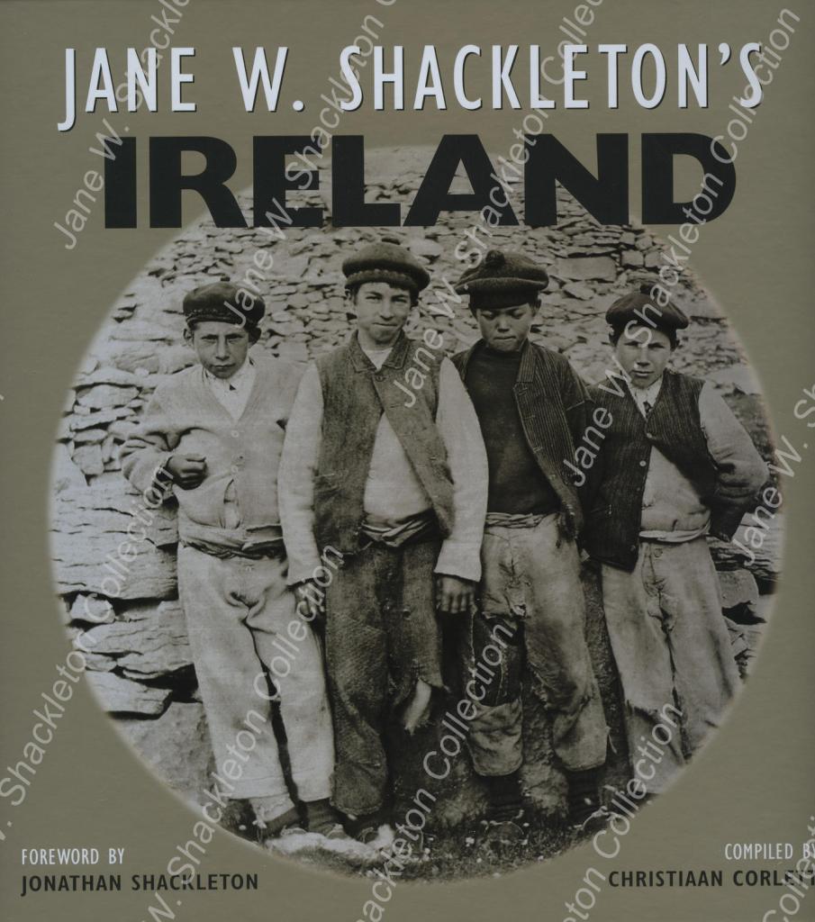
Jane W. Shackleton’s Ireland compiled by Christiaan Corlett (Cork, 2012) is an attractive large format publication was issued by Collins Press and consists of 180 well produced photographs by Jane Shackleton. These pictures are important for the photographic record in County Offaly and mostly date to 1894.
Not surprisingly there are many pictures of mills in this book and there are about ten pictures of Offaly interest. Jane Shackleton started taking pictures in the 1880s and made several tours on the Shannon and along the Grand Canal and Barrow lines. These waterways photographs contribute greatly to the history of the canals and the great mills which were associated with river locations. Many of these were in fact owned by Quaker industrialists. Like other interested women of the period Jane Shackleton was a member of the Royal Society of Antiquaries (RSAI) and took photographs of some of their tours including that of June 1904 around Ireland. Midleton Biddulph, the amateur photographer and retired army officer of Rathrobin near Tullamore was also on this trip and some of his pictures survive and have been published as Rathrobin and the two Irelands; the photographs of Middleton Westenra Biddulph, 1900–1920 (Tullamore, 2021). Corlett informs us that the Shackleton collection consists of 1,000 lantern slides and 44 albums containing several thousand prints, mostly of Irish subjects. This writer had the pleasure of seeing some of the Grand Canal and the turf works at Pollagh back in the early 1970s with Richard Shackleton and Jonathan Shackleton.
Along our Grand Canal Journey from Edenderry to Shannon Harbour we come to Rathmore, a small townlands, on the south side of the canal. Rathmore is in the Electoral Division of Edenderry Rural, in Civil Parish of Monasteroris, in the Barony of Coolestown, in the County of Offaly.
The Irish name for Rathmore is An Ráth Mór meaning great, big ring-fort.
Here we can find the site of a possible Enclosure, it can be seen in outline from aerial photos. Enclosures are one of the most common sites found in Co. Offaly, with over hundred found all over the county. They are often similar to other types of enclosures defined either by a bank or a fosse, such as the Ringforts.
They are identified from other enclosures by being either very large or small and without an entrance. Many are only known as cropmarks, visible only from aerial view, they have no original dates but some may be from the Iron Age.