The noun ‘palimpsest’ derives from the Greek words pālin (again) and psēn (to scrape), and it relates to phenomena that have experienced temporal change and show clear evidence of such transformation.1In industrial heritage, the term ‘palimpsest’ is used to describe the ongoing spatial and social cycles involved in the reutilisation of industrial sites. It indicates multiple layers of activities and cultural practices that evolve within the same geographical space over time. Elements that endure across different periods can be either tangible, such as built heritage structures and redundant machinery, or intangible, like traditional craftsmanship, traditional knowledge systems, and cultural values.2It is important to recognise that the International Committee for the Conservation of Industrial Heritage (TICCIH), the International Council on Monuments and Sites (ICOMOS), and the Industrial Heritage Association of Ireland classify industrial heritage as a vital part of cultural heritage.3
(more…)Category: Historic Towns
-
An opportunity to see the old Tullamore jail and hear of its turbulent history in the 1880s, 28 March, Saturday from 10.00 a.m. A welcome to all and meet local history enthusiasts for coffee at 10 and the book launch at 11 a.m. An Offaly History blog, no. 788, 27 March 2026.
28 March Saturday at 11.00 a.m. at the former Tullamore Prison/Kilcruttin Business Park, Cormac Street, Tullamore, for the Launch of a new edition of Prison Poems or Lays of Tullamore by T.D. Sullivan, edited by Terry Moylan and Padráig Turley. Sullivan like William O’Brien and John Mandeville were political prisoners who refused to wear the prison clothes.
See Cormac Street from a new perspective
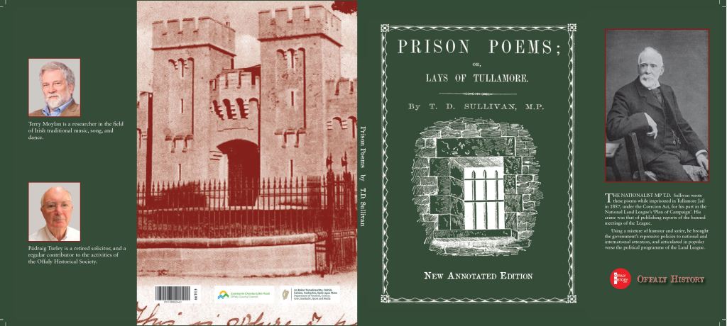
Jacket of the new edition of Prison Poems Today we are reminded of the jail every time we stop at the lights at the junction with Cormac Street, Kilcruttin and Charleville Road and look to the magnificent limestone façade, memorial tablet, jail warders’ cottages and the very fine gates with their Roman fasces to remind us of the symbols of authority back to early times. Then who has not heard of the underground passage (now mostly closed off) that allowed the prisoners to be brought into one of the two semi-circular courts in the old pre-1922 courthouse.
(more…)
-
The new Birr Urban District Council 1899: women were included on the electorate for the first time and the end of the Birr Town Commissioners. Blog No 774, 10th Jan. 2026. By Martin Hoctor
Town Commissions in Ireland were possible from 1847 after the introduction of the Towns Improvement (Ireland) Act that would allow the larger towns to introduce a series of measures starting with the appointment of commissioners to carry out works in a town like drainage, paving, and other improvements to the infrastructure. Unfortunately, this legislation was neglected in Ireland during the years of the Great Famine and it was not until the early 1850s when events slowly improved in terms of lesser number of deaths that several towns began to explore embracing this legislation for their districts. Parsonstown (Birr) Town Commissioners held their first meeting on August 4 1852 with Laurence Parsons elected as the first chairman and slowly began to implement the 1847 Act and its subsequent consolidation statute in 1854. Over the next 46 years Parsonstown/Birr Town Commissioners attempted to run the town from the rates received from the ratepayers and loans from the Local Government Board as they engaged in constant disputes with the King’s County Grand Jury and the County Surveyor for decades over which authority was responsible for the scavenging and cleaning of the streets and the expenses incurred.
We are glad to welcome the second of our Young Historians blogs this week and this year. If you have an article or an idea for an article do contact us at info@offalyhistory.com. Offaly History blogs now number 774 and reach 80,000 to 100,000 views each year. So do join the panel of authors of this treasure trove of easily accessed articles since 2016. Doing (or have done) a Leaving Cert History Project on local history -keep Offaly History in mind for your piece of research. We can help with editing and illustrations.
(more…)
-
The ‘Elite’ of Tullamore skating at Charleville Lake on St Stephen’s Day 1864. By Cosney Molloy. Blog no 770, 26 12. 2025
Skating on Charleville Lake, Tullamore was a popular pastime when I was a young lad. I remember the cold icy winters of 1962, 1982 and 2010. I can recall as a young man the Tullamore people skating on Charleville Lake in 1962. I am a long time now in D 4 but I got down a few weeks before Christmas of 2020 to the nice butchers in Tullamore – old Tormey’s was still going strong and then you had, Hanlon’s, Crossan’s of Main Street, Ray Dunne and Fergus Dunne, and a few more I would not know. I was sorry to see Grennan’s main shop closed for now in 2020. I miss Paddy Mac’s, Cleary’s and Joe ‘the Butch’ Kearney and not forgetting Dunne’s butchers off the Square. It was Treacy’s later. Liver we got a lot of and sheep’s hearts in that fine shop. Many old friends gone to the heavenly pastures. I always like to get my turkey in Tullamore and a nice ham even though I am out of the town now for over forty years. What with the bacon factory open until 1989, and now Tullamore Meats, the town has a long tradition in fine food. Come to think of it the bacon factory did a huge business in turkeys back in the 1940s and 1950s when my father was rearing same.
(more…)
-
The making of O’Connor Square, Tullamore: People, Houses and Business will be launched on Wednesday 10 December 5 p.m. at the Brewery Tap, Tullamore and Ferbane 1950-2000 on 12 Dec. in Ferbane Blog No 766, 9th Dec 2025
The making of O’Connor Square, Tullamore: People, Houses and Business will be launched on Wednesday 10 December 5 p.m. at the Brewery Tap, Tullamore. The Brewery Tap is the longest established business in the square dating back to the 1830s as a pub and brewery. The lease of the site was dated to 1713 with the property in possession of the Brennan and Thornburgh families, later Deverell, Egan, Adams, Carragher and now Paul and Cathy Anne Bell.
We look forward to meeting you at the launch where savouries and tea/coffee will be served. Parking will be available at this time and should not cost more than 1 euro for an hour. Walkers and cyclists go free.
The making of O’Connor Square, Tullamore: People, Houses and Business (Offaly History, Tullamore, 2025), pp 440, p/b €23, h/b €29. ISBN978-1-909822-45-0 (hardcover) ISBN978-1-909822-46-7 (softcover). The book contains fifteen essays by Michael Byrne, Fergal MacCabe, Rachel McKenna and Timothy O’Neill. Publication is supported by the Heritage Council.
At the same event we launch Offaly Heritage 13. This the 13th issue of the Offaly History Journal It’s another bumper issue with over 330 pages and well-illustrated, €19 soft and €25 hardback. The issue is dedicated to the late Christy Maye – a great friend to Offaly History.
The two books are now available from Offaly History Centre, Midland Books and at www.offalyhistory.com for online.
(more…)
-
Church Street, Tullamore 125 years ago: the ‘families’ (including boarders, lodgers, and assistants in 1901) – at a time of solid fuel cooking, no sewerage, poor lighting and piped water a recent novelty. No. 12 in the 2025 Living in towns series, prepared with the support of the Heritage Council. By Michael Byrne and James O’Brien. Blog No 758, 31st Oct 2025
Did you have old friends or family in Church Street 125 years ago? Probably not. It was a busier trading street 125 ago than it is today. That could be said even sixty years. As to its trade it probably suffered from the introduction of one-way systems and restricted parking in the 1960s. Yet another factor may well have been the closing of the markets in Market Square, and also the decline of the Methodist community in the street. Back in 1901 and further back to the first printed valuation of the mid-1850s it had about 57 rateable units – almost all private houses and shops, but also including Hayes’ Hotel, the Methodist church, the Costello private second-level school, the county infirmary (from 1942 the County Library), Charleville School (until 2006) and the Foresters Hall and Shambles (the meat and veg market).
Church Street is an interesting street to study with a good mix of mostly middle-class housing, good shops and trades, institutions, and good terraces with lots of boarders and lodgers to add novelty.
(more…)
-
King’s County/Offaly Infirmary, Church Street, Tullamore, 1767–1921. By Michael Byrne and Offaly History. No. 11 in the 2025 Living in towns series, prepared with the support of the Heritage Council. Blog No 757, 24th October 2025
You might wonder what was Library Hall used for before being transformed into 15 apartments in about 1995 with a new block of ten to the rear (PD 2824). Yes, some will recall when it was the county library and the happy hours borrowing books and perhaps sitting in the large windows or close to its pot-bellied stove in winter. That was almost fifty years ago. From 1923 to 1927 the building served as the first garda station in Tullamore. And before that: yes, it was the county infirmary or county hospital from 1788 to 1921. How many beds? It had 50 and thirty were generally in use. Budget was £2000 per annum by 1920. That might get you ‘a procedure’ now or a very ‘short stay’.
(more…)
-
Tullamore’s Irish National Foresters building in Church Street. By Michael Byrne and Offaly History. In the Offaly History series on Church Street, Tullamore: houses, businesses and families over 300 years. No. 10 in the 2025 Living in towns series prepared with the support of the Heritage Council. Blog No 755, 15th October 2025
The Foresters building fronting Church Street would not be so easy to recognise today as the ground floor is part of the Chanapa Thai restaurant east of the old Shambles.
In March 2024 we published two articles in this series by Aidan Doyle marking the 125th anniversary of the founding of the Tullamore branch of the Irish National Foresters (I.N.F) and the 100th anniversary of the opening of its new cinema in Market Square. As was noted in a Midland Tribune article forty years ago[1] the Irish National Foresters Benefit Society is an organisation about which most people know very little about although the Tullamore (Conn of the Hundred Battles) branch has been part and parcel of the town since 1899. The I.N.F. may be the fourth oldest organisation in Tullamore after the Freemasons (1759), GAA Tullamore (1888) and the Tullamore Golf Club of 1895-6.
The home of the club in the early years was the CYMS , later called St Mary’s Hall in Thomas/Benburb Street. By 1903 Tullamore I.N.F had its own building on part of the harbour site at the junction of Harbour Street and Henry/O’Carroll Street. The new building worked well for four years but things went badly against them with a fire in the clubhouse in Harbour Street in July 1907: ‘The Tullamore blaze destroyed what was probably one of the finest Forester Halls in the provinces. And what makes the occurrence all the more lamentable is the fact that it had been built only four years.’
(more…)
-
Portavrolla not Portavolla Banagher. By Kieran Keenaghan. Blog No 752, 1st Oct 2025
The place name ‘Portavrolla’ in Banagher can be traced back at least 450 years. Just very recently one ‘r’ was dropped so we now have Portavolla. ‘Port an bhrollaigh’ means ‘the port or harbour at the breast’ (of the hill). Moiler McCoghlan, pardoned by Queen Elizabeth in 1571 was of Porteabroghla and Portwroly appears on a 400 year old map.
‘Logainm’ makes it clear that the correct name is ‘Portavrolla’.
Unfortunately when the Portav(r)olla housing estate development took place about 30 years ago an ‘r’ was dropped..
The sign above by Offaly County Council ‘Beats Banagher’! – ‘Port an bhrollaigh’ being correct and ‘Portavolla’ being incorrect. Regrettably the beautiful sign itself has recently disappeared.
(more…)
-
The leasing of plots or sites for building in Church Street, Tullamore from Lord Charleville to his tenants, 1786–1830s. Part 2. By Michael Byrne and Offaly History. In the Offaly History series on Church Street, Tullamore: houses, businesses and families, over 300 years. No 9 in the 2025 Living in towns series prepared with the support of the Heritage Council. Blog No 751, 27th Sept 2025
Table 1: Buildings erected in Church Street, Tullamore from 1726 to 1924
Here we present a summary of the discussion in the last blog on the leasing of Church Street. GV 1 was up to 2000 the old Hayes’ Hotel erected in 1785-6 and having a long garden as far as the Methodist church. Beyond the church is the terrace of 13 houses, the former infirmary and five smaller houses to the river.
On the north east side were two smaller leaseholds and the Charleville School.

To follow things see the 1838 map, that of 1890, the leaseholders map and the Griffith Valuation map. Enjoy!

The OS six-inch 1838 map of Church St 
The Griffith valuation map for most of Church Street of 1854. It can be viewed on Ask About Ireland site. A handy summary of the Valuation of 1854 with notes by MB
Griffith val. 1854 No. Street Date of construction Lessee Immediate lessor in GV 1854 Lease details GV 1 Church Street GV 1 to 5a 1785, or may be a reconstruction in that year– Reps John Tydd in respect of GV 1 to 5a, for ever John Towers Lease for ever of frontage from Bridge Street to Methodist church of the hotel site on Church Street SW GV 2 Church St House on hotel plot Sublease to Henry Mulholland as in GV George Ridley Ridley succeeded Tydd, Towers and Doherty GV 3 do do Sublease to Michael Delaney as in GV do part of hotel lands GV 4 Sublease to John Lynam as in GV John Tidd part of hotel lands GV 5 Sublease to Mary Lynam as in GV John Tidd part of hotel lands GV 6 Pt of garden of Cuddihy below May predate Cuddihy lease of 1805 Henry Manly of Charleville Sq The haggard garden carved from the Cuddehy plots south of Methodist church GV 7 Church Street GV 6 and 7 1788 Methodist church site in place of destroyed preaching house in Bride’s (Swaddling) Lane. GV 6 is garden behind preaching house and haggard in Tarletons no 6 Charleville Sq No lease sighted for church, 33 ft in front. The haggard was part of Charleville Square House up to late 1930s GV 8 Church Street GV 1805 plus Lease to Michael Cuddehy, Lord Charleville’s mapping surveyor, 1805 of three plots 96 ft in front by 248 sq ft containing 0.1.15 , plot 1 Lyddon. House with two front doors. Let from Revd R.T. Tracey Copy lease with map in OA. Yard at no. 6 part of Cuddehy leasehold and sublet to Manly of GV 6 O’Connor Square GV 9 Church St GV do Cuddehy plot 1 Revd William Molloy House with two front doors. Let from Revd R.T. Tracey GV 10 Church St do Cuddehy plot 2 Sublease to Thomas Stanley (Book Stanley, antiquarian) features in RSAI jn GV11 Church St do Cuddehy plot 3 Miss Catherine Cuddy immediate lessor Christopher Woods, distiller GV 12 Church St do Plot 4 in the terrace to Charles Warren, 32 ft in front. Richard Warren immediate lessor GV let to Miss Turpin GV 13 Church Street do Plot to Darby Hyland, 32 ft in front Abigal McDonnell Let to Revd R. F. Tracey GV 1854 GV 14 Church Street Plot to Daniel Warren, 32 ft in front Mrs Daly Let to Mrs Anne McDonnell GV 1854 GV15 Church Street 3 Plots, 1 to George Slator 96 ft Reps Revd Nath. Slater GV 1854 Thomas Briscoe GV 16 Church Street 3 Plots, 2 to George Slator 96 ft do Francis Dorman GV 17 Church Street 3 Plots,3 to George Slator 96 ft do James H. Marshall GV 18 Church Street 3 Plots,3 to George Slator 96 ft do William W. Philips GV 19 Church Street 2 plot 1 plots to Robert Belton, Wm K. Fawcett GV Vacant, related to Michael Molloy d. 1846, the distiller and Anthony M. died 1851. GV 20 Church St 2 plots 2 to Robert Belton, temporary barrack do GV Vacant GV 21 Church Street 1788 3 plots 2 to Robert Belton, temporary barrack do The third house on two plots GV James Reilly GV 22 Church Street 1788 No lease King’s County infirmary 86 ft in front Held from head landlord the earl of Charleville GV 23 Church Street Mrs Jordan original lessee Held from Thomas Duggan Occupier GV John Pilkington GV 24 Church Street Samuel Woods Held from earl of Charleville Occupier GV Christopher Woods GV 25 Church Street Held from Elizabeth Woods do Occupier GV Christopher Woods GV 26 Church Street do do Occupier GV George Whitten GV 27 Church Street Pound and House see pic with this blog Held from earl of Charleville Occupier GV Christopher Woods GV 28 Church Street 1869 vacant and later Feehan fowl store, now part of a new 2025 terrace in yard do Occupier GV Thomas Clooney GV 29 Church Street Mary Lynam Occupier GV Charles Crowley GV 30 Church Street Mary Lynam Occupier GV Maurice Summers GV 31 Church Street GV School house and yard, opened 1811 Held from earl of Charleville. The female school was in Henry/O’Carroll Street Charleville Schol boys, on the former Fair Green plots fronting Henry St GV 32-49 and Market Lane 1-12 Late Robert Belton George Slater for ever 398 ft in front in 1854 Thomas F. Slater 17 houses, and one office building let to Sterling. This holding included the 12 cabins in Market Lane or Church Lane (Pike’s Lane) valued each in the range of 10s to 15s. From Sterling to Henry Street incl Market Lane. Nos 48 and 49 let to Thomas Sterling by T F Slater and part sublet to James Byrne GV 50 Church St Mr Sterling A plot occupied by Thomas Sterling from earl of Charleville and probably formed part of the curtilage of the 1726 church Laneway not rated Garden [now Market Lane access to The Cornmarket Earl of Charleville In GV called Corn Market Lane GV 1 Church St but from Market Square Meat Market (Shambles) Do. Tolls of shambles and corn market let to Robert Willis by 1854. In 1843 with Sterling. Site with part of the Michael Byrne plot of the 1726-1815 church GV 51 Church St Michael Byrne plot 1 Immediate lessor John Perry GV occupier Thomas Magill, much later Morris drapery GV 52 Church St Michael Byrne plot 2 GV occupier John and A Warren GV 53-57 Church Street and 1 Columcille Street Church St 44’ 6 inch to William Street and 192 ft to Church St (180 ft by lease) Immediate lessor John Slater from earl of Charleville Five houses held by John Slator GV 1854 occupiers – Atkins, Duggan, Little, Irwin and Nugent, valued in range of £4. 10s. to £8. 10s. 
Church St on the five-foot scale, surveyed 1885-90. 
The Griffith map of 1854 – available on Ask about Ireland.com Thanks to the Heritage Council for support to Offaly History in preparing this article.

