The town councils of Tullamore, Birr and that of Edenderry were abolished ten years ago in what some consider was a mistake and a hasty reaction to the calls for pruning in that recessionary period. Here we provides some headlines for significan events since the first council body – the Tullamore Town Commission – was established in 1860. This was followed by the urban council in 1900. We post this blog on the anniversary of the great balloon fire of 10 May 1785.
(more…)-
54 Charles Coote’s observations on Ballycowan barony and the district of Tullamore for his Survey of King’s County published in 1801. No 54 in the Grand Canal Series from Offaly History. Blog No 610, 8th May 2024

The line of the Grand canal to Philipstown and Tullamore is the only navigation through this county, and is material advantage to the district, through which it passes. Levels have been taken, and the line laid out for a further extension of this canal to the Shannon, with off branches to Birr and other towns, which is not yet put into execution.
The terminus of the line from Dublin to the Shannon was Tullamore for the years 1798 to 1804 when the link with the Shannon was at last completed. In the 1790s a line to Kilcormac and Birr was considered but on the grounds of expense that along the Brosna was selected.
[175] Ballicowan village is the estate of the [176] Earl of Mountrath, and here are the ruins of a castle, which gives name to the barony. Turf fuel is in plenty, and had on the cheapest terms. . .

Ballycowan castle c. 1958, it took its present configuration in 1626 and was destroyed by the Cromwellians in the early 1650s with the Cootes succeeding to the estate forfeited by the Herberts. Tullamore is the market for grain, and indeed the produce of many adjoining baronies is sent thither, there being the fairest sale and a good demand amongst the buyers, occasioned principally on account of the many stores, which were established by the Grand Canal extending here, and which divides this barony for some distance. This proves the value of inland navigation and gives the farmer in these distant parts the advantage (as we may say), of bringing Dublin market home to his door.
(more…)
-
Offaly and the Great War essays published in 2018 now on Open Access to all. Thanks to the Decade of Centenaries. Blog No 609, 4th May 2023
The bumper volume of essays (list below) in Offaly and the Great War (Offaly History, 2018) can now be accessed free online at www.offalyhistory.com thanks to the Decade of Centenaries. The book of 28 essays is also available in hardcopy from Offaly History for just €20. In all over 50 articles free to download. Go to the Decade of Centenaries on the offalyhistory.com website.
When the great historian and first ‘telly don’ A.J.P. Taylor published his short history of the First World War just in time for the remembrance days of over fifty years ago he wrote that the war reshaped the political order in Europe. That its memorials stood in every town and village and that the real hero of the war was the Unknown Soldier.
(more…)
-
Father Whelan from Ballycommon, County Offaly. He laid the foundation for the Catholic Church in three American States. By Danny Leavy. Blog No 608, 3rd May 2024
Prior to 1783, the history of the Catholic Church in America was one of struggle and suffering. The country was under British rule until the victorious War of Independence that year. In her struggle for independence, France was America’s greatest ally. King Louis XVI sent out a large fleet, under the command of Comte De Ternay on April 16, 1780. It anchored off Rhode Island on July 11, 1780. It was to wait for a second fleet under Comte De Grasse, which departed on March 22, 1781. The second fleet reached Chesapeake Bay on August 26th of the same year.

At this time, the Irish Capuchins had two convents in France, Bar-sur-Aube and Vassy, where the friars were trained with the intention of returning to Ireland. Ireland at the time was under the penal laws. The Capuchins had removed their novitiate to France. The French King put out the call for Chaplains for the forces destined for America. Twenty Capuchins answered the call including, Father Charles Whelan, from the Vassy convent. Father Whelan was born in Ballycommon near Daingean, County Offaly, in the year 1741.
(more…)
-
52-53, Grand Canal Townlands East to West: Ballysheil to Clonony Beg No 52-53 in the Grand Canal Offaly Series. By Philomena Bracken, Offaly History. Blog No 607, 1st May 2024
Ballysheil is in the Electoral Division of Gallen, in Civil Parish of Gallen, in the Barony of Garrycastle, in the County of Offaly. The Irish name for Ballysheil is Baile Uí Shiail meaning the town of O Siail.
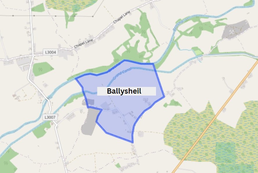
Ballysheil townland.ie/ Image Source: https://www.townlands.ie/ In this area we come to two smaller bridges, not far part from each other. Glyn and Judge’s Bridge. You will find the remains of the old Ballysheil house, once a beautiful tall building that stood out for its unique stone work and design. Where it once called home to noble guests, where it saw a number of events over its time, which would have had servants pacing back and forth doing the bidding of lord and lady of the house[1]. You will also find a bawn here this property was owned by the Sheil family, well known for their medical skills. The house and bawn exchanged hands to new owners when the Sheil family were forcibly transplanted to Galway in the mid17th century. If looking around this area along the way, you may also find evidence of a corner tower[2].
(more…)
-
50-51, Grand Canal Townlands East to West: Derries to Glyn No 50-51 in the Grand Canal Offaly Series. By Philomena Bracken, Offaly History. Blog No 606, 27th April 2024
With the construction of the Grand Canal from the late 1750s, brought with it the expansion of Trade. goods could be carried from East to West along the line, this helped boost the development of the local economy from the late 18th century. The Offaly section of the canal runs approximately 42 miles and is home to a number of species and wild plants, due to the cross over through wet bog land during the development of the canal way[1].
The first townland we come to along this way is Derries. It is situated in the Electoral Division of Ferbane, in the Civil Parish of Wheery or Killagally, in the Barony of Garrycastle, in the County of Offaly. The Irish name for Derries is Na Doirí meaning The Oak Woods.

Derries townland map. Image Source: Townlands.ie / Illustrations Nature on Irish Canals by Paul Francis Wheery or Killagally is a large civil parish and it extends about 7 miles from Pollagh Village.
(more…)
-
‘Altogether, Tullamore was voted an excellent destination’. A visit to Tullamore and district in September 2023 by Michael Fewer. Blog No 605, 26th April 2024
In April 2023 our little history group had a successful trip to the town of Wexford, where it was decided that our next outing would be Tullamore. So, on 28 September, we came together for lunch in the bar of the Bridge House, of which I have fond memories of getting warm and dry after a trek in driving rain from Daingean during my walk across Ireland in 2001, before checking in to our bed and breakfast accommodation at the Sea Dew guesthouse.
After lunch we took a walk up the town to have a look at the Offaly History Centre owned by the Offaly Historical and Archaeological Society. It is a very impressive facility indeed, an extensive premises just chock-a-block with books old and new, collections of records of all kinds, bound newspapers, photographs, family papers, school records – the list goes on and on. Michael Byrne had been introduced to me by Fergal McCabe: Fergal’s watercolour works are everywhere there.
(more…)
-
48-49, Grand Canal Townlands East to West: Pollagh to Turraun No 48-49 in the Grand Canal Offaly Series. By Philomena Bracken, Offaly History. Blog No 604, 24th April 2024
Pollagh also spelt as Pullough, is located in a small village in County Offaly, it is in the Civil Parish of Lemanaghan. A small parish, it extends from Ballycumber to Ferbane. Pollagh village can be found on the north side of the canal. The Parish lies in the territory of Dealbhna Eathra of the MacCoghlans – an ancient people. It has a rich heritage in its archaeology including the important monastic site, churches, and ringforts and the famous castles.
One of The townlands that we come along as we work our way down the line is Pollagh, the name in Irish is Pollach, meaning Place full of Holes.
(more…)Townland Area Pop in 1841 Pop in 1851 No. of Houses in 1841 No. of Houses in 1851 Pop in 1871 Pop in 1911 No. of Houses in 1871 No. of Houses in 1911 Pollagh 907 267 168 43 33 282 223 42 50 An interesting profile in the fall and rise of the population due one assumes to the successful brick industry.
-
Renewing your subscription to Offaly History (Offaly Historical and Archaeological Society) for 2024: a gentle reminder to Canon Stubbs, the Regius Professor of Modern History at Oxford, in regard to his membership subscription due to the Hellenic Society, in 1882. Joining OHAS in 2024. Blog No 603, 21st April 2024
A recent purchase by a ,member of Offaly History of the Letters of William Stubbs (1825-1901), edited by W.H. Hutton included an original letter from the Hon. Secretary of the London-based Society for the Promotion of Hellenic Studies sending a gentle reminder to the learned and revered historian that his subscription was outstanding for four years. i.e. from when that society was formed in 1879. This sometimes happens in Offaly History too, when perhaps a distinguished member will forget to renew and one would not have the temerity to send a reminder. Not so the Hellenic Society.
(more…)
-
46-47, Grand Canal Townlands East to West: Ballindrinan to Cornalaur No 46-47 in the Grand Canal Offaly Series. By Philomena Bracken, Offaly History. Blog No 602, 20th April 2024
Rahan, Civil Parish is situated in the ancient O’Molloy territory of Fear Ceall meaning Men of the Woods or Men of the Churches. It is bounded on its north west side by the Brosna River. Its bedrock is Limestone and it has deposits of brick and clay along the Grand Canal.

The townlands from Ballydrohid, Tullamore to Cornalaur 
Ballindrinan Townland/ Image Source Townlands.ie Its best know archaeological site is the Rahan Monastic Centre which was an area of great importance in the early Christian Period.
Townland: Ballindrinan is in the Electoral Division of Rahan, in Civil Parish of Rahan, in the Barony of Ballycowan, in the County of Offaly.
The Irish name for Ballindrinan is Baile an Draighneáin meaning land of the blackthorns.
(more…)
