
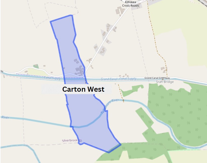
Coming into Carton West, a small townland east of Tullamore that can be found in the Kilbride civil parish, this parish following the division of the original parish, is distinct from a second civil parish of the same name (Clara). The landscape in this area is mainly woodland, with a bedrock of dark Limestone, as in in the Ballyduff Quarries, this was used in the 19th century Tullamore buildings.

This parish lies in the ancient O’Molloy territory of Fir Ceall or Men of the Churches or Men of the Woods. Here you will find many archaeological sites, which some have been destroyed or taken back by nature.
Carton West is in the Electoral Division of Silverbrook, in Civil Parish of Kilbride, in the Barony of Ballycowan, in the County of Offaly The Irish name for Carton West is An Cartrún Thiar meaning the West Carton (land Measure). This is an old measure of land.
| Townland | Area | Pop in 1841 | Pop in 1851 | No. of Houses in 1841 | No. of Houses in 1851 | Pop in 1871 | Pop in 1911 | No. of Houses in 1871 | No. of Houses in 1911 |
| Carton West | 84 | 39 | 24 | 7 | 5 | 17 | 11 | 4 | 4 |
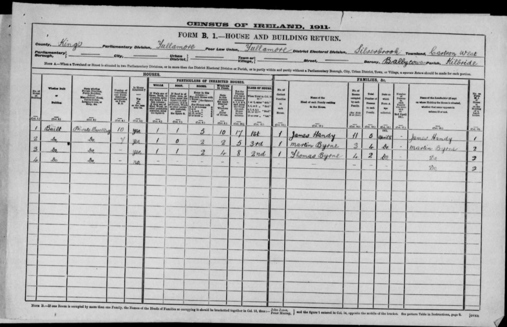
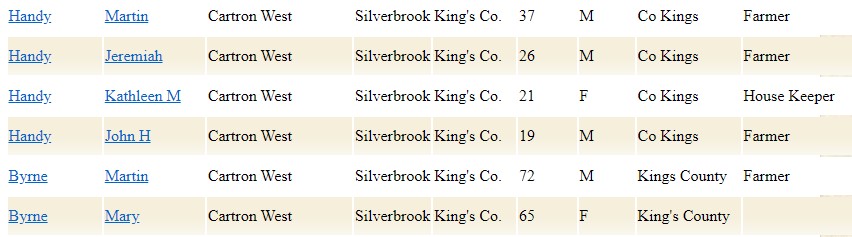
In 1911 Carton West had a small record of houses in the area, during this period the household returns and ancillary, shows us that there was 4 buildings all of Private Dwelling, with 2 inhabited, with classes of one 1st class dwelling, one 3rd and 2nd. Here are some of the families that occupied these buildings during this time:
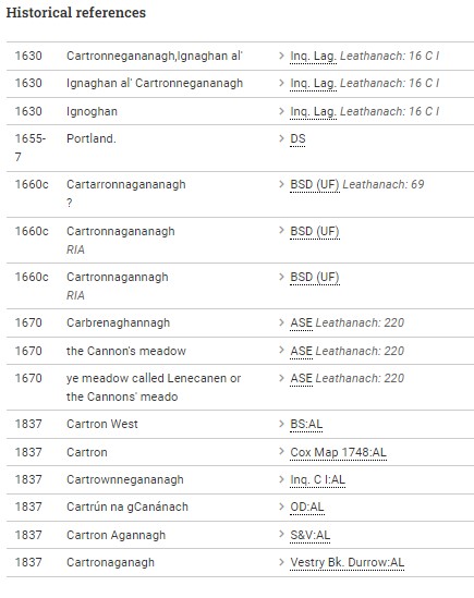
Place name of Carton
Cartron West B.S.S.
Cartrun na gCanananch, the cartron of the Canons.
Cartron &c J.O’D.
Cartrownegananagh Inq Temp Car 1
Cartonaganagh Durrow Vestry Book 1707
Cartron Map 1748
On the Grand Canal, ½ mile west of Srah Bridge, and bordering the parish of Lynally. Contains 82a. 2r. 32p. Is all arable and pasture, but the south part is subject to floods. (From the name books to accompany the mapping of 1838).
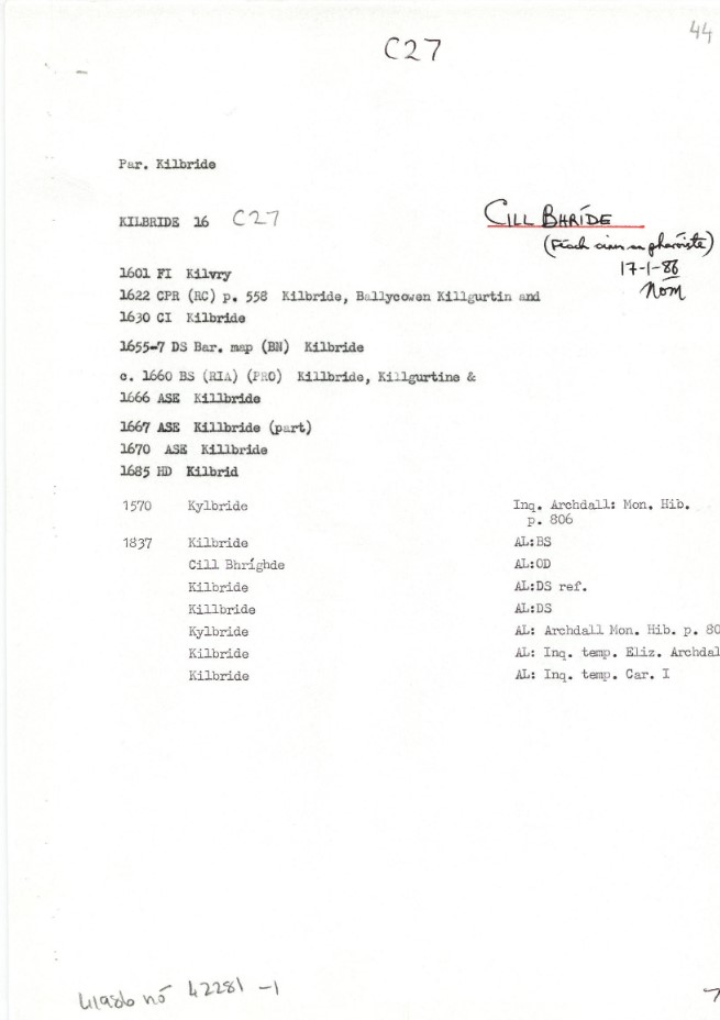
Next Townland: Kilbride, in the Electoral Division of Silverbrook, in Civil Parish of Kilbride, in the Barony of Ballycowan, in the County of Offaly. The Irish name for Kilbride is Cill Bhríde meaning St Brigid’s Church.
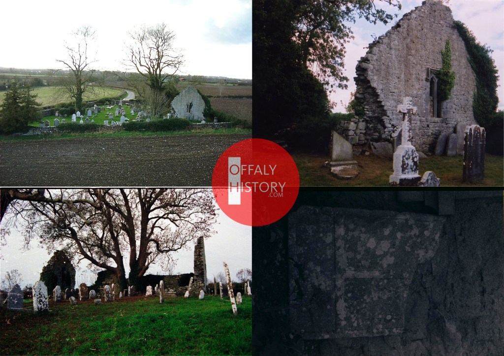
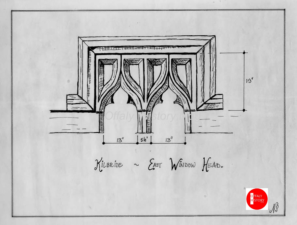
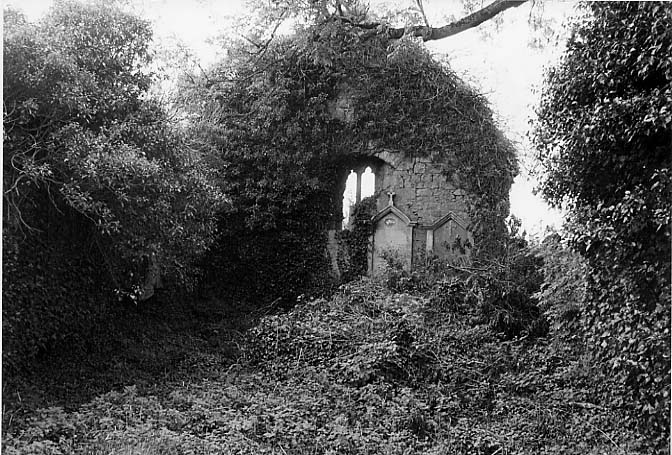
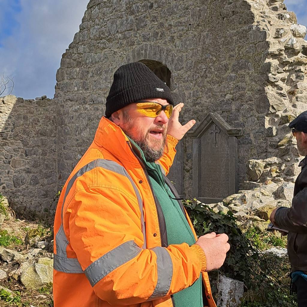
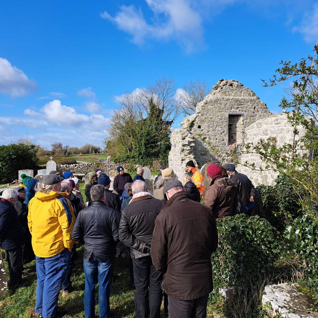
In this townland you will find a church and old Graveyard, parts of the church can be still seen standing today. There is a medieval grave slab inside the church now taken back by nature and debris. The church is named after St Brigid.
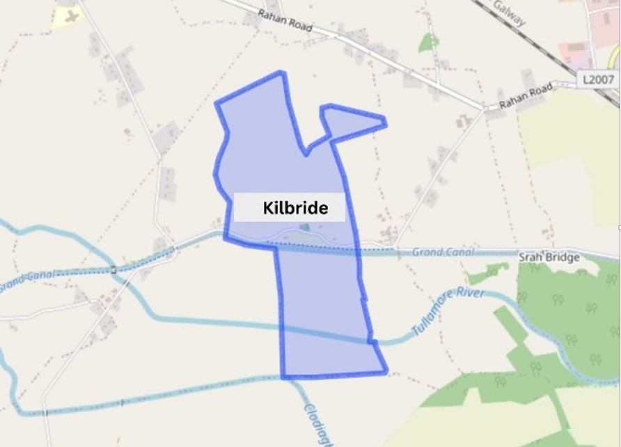
There are a number of architectural fragments around Kilbride especially in the graveyard, which date back to medieval periods[1].
| Townland | Area | Pop. in 1841 | Pop. in 1851 | No. of Houses in 1841 | No. of Houses in 1851 | Pop. in 1871 | Pop. in 1911 | No. of Houses in 1871 | No. of Houses in 1911 |
| Kilbride | 192 | 67 | 47 | 10 | 8 | 42 | 17 | 8 | 4 |
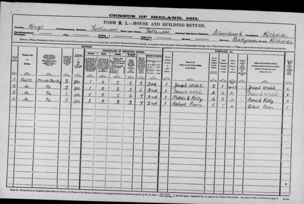
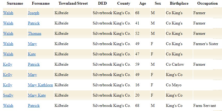
In 1911 Kilbride had a small record of houses in the area, during this period the household returns and ancillary, shows us that there was 4 buildings all of Private Dwelling, with 17 inhabited, with classes of houses between 3rd and 2nd. Here are some of the families that occupied these buildings during this time:
Place name from Logainm.ie and the name books of the first OS mapping in 1838
Kilbride Parish B.S.S. 3 & 4
Cill Bhrighde, the church of St. Bridget.
Kilbride & Co. J.O’D.
Kilbride Inq. Temp. Eliz.
Kilbride al’ Moylena Inq. Temp. Car. I
Killbride Inq. Temp Car II
Kilbride Down Survey
This parish is locally called Magh Lena (Moylena), which preserved the name of a plain of ancient celebrity, the site of a famous struggle between Conn of the Hundred Battles and Mogh Nuadhat. It got the name of Cill Bhrighde (Kilbride) from an old church of that name, the ruins of which still stand in Kilbride td. The ruins, however, are not so early as St. Bridget’s time, but probably occupy the site of a medieval church dedicated to St. Brigid.
This parish contains152a. 2r. 36., the greater part of which is fertile, well cultivated land; the remainder is of inferior quality, consisting chiefly of rough pasture with some bog.
For the lands & Co. held in this parish by the Abbot of Durrow, according to the Inquisitions made on 28th December, 12 Elizabeth, see Archdall’s Mon. Hib., P. 806.
Kilbride B.S.S 26
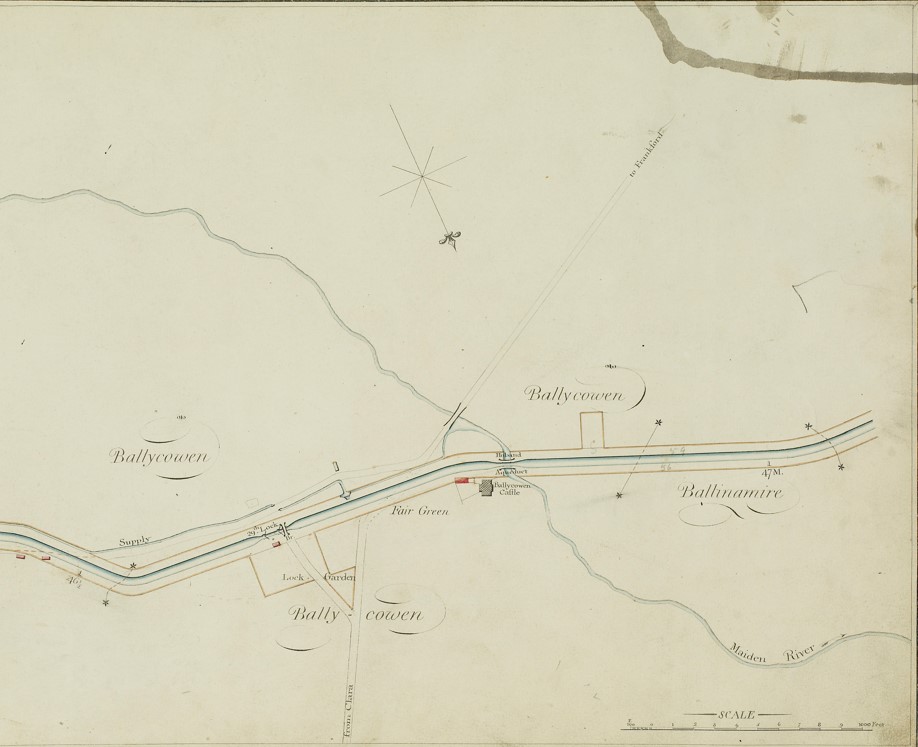
Lies on and N. of the Grand Canal, ½ mile E. of Ballycowan Castle ruins, and contains 192a. 2r. 26p.
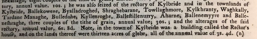
” In the town of Kilbride was a house, called the rector’s house, and on the lands therof were 13 acres of Glebe, all of the val. of 3s. 4d.” Archdall, p. 806. This cannot now be determined, it having fallen out of the hands of the church. The td. contains the ruins of a church and some brickyards. The land is arable and pasture; but some of it is subject to heavy floods.
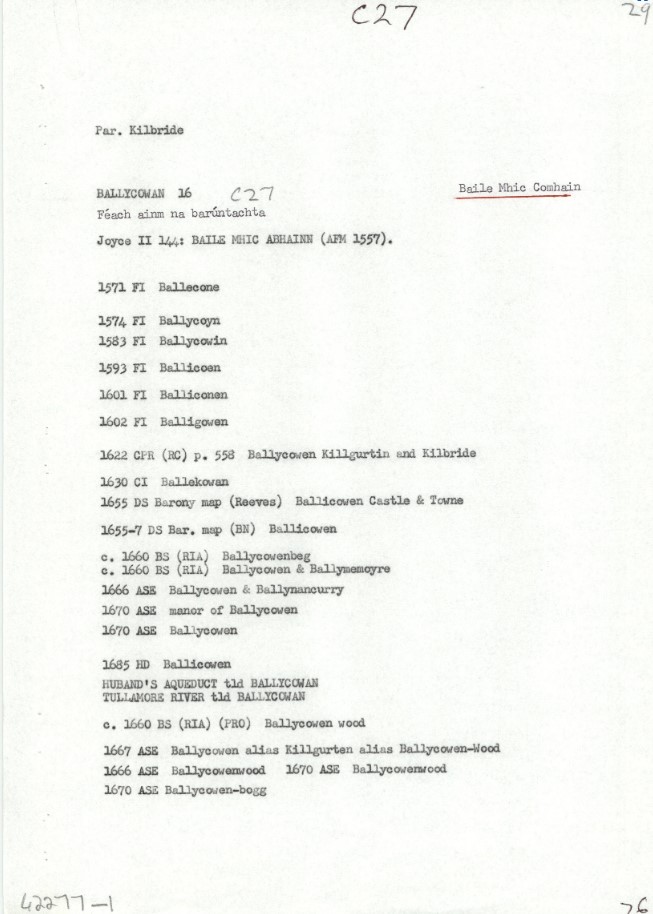
Ballycowan is in the Electoral Division of Silverbrook, in Civil Parish of Kilbride, in the Barony of Ballycowan, in the County of Offaly
The Irish name for Ballycowan is Baile Mhic Comhainn meaning Cumming’s/land
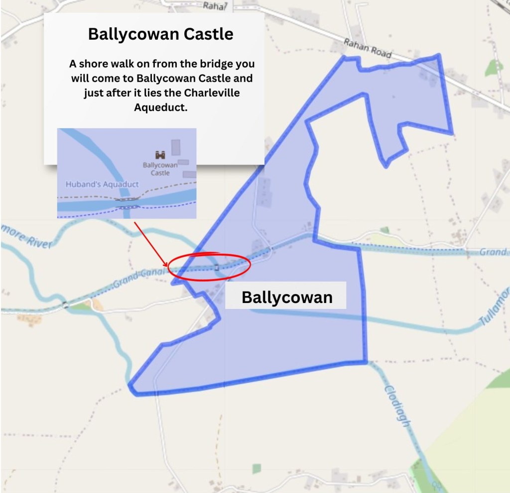
Just a little less than 2 miles, 30mins walk after you past the 29th Lock we come to find another ruins of a castle along the line is Ballycowan Castle, unlike Srah castle a lot more of its detail and walls have stood the test of time throughout the years.
| Townland | Area | Pop in 1841 | Pop in 1851 | No. of Houses in 1841 | No. of Houses in 1851 | Pop in 1871 | Pop in 1911 | No. of Houses in 1871 | No. of Houses in 1911 |
| Ballycowan | 364 | 167 | 132 | 33 | 30 | 20 | No Data | 78 | 13 |
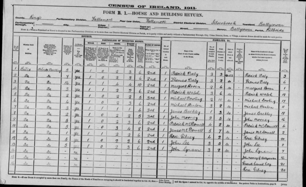
In 1911 Ballycowan had a record of 16 houses in the area, during this period the household returns and ancillary, shows us that there was 13 buildings all of Private Dwelling, that were inhabited, with classes of houses between 3rd and 2nd. Here are some of the families that occupied these buildings during this time:

A Canal bank ranger at this time, was employed to help maintain the canal banks, some of his duties were to ensure the banks were water tight and inspect the banks daily for any signs of destress that may cause a burst in the banks. They also made sure the canal line was kept clean and clear for easy navigation for boat to pass along.

Place name records from the first Ordnance Survey of 1838 and the logaim.ie historical records of the name.
Ballycowan Barony B.S. Sketch 1& 2
Baile Mhic Abhainn, the town of the son of Abhann or Aubhne (anglicised Evenew).
Pronounced locally Baile /ic/abhainn.
Ballycowan J.O’D.
Ballycowan Barony Map
Ballycowne Inq. Temp. Car. I
Ballycowan Inq. Temp. Car II
Ballycowne Inq. Temp. Gul III
This barony lies in the north of the King’s County, bordering on the County Westmeath. It contains the parishes of Kilbride, Lynally and Rahan, with part of the parish of Durrow.
It takes its name from the ancient castle of Baile Mhic Abhainn, which stood about 2 [Irish] miles to the west of Tullamore. The original castle, a stronghold of the O’Molloys, was greatly extended and the following inscription over the entrance: “This house was built by Sir Jasper Harbert and Mary Dean Finglas in the year 1626.” This barony was not in Offaly, but formed part of O’Molloys country of Feara Ceall.
On the Grand Canal and bordering the parish of Lynally. Contains 364a. 2r. 24p.
Ballycowan village is on the estate of the Cootes, earls of Mountrath, [since the distribution as part of the Cromwellian Settlement and contains the ruins of the castle which gives name to the barony. A fair for cattle was held here on 31 July. The td. is under grass and tillage, but the southern parts are subject to heavy floods.
Built in 1626, under its foundations the remains of an older castle, O’Molloy Castle. The owner of the time were Jasper Herbert and Lady Jane Finglas. The life of the extended 1626 castle was cut short by the 1641 rebellion and its consequences.,[2].
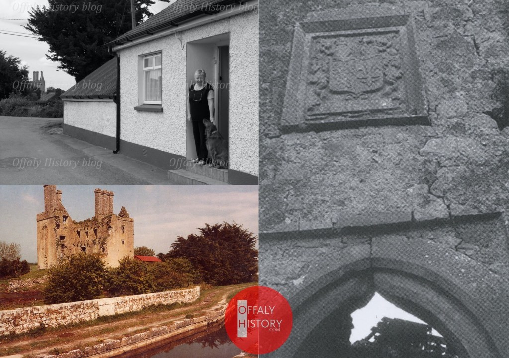
Over the entrance door of this old castle can still be seen the plaque, it displays the coat of arms of the Herbert family and in writing the words, By God of Might, I hold my Right. Which can be seen in the above photo, along with a phot of Ballycowan castle and a photo of the lock house and Retired keeper, Look closely and you can see Ballycowan castle in the background.
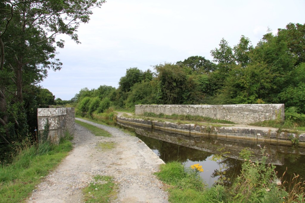
Most Aqueducts along the Grand Canal can be located, some have now be buried or disused, left for nature to take it over. When construction started on the Huband Aqueduct, in 1803 it was said that the Canal Workers stated to loot the stones from the ruins of the Ballycowan Castle. Thankfully they were stopped by locals before they caused too much damage.
After a short travel down along the line, follow the bend of the Canal, and you will come along to the Charleville Aqueduct, named after local Lord Charleville, whose castle lies just south of the Canal[3].
This remarkable castle, is one of the finest Gothic houses in Ireland and is surrounded by one of the best known forest, locally and international. When entering into the property you are greeted by a Giant Oak Tree, that some may say is more famous then the castle. It is one of Ireland’s oldest oak trees and is estimated to be 600-800 years old.
Over time from the loss of family members over a short period of time, the bury family started to believe if a branch of the King Oak fell, one of their family would die shorting after. To prevent this from happening. Wooden props were used to support the great reach of the branches of the so called King Tree.

During the 1960s a great storm came, and a thunder struck the tree losing some of its branches, the tree did survive but shortly after the head of the family Colonel Charles Bury passed away in September, Just 4 months after the tree was struck[4].
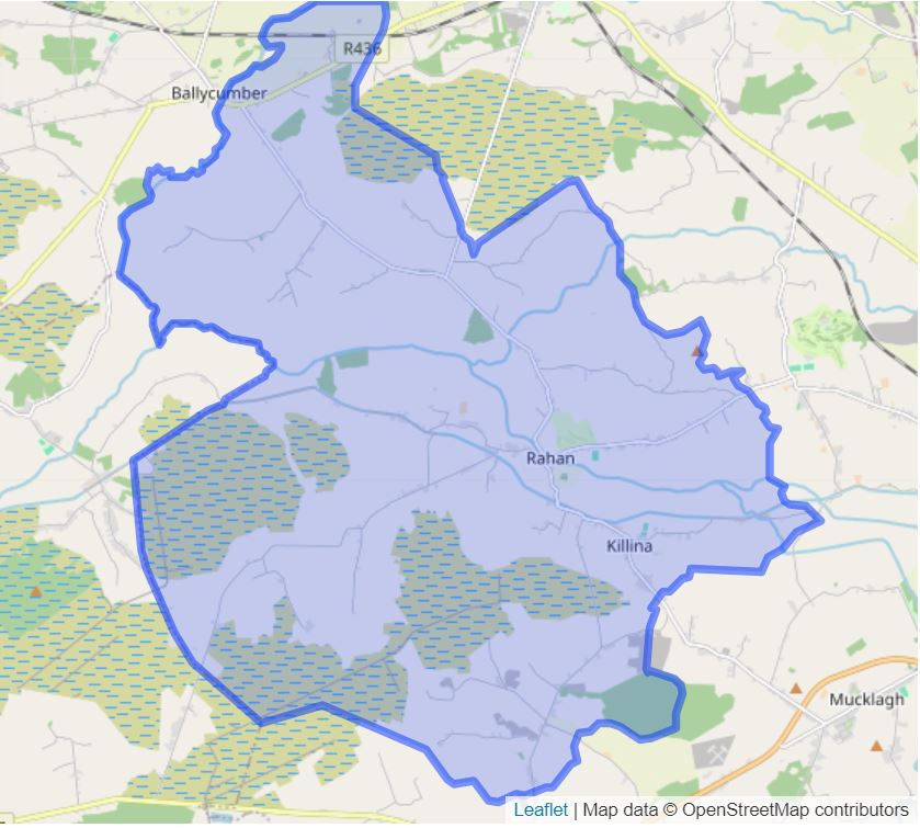
Coming along the line, a few miles down. We come to a series of bridges, which leads us into Rahan. Rahan civil parish has 44 Townlands and we will be looking at ten of these townlands in the next 2 series. Where we will look at the bridges along the way, they history and how the grand canal brought about a new atmosphere to the townlands and people of Rahan.
[1] Offaly, Through Time & Its Townlands. Thomas Lee. Pub. Ottait Publishing. 179
[2] Heritage of our Land, Ballykilmurray/Ballinamere. Michael Dalton. Pub: Print Plus, Tullamore. 2015. Pp 35-40.
[3] Offaly, Through Time & Its Townlands. Thomas Lee. Pub. Ottait Publishing. Pp97-98.
[4] “Did you Know, 100 Quirky facts about County Offaly” Amanda Pedlow. Pub: Offaly County Council. 2013. Pp 35/131
