
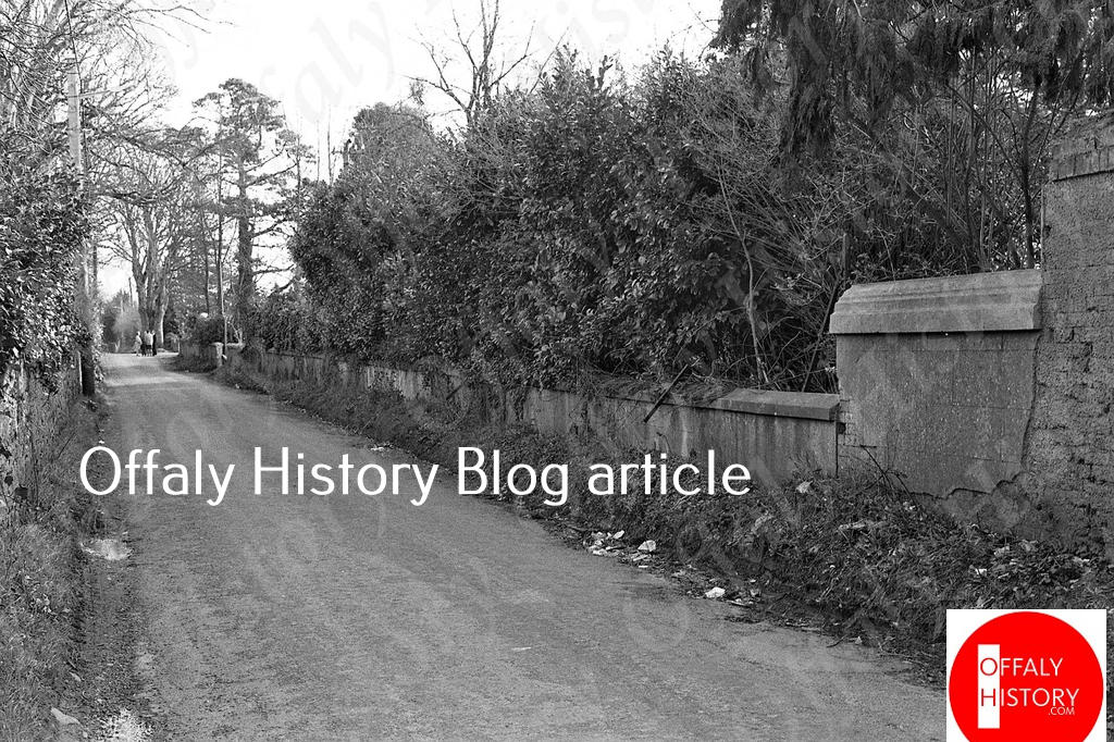
The sunniest place in Tullamore in the early morning must be to the front of the rugby club in Spollanstown as the rising sun enjoys an unobstructed sweep across from Tullamore Distillery to the east. This Saturday 11 July starting at 10 30 a.m. and finishing at 12 noon there is a tour of Spollanstown commencing at the front of the Tullamore Court Hotel and taking the three Spollanstown Roads from the hotel to the boundary with Healion Drive, Ballard and emerging at the junction with Charleville Road at Aras an Chontae, to return on a brisk walk to Cormac Street. The tour is organized by Offaly History and this writer is the guide. We plan to have some local celebrities with us to show us the purple passages as we wind our way along the three Spollanstown roads.
For a quiet suburb with no major through road and a single-lane railway bridge the townland of Spollanstown, was often called Spollenstown and sometimes back in the 1790s Spollinstown. Surprisingly, the road network configuration has not changed in almost 200 years save that the width of the roads is much greater than it was even in the 1970s.
Was it the land of the O Spollen family? It may well have been. Back in 1660 a census of household names in the barony of Ballycowan (where Tullamore district is situated) turned up Spollan as one of the more numerous households, but well behind the Molloy surname.[1]
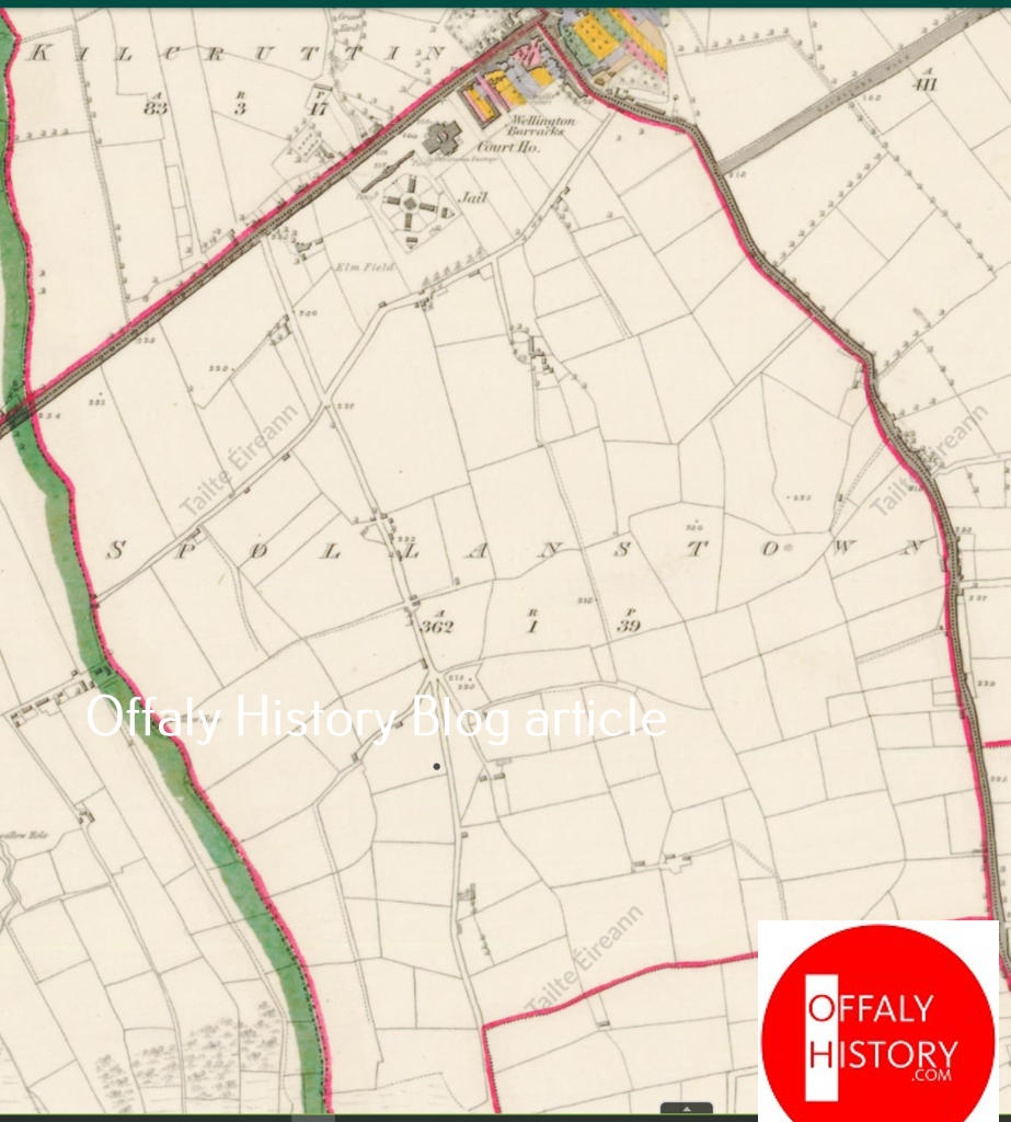
Spollanstown, containing 362a. 1r. 39p, is east of the road from Tullamore to Birr and west of that from Tullamore to Killeigh. The south side of O’Moore Street, Clonminch Rd W., Cormac St. E and part of Charleville Rd E. provide the town boundaries. Spollanstown contains two of the most important public buildings in Tullamore: the former county jail (1830) and the court house (1835); two of the finest houses, Elmfield ( erected late 1700s, demolished 2000 to provide a site for the county offices, Aras on Chontae) and Dew Park (1900); two of the finest terraces at Cormac St. E. and O’Moore Street S.; two sports grounds at the Rugby Club (since 1880s) and the Harriers (since the 1960s). In early times it had a tennis court and hockey pitch.
The entire townland has no shop as those in O’Moore Street are on the northern side in the townland of Tullamore. However, it does have the Kilcruttin Business Park (formerly Salts Woollen Mill) and the small industrial estate running from the rear of O’ Brien Street. Here you can get the Tullamore sausage, local soft drinks and visit Tirlan – the new life for the old North Offaly Co-Op.
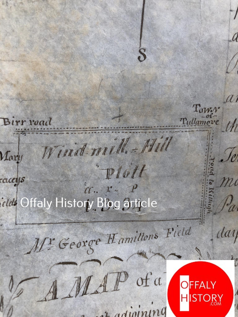
Spollanstown has two hills: the best known is Windmill Hill which was behind what is now Cormac Street E. and O’Moore St. S. These mills went back to the early 1700s but were in ruins by the time of the first Ordnance Survey map of 1838. Windmill Hill was referred to in the lease for building plots on Cormac St. E from Lord Charleville to the developer Thomas Acres in 1795. The second hill is where Collier’s Brook is today and was known in the 1930s as Buckley’s Hill. The name Collier comes from the nearby Collier’s Stream and was the name of a tenant from as early as 1713.
Charleville Road provided the boundary between Kilcruttin/Ballynagh and Spollanstown on the west and Clonminch Road on the east. Clonminch RC graveyard is in the townland of Spollanstown since 1893. The older Kilcruttin Cemetery is west of Spollanstown in the townland of Kilcruttin and now part of the Tullamore (Lloyd) Town Park.
Mentioning the town park it should be said that much of the land in Spollanstown was used by the chief tenants in Tullamore for farming purposes. A tenant with a perpetual lease of a large house and garden in the town centre would also be granted a bog plot in Ballard or Puttaghan, and up to ten acres of land for say 30 years at a separate rent and called a town park, and for use in farming as an adjunct to the large house in the town centre.
The valuation records of 1854 confirm that there were 16 houses in Earl St. S. (now O’Moore St. S.); 12 houses in Charleville St. E (now Cormac St E.) plus the jail and courthouse (all built in Spollanstown). There were few houses on Clonminch Rd or Charleville Rd., before 1900 and in rural Spollanstown only 44 houses in 1854 all of which had low valuations except Elmfield. It was occupied by Pim Goodbody of the tobacco factory in O’Connor Square W. and had the modest valuation of £11. 5s. in contrast to the two houses north of the courthouse (the dentist and a residence) at almost double the figure for Elmfield. This would suggest the improvements of the 1850s to Elmfield had not yet been carried out. The other 43 houses were mostly 10s. to 15s. valuation suggesting one or two rooms with mud walls and thatched roof. These were houses for farm labourers – those working on the 10-acre plots and living close by.
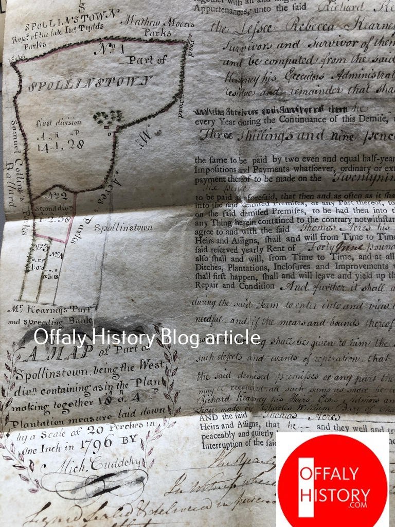
Things began to change in 1900 with the building of Dew Park and the long lease to Daniel E. Williams of the holding running from Charleville Road to Spollanstown Road at the rear. Today Dew Park might have two acres and with ten to 12 houses now built on the former Dew Park lands – almost all being large houses and gardens. Eleven years earlier the four houses at jail lawn were built (1889). The Williams family were in Dew Park until the 1980s and in ‘The Bungalow’ nearby from 1915 until the late 1960s. The ‘cottage’ recently sold at Spollanstown S. and near to Dew Park was built for a Mr Molloy a gardener working for the Williams family (it was later Clune and Choiseul). After the sale of Dew Park in the 1980s to the Loomis family four sites were sold off close to the house while sites to the rear at Spollanstown Road had been sold in the 1960s to Jaffray and MacNamara families.
The Elmfield holding was extensive comprising about 12 acres between two of the Spollanstown roads and the railway line. The temporary use for the hockey club came to an end in the 1990s with the sale to John Flanagan for the Elms housing scheme. About 1997 the old house was purchased by the county council for almost £1 million as a site for the new council offices.
Across from the hockey field was the sports ground of the 1880s, later used for cricket, GAA games, soccer, men’s hockey and rugby. Looking very well today with extended grounds and much activity including tag rugby.
The railway line and bridge date to 1858–9 and provided the link to Galway. The connection became very important from the 1970s with 17 trains to Dublin each day all having to pass through the narrow ravine between The Elms and the grounds of the old jail now Kilcruttin Business Park.
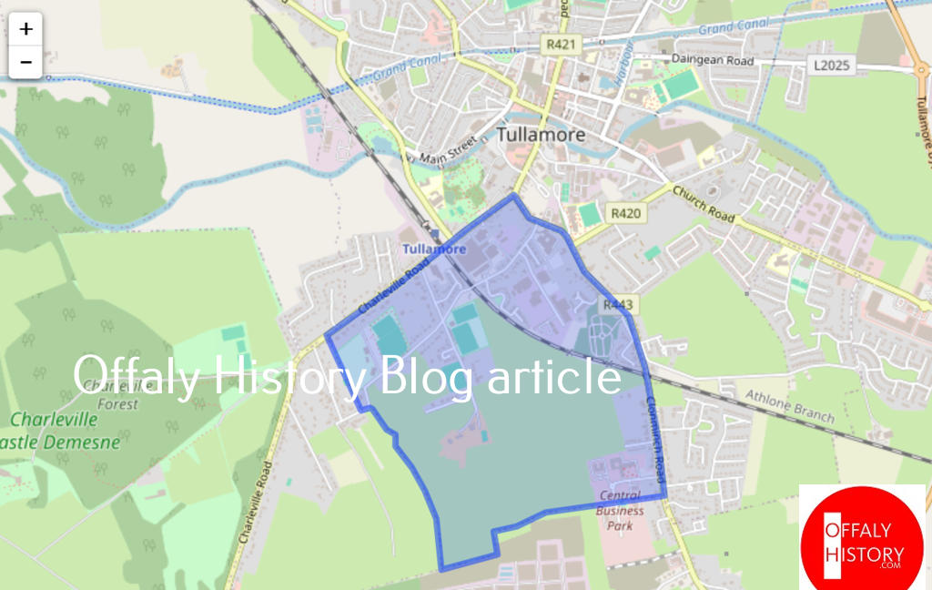
When O’Brien St. was completed in 1914 with 20 houses it was the only the fourth council housing scheme in Tullamore. It was followed in 1939 by ten houses for Salts employees and in the 1990s by The Elms, Glenkeen, Spollanstown Wood and Furlong Grove. Once-off houses number perhaps 50 with the Kildare firm of Reindeer Holdings building four at the junction with Furlong Grove and O’Moore Street at the same time as the Tullamore Court Hotel was completed by the Flanagan Group on a site that had been intended in the early 1900s for council housing.

Spollanstown is greater in size than we may think and varied in its buildings. It has managed to preserve its rural character especially on the border with Ballard close to Adams Villas. Now what would the late Paddy ‘Mac’ the butcher and local farm owner make of it all.
See what you think by coming on the Spollanstown Walk this Saturday 11 July at 10 30 a.m.
[1] 1659 Census, King’s Co., Ballycowan, p. 439.

