The story of Alderborough Nursery, Geashill is a must have for delightful summer reading. This book tells the story of Reamsbottom & Co., Alderborough and West Drayton, and the development of the Alderborough strain of the St Brigid Anemone which made it famous around the world. Geashill was for decades at the center of Irish horticulture with an international reputation for the quality of its plants. Alderborough Nursery competed with the best nurseries in the world, winning awards, medals and accolades from judges and gardening publications. From 1890 to the 1980’s Anemones and a wide range of plants were exported from Geashill. Archives of all the important horticultural shows in Ireland and Britain record that Reamsbottom & Co. exhibited their produce and won prizes, particularly for their St. Brigid Anemones. By 1907, Reamsbottom & Co., had won 33 medals for Alderborough St. Brigid Anemones, including four gold. [This is a beautiful book and adds to the growing Geashill library of attractive volumes reaching a wide and enthusiastic market.]
I first began to take notice of things in the village when I started school in 1926. Kinnitty was very different then to what it is now and indeed even twenty years after I started school there were already many changes taking place. It was a very busy and prosperous place in those times and it had a great array of businesses and personnel.
Tullamore is a well-preserved town and is the county town of Offaly since an act of parliament in 1832 displaced Philipstown (Daingean) which had been the county town since the shiring of Offaly as part of the new colonial government policies in 1557. The new county to be known as King’s County was then comprised of the baronies reflecting the Gaelic lordships of the O’Connors and that of the O Dempseys. The king in question was none other than Philip II of Spain married at that time to the tragic Queen Mary of England (1553–58) hence the new forts of Philipstown and Maryborough (Portlaoise). The county was extended about 1570 to include the territory of the O Molloys (now to be the baronies of Ballycowan, Ballyboy and Eglish) and also that of the Foxes in Kilcoursey and the MacCoghlans in what would be called Garrycastle. In 1605 the territory of the O Carrolls (to form the baronies of Ballybritt and Clonlisk) was added, as also was the parish of Clonmacnoise (1638) at the behest of Terence Coghlan of Kilcolgan. Those looking for an exciting seventeenth-century history for Tullamore will be disappointed as the surviving evidence of town growth in that troubled century is thin. This week we continue to series to mark the 400th anniversary of Tullamore as a town.
“Some of old stonies will hold their heads high, and carry with them to the grave the feeling that they have left their mark on many a church, and on many a building, and that in years to come, there will be people to admire the work they have left behind them, as we of this generation respect and understand the work of the men of long ago. All men hope for praise of some sort, and it is a nice thing to see a man smile when he knows you are in earnest in liking his work. We become children again, and are mightily pleased with ourselves and want to show that we can do even better.”
From the book Stone Mad by Seamus Murphy, stone carver, 1966.
In this article, I write about some of the fine buildings and monuments in other parts of Ireland built using limestone from the Ballyduff quarries. There is a section on aspects of the lives of stoneworkers in Tullamore in the 19th century, and finally I have a look at a couple of Tullamore families that were prominent in stoneworking over long time periods.
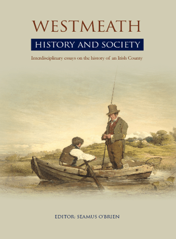
The Mullingar and Athlone launches of Westmeath History and Society have provided two interesting and original addresses on the status of local history in Westmeath, our neighbouring county. The Offaly History and Society volume was published in 1998 and is long out of print. A few copies were secured by Offaly History some years ago and are offered for sales as scarce titles. We thank our friend Dr Harman Murtagh for a copy of his address on 31 3 2022 and we have added some pictures for our readers. Enjoy the address in Athlone and you can get the book at Offaly History Centre and online at www.offalyhistory.com, over 900 pages, hardback, €60.
My friends,
This is the south Westmeath launch of this magnificent volume, Westmeath history and society.
A week ago it was launched in north Westmeath by the archbishop of Dublin, the very Reverend Dr Farrell; south Westmeath must make do with the most irreverent Dr Murtagh.
The book is 900 pages long. As the archbishop observed in Mullingar, it’s about the size of a concrete block: in my view, its only fault is that it’s rather heavy to hold in bed.
Westmeath history and society is one of a series of county books – incredibly it’s the twenty-ninth in the series. The series has been appearing at the rate of a volume a year since 1985.
The series founder, general editor and manager from the start is Dr Willie Nolan, aided and abetted by his wife, Theresa. Their contribution to Irish society and to local studies is without equal. In France they would undoubtedly be awarded the Legion of Honour; in Britain surely Sir Willie and Dame Theresa? In Ireland, and here in Athlone, we can offer at least our enormous admiration for their magnificent achievement – twenty-nine county volumes of this size down, and only three to go! Wow!
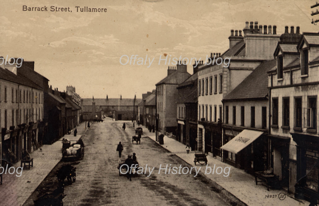
The barracks of 1716 was at the western end of Patrick Street and Hayes Hotel, dating to 1786, at the eastern end on the corner with Church Street and Bridge Street (now Boots Pharmacy). The barracks was destroyed in July 192 2on the retreat of the Republican soldiers from the town during the Civil War. Within fifteen years the site was fully taken up with urban council housing and a garda station built here in 1937 and rebuilt in 2002. The military barrack of 1716 brought about 100 soldiers to the town and is thought to have been a major factor in the town’s growth because of the increased demand for goods and services that followed its construction. After the 1870s, soldiers were stationed at Tullamore only at infrequent intervals.
Barrack/Patrick Street, Tullamore about 1910. The barracks dated to 1716 and destroyed in 1922.
The police moved into the old barracks about the year 1899. The building was occupied by the old I.R.A. in March 1922 when the British army quit the town as part of the Treaty settlement and was destroyed some four months later as the Republican soldiers left town in the course of the Civil War and before the arrival of the Free State army. Parts of the old walls survive and one can see the star-shaped fort pattern in the part of the wall opposite DNG Auctioneers.
Part of the old star-shaped fort style for the new barracks of 1716 erected in Tullamore(more…)
Thomas Armstrong, son of Andrew Armstrong and Lucy Charnock, was born on 22nd August 1702 and when he retired from his position as First Director of his Majesty’s Engineers, Chief Engineer of Minorca and Senior Engineer in the service, purchased the estate of Moorock and built a house there. He died in 1747, unmarried and the estate passed to his brother Warneford Armstrong.
On the 9th October 1793, Warneford Armstrong (1699- 1780) made a lease agreement for three lives and thirty one years of the House, Gardens and Land of Moorock to Richard Holmes, a gentleman of an old King’s County family based in nearby Prospect House. The 390 acres had been leased to James and John Reamsbottom. In 1795 Warnesford Armstrong demised the whole estate of Moorock to Richard Holmes of Prospect House for “lives renewable forever”.
The first article in this recent series to mark the 400th anniversary of the grant to Sir John Moore of Croghan and Tullamore of a licence to hold fairs and markets and establish manorial government was about Tullamore in 1804–7 and was based on two surviving Grand Canal maps. The earliest surviving comprehensive map of Tullamore is that of 1838 and can conveniently be found at osi.ie and its Geohive platform. The purpose of this article is to review the street plan and buildings of the town of Tullamore as shown on part of the Ordnance Survey six-inch sheet no. 17 of which the first edition was published in 1838. It will take three or four blogs to view the 1838 map of Tullamore and in OS fashion and matching the design of Tullamore town from the 1790s we can proceed in gridiron format from the north west of the town to the south east.
As a native son of the county, it gives me great pleasure to be invited to launch Westmeath: History and Society. Interdisciplinary Essays on the History of an Irish County, the 29th volume in the Irish County series; this volume of thirty-five essays covering themes from the prehistoric to the present era utilises a multidisciplinary approach to explore at the county level broader regional and national themes. It contains contributions from historians, geographers and cartographers, archaeologists and Irish scholars (Cathal O Háinle –Westmeath Bardic Poetry). It charts the economic, social, religious and political life of the county. The aim is to achieve an understanding, rather than to produce desiccated informatio
While reading the poems of the Birr poet John de Jean Frazer recently I came across this satirical poem `The Gallant Police of Shinrone` which raised my curiosity levels a bit. You can read more about the Birr-born poet in a article issued on OffalyHistoryblog on 23 March to mark the 170th anniversary of the death of Frazer.