In the first half of the nineteenth century all of the original buildings in O’Connor Square were three-storey with the exception of the market house and the house where PTSB is now located (GV 8). The finest house was that of Pim/Wilson (GV 7) of c. 1740–48 (demolished 1936) and not unlike the fine houses in the square of the Quaker settlement of Mountmellick where the Pims and Wilsons would have had connections.
It was not surprising that the market house was placed here by the landlord in 1789, but with the growth in trade from the new canal (from 1798) and, no doubt, the desire of the residents to remove noxious trades to another part of town, a new market square and shambles were provided by the owner of the town, Charles William Bury, the earl of Charleville about 1820. The clearing of the site of the old Protestant church (1726) in Church Street, following on the completion of the new church of St Catherine’s at Hop Hill in 1815, provided the opportunity. So also did the development of Harbour Street and the new Market Square from 1805 up to the mid-1820s.
In Tanyard Lane, off the original Market Square, were substantial businesses such as tanning from the 1750s, followed in the 1800 by at least two breweries, and a large provision and slaughterhouse from the middle of the nineteenth century for Aylward. The square itself was decidedly residential with perhaps no more than three shops on the southern side and junction with High Street. The building of a new post office there in 1909 brought much pedestrian traffic to the square until its relocation in 1997 to the western side of the square as part of the Bridge Shopping Centre.[1] This was its fourth location in the square since the 1880s. There was additional pedestrian traffic from the opening of the new vocational school in 1937 up to its relocation in 1974–5 to O’ Carroll Street. By 1977 the 1937 Vocational school building was converted for use as the Offaly County Library and offices for the Offaly Vocational Education Committee and Tullamore Urban District Council.
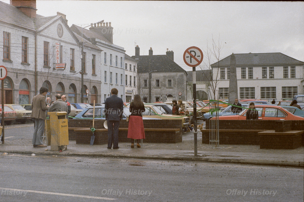
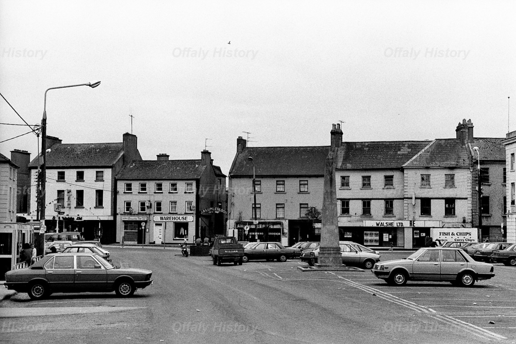
From the 1960s the square had two cafes –Morris’s Capri Cafe in the former market house and beside it Kelly’s Sunshine Café in the brick building incorporated in the Bank of Ireland in 1979 (GV 12 O’Connor Square). In the same year the market house, having been a café for almost twenty years (GV 11) was acquired by the Northern Bank and opened as a banking hall in 1981. It reverted to its café use in 2014 and is now known as Eddie Rockets.
The closure of the local offices of many of the insurance companies, including Hibernian, Yorkshire and later Woodchester, led to vacant space in GV 5 and 6 O’Connor Square. This was filled after 2015 by Bake (now The Square Café) and a public house (The Phoenix) in 2018. This was the first such licensed premises in the main part of the square since the 1720s, if one looks on the Brewery Tap as also part of High Street.

So how did this central place in Tullamore come together? In 1713 it was simply known as the Market Place.[2] The southern side of the square was classified as New Street in the 1740s and 1750s because of the three new houses on this side (GV 3, 4 and 5).[3] The area was known as the Market Square by 1766, although it could hardly have been a proper square until the northern side with its market house was completed in the late 1780s.[4] In the late 1740s the Pim-Wilson property (GV 7 and 8) was built. This was the finest and most ambitious in the developing square. Because it was also an industrial concern it had its back to the river and the total plot amounted to 3a. 3r. running along the Tanyard beside the river and making it one of the largest holdings in Tullamore town, save the Crowe estate in High Street and the Crofton site (GV 29 High Street). See the earlier blogs on both properties at http://www.offalyhistory.com.

The favourable lease of 1750 for plots GV 7 and GV 8 from Charles, Lord Tullamore to Wilson with extensive lands was in consideration of starting an enterprise and determined the pattern of development in Tanyard Lane over the following 250 years. Ultimately, the lands passed intact from the successors of Wilson to the Quaker Neale family of County Kildare who sold the property to Offaly Vocational Education Committee, and three roods of lands near Church Road to the new Midland Butter & Bacon Company in the 1930s.[5] The deal of the century as the main house and 4 acres was only £1,000.

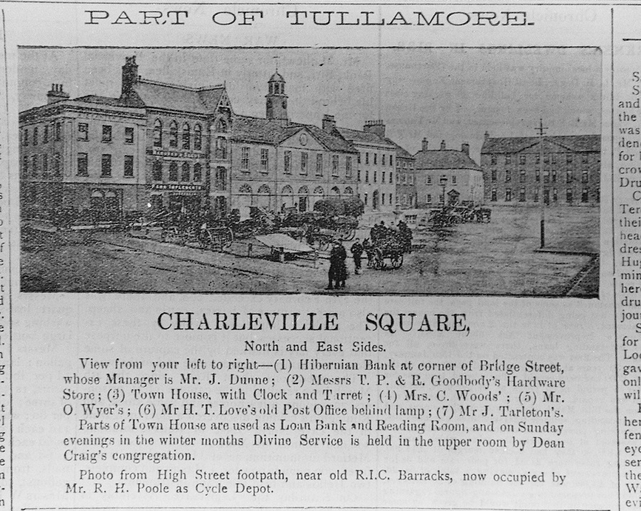
What was there on the northern side of the square before the 1780s? It may have been no more than the southern boundary of the Briscoe plot in Bridge Street (GV 13 and 14) and that Bridge Lane was formed with the laying out and building of GV 9 to 12 Charleville Square and GV 10, 11 and 12 Bridge Street. R.S. Craig in his 1907 lecture remarked that in 1780 (that is before the fire of 1785 and the Bury family coming into active possession and management) Bridge Lane continued over the bridge over the river at the back of what is now Tullamore Central Library. He provides no evidence to support this view basing it on Lewis, Topographical Dictionary (1837) and oral information. Craig wrote in 1907:
There is no doubt however, that the town at the time was much less imposing than it now is. It was irregularly built and consisted to a considerable extent of thatched and wattled houses. Its principal streets in those days are now insignificant lanes. Indeed, I am told that one of the most important was that which runs parallel to the river at the back of the Town House (in former times the market house, with a courthouse for its upper storey), and which then continued on past the site of the old post office and across the river by a bridge at the back of the Wesleyan church.[6]
Craig produces no evidence for this and there is nothing available to support the idea save that possibly the lands formed part of the market place and that the owners of the Wilson property could exit comfortably from their lands which bounded the river in the vicinity of what is now the PTSB and had an extensive holding beyond the river on shorter lettings. Perhaps in the late seventeenth century before the barracks was built there was a road or laneway along the river but that is no more than speculation. There is also good reason to think that the old bridge behind the library was an accommodation bridge only for the use of the owners of GV 7 and 8.

The Joseph Flanagan building at GV 49 High Street and GV 1 and 2 Charleville Square was a considerable and well-designed addition to the completion of the square. The double front building style was repeated by Thomas Acres at the junction of O’Moore Street and Cormac Street in 1800. We can be sure the Flanagan building was completed by 1787 because of the date-stone and evidence of building (cited below). In the case of Flanagan it is interesting that in 1786 he secured a 999-year lease of the substantial site at the corner of Charleville Square and at the same time the site at the other junction with Tanyard Lane (Tanyard Lane GV1).[7] Flanagan was the first Catholic to secure a head lease from the landlord and that was in line with the provisions of the Relief Act of 1778 which permitted 999-year leases for Catholics but not freeholds. The lease for lives for ever granted to Protestants from the 1740s was regarded as a virtual freehold and was not available to Catholics until 1793. Flanagan was a distiller and his long lease, not being a three lives renewable lease, was not a freehold and therefore did not carry the right to vote. Catholics with a 40s. freehold did not secure the franchise until the 1793 Relief Act. This form of tenure was exceptional in Tullamore until after 1805 when many of the new leases were for three lives and 61 years and so not freeholds.
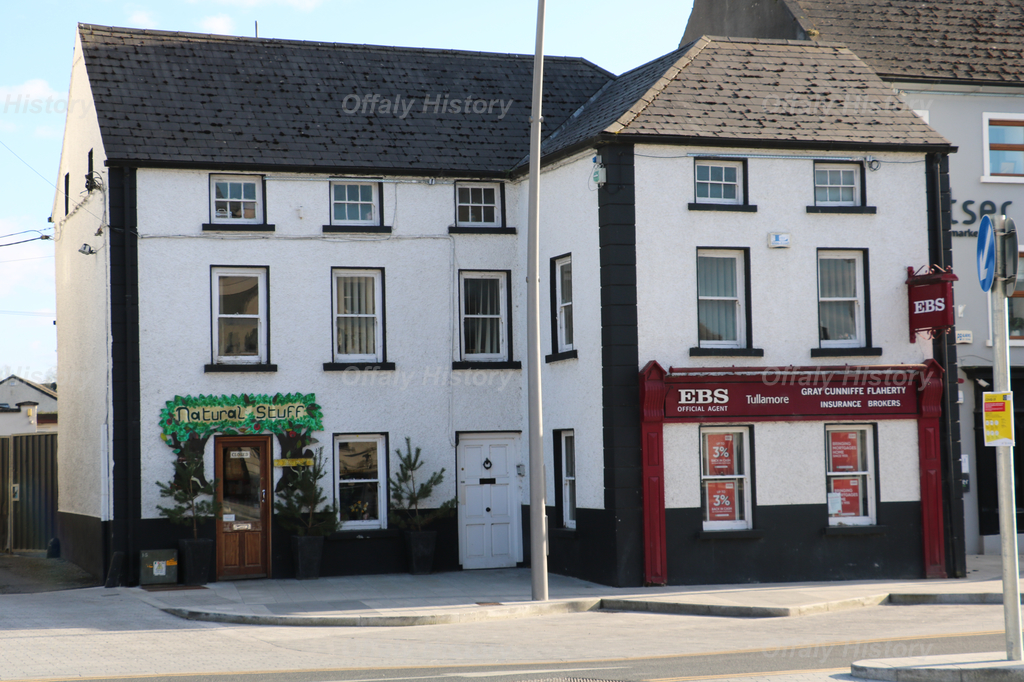
The other houses erected to complete the square were the Tabuteau holding at no. 6 (now the Square café, earlier Hibernian) in 1786 and the block of leases for lives for ever that consists of 9, 10 and 11 O’Connor Square and all of the Bank of Ireland premises at 12 O’Connor Square and the part of Bridge Street extending to Bridge Lane.

Who were the grantees of the leases? There were twelve rateable properties and eight leaseholders in the square proper. The west side of the square at GV 1 to 4 High Street (where the Brewery Tap is) can be included as part of O’Connor Square and was considered to belong to Charleville Square for the census of 1901 and 1911.[8] Flanagan was the only Catholic leaseholder in Charleville Square with GV1 and 2 and his 999-year lease of that important site and the yard now Robbins Ltd and Oisin Sullivan at the entrance to the Tanyard. Matthew Moore in GV 3 was an early convert to Methodism. Finnamoor and Revd Mr Dixon in GV 4 and GV5 were Anglican. Tabuteau in GV 6 was Huguenot in origin. Pim, Wilson and Manly in GV 7 and 8 were Quakers, so to was Scott in GV 9 and 10 (now Dr Fahey and Farrell’s) Scott was a building speculator and did not retain the sites 9 and 10 for long. Bury built the market house (GV 11) and Margaret Ridley (Anglican) GV 12. On High Street (GV 1–4) Manlys and Goodbodys were Quakers while in GV 3 was Richard Brennan and Charles Moore in GV 4, both in business as merchants.
The leaseholds granted were all for lives renewable for ever save that on the corner of the square and High Street (GV 1 and 2 in the Griffith Valuation) which was for 999 years and was demised to the distiller Joseph Flanagan in 1786. The frontage to each of the Charleville Square leases were on average fifty feet with generous gardens for those houses on the southern and western sides. The river acted as a natural boundary on the north and east sides. As the whether the lane behind the market house was a service passageway or the remnant of an old road is uncertain, but as a service route for the shambles behind the market house is the more likely. This meat shambles was marked on the Charleville Leaseholders Map of 1869, but the detail copied from an original map – possibly the atlas of 1786 – is missing since 1958.[9]
Was there an earlier layer of leases in Charleville Square? In Matthew Moore’s lease of 1743 the plot (GV 3, the insurance brokers) is said to adjoin that wherein Edward Price, the younger, lived. Edward Price and James Price are mentioned in the 1763 list of tenants. [10] In GV 7 Thomas Pim lately deceased is mentioned as the builder of the house but no lease to Pim has been located. Possibly he built on the understanding of securing a lease.[11] According to Michael Goodbody he died in 1748 aged 35.
In putting a date on the leaseholds it is helpful to begin at Bridge Street with several houses of the 1720s to the 1740s. Moving to High Street numbers GV 1 and GV 4 are also dated to the 1740s, but there is evidence of building before that, back to 1713. In the square itself on the eastern and southern side houses 3, 4, 5 were built in the 1740s and 1750s with houses GV 1, 2, O’Connor Square and GV 49 High Street (more recently Dunne’s shoe shop) completed in the late 1780s. The same can be said for house GV 6 in O’Connor Square (Tabuteau, now The Square café) and houses 9 to 12 on the southern side – all built as part of the completion of the square in the late 1780s.
So, in the 1740s and 1750s one is looking at four houses completed on the High Street part of the square, three in the ‘New Street’ or southern side of the square and the large Pim house on the eastern side with its back to the river and extensive town parks running along the river into the Tanyard. The northern side of the square (GV 9 to 12) was not completed until 1786–94 and may have been open ground owned by Lord Charleville and forming part of the market place until the late 1780s. The market house (GV 11), being the new public building on this side, was the only public building in the square until the school was completed in 1937. The library replaced the school forty years later. The new market house was noted by John Wesley, the founder of Methodism and a frequent visitor to Ireland, in a journal entry for 1789. Two years earlier he had preached in old Mathew Moore’s parlour.
More on the square next week. See also the YouTube video. YouTube Offalyhistory channel – for 52 videos and more to come.
Please note that the lecture on the square and High Street on 4 Dec. has been deferred to a later due to book launches in Offaly History Centre on 1 Dec and 11 Dec.
