The place name ‘Portavrolla’ in Banagher can be traced back at least 450 years. Just very recently one ‘r’ was dropped so we now have Portavolla. ‘Port an bhrollaigh’ means ‘the port or harbour at the breast’ (of the hill). Moiler McCoghlan, pardoned by Queen Elizabeth in 1571 was of Porteabroghla and Portwroly appears on a 400 year old map.
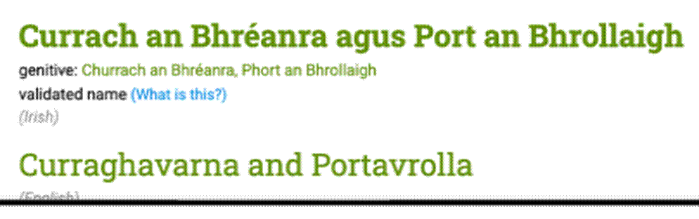
‘Logainm’ makes it clear that the correct name is ‘Portavrolla’.
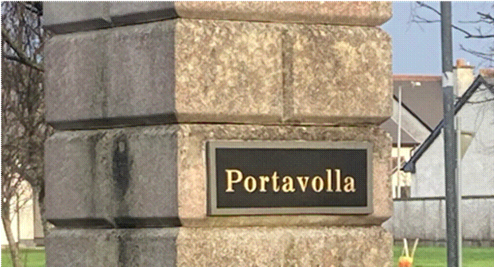
Unfortunately when the Portav(r)olla housing estate development took place about 30 years ago an ‘r’ was dropped..
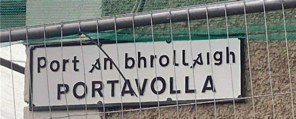
The sign above by Offaly County Council ‘Beats Banagher’! – ‘Port an bhrollaigh’ being correct and ‘Portavolla’ being incorrect. Regrettably the beautiful sign itself has recently disappeared.


Portavrolla appears in the ‘Fiants’ for 1571,1586 and1602

Map SP 46 91/207, c1620, shows ‘Portwrolly’ about two kilometers out the Cloghan road which is where the ‘breast’ of Keeraun hill is.
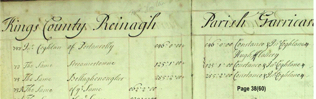
‘Portarnolly’ in Book of Survey and Distribution (1660)

Topographical map of Banagher shows the breast of the hill (port an brollaigh) of Keeraun hill as it extends towards the Shannon below the Banagher-Cloghan road. This corresponds exactly with the location of ‘Portwroly’ as shown on the four hundred old map from the De Renzy MS (MP 91/207)
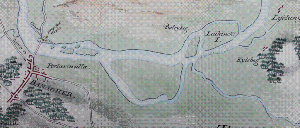
‘PORTVRULLA’ ON 3 BEAUTIFUL c.1800 MAPS
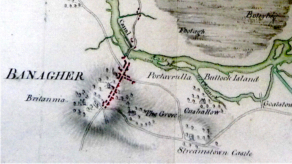

It would not be common knowledge that there was a ‘Cushcallow House’ as can be seen on the map above. Streamstown Castle was still standing at that time.
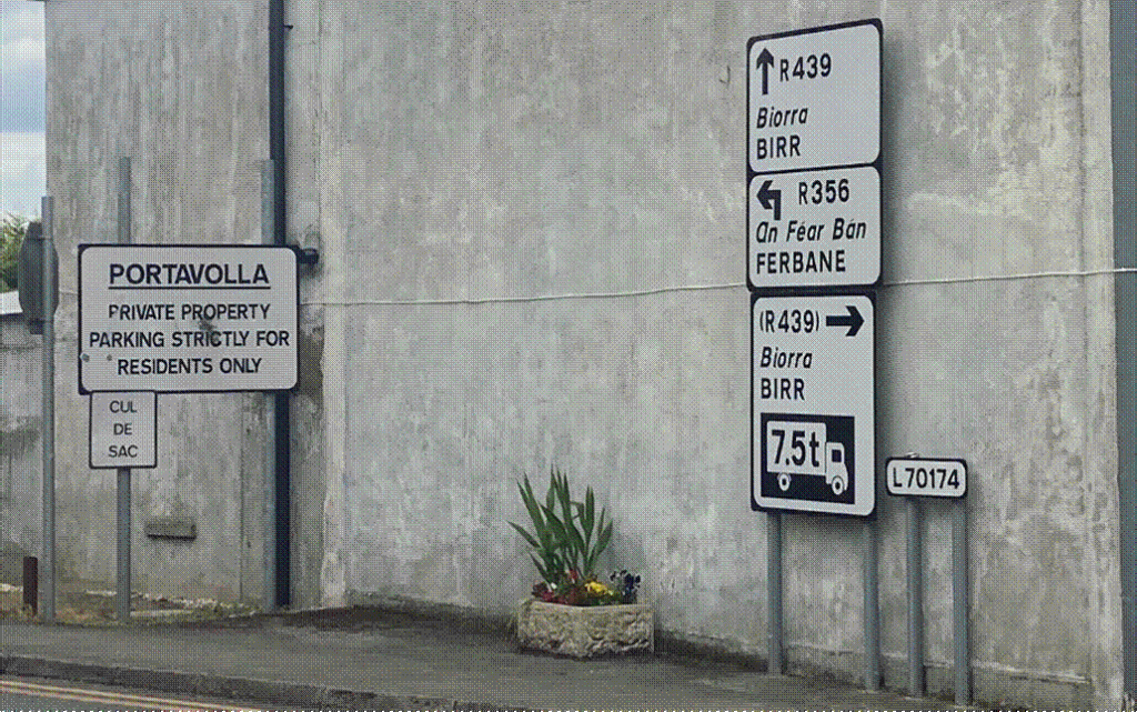
The signage at the entrance to Portavo(r)lla Housing estate is unlikely to win an award for creative presentation. PORTAVOLLA PRIVATE PROPERTY PARKING’ probably could be removed without being missed. Signs for Ferbane and Birr could be in a better location.This wall would be ideal for a mural.
We are fortunate that most Irish placenames have survived in their centuries-old Irish form. ‘Portavrolla’ is one such case, and consequently it must be corrected. The cost will be minimal — but the cultural value is immense. Action is required now, before more of our heritage is lost
