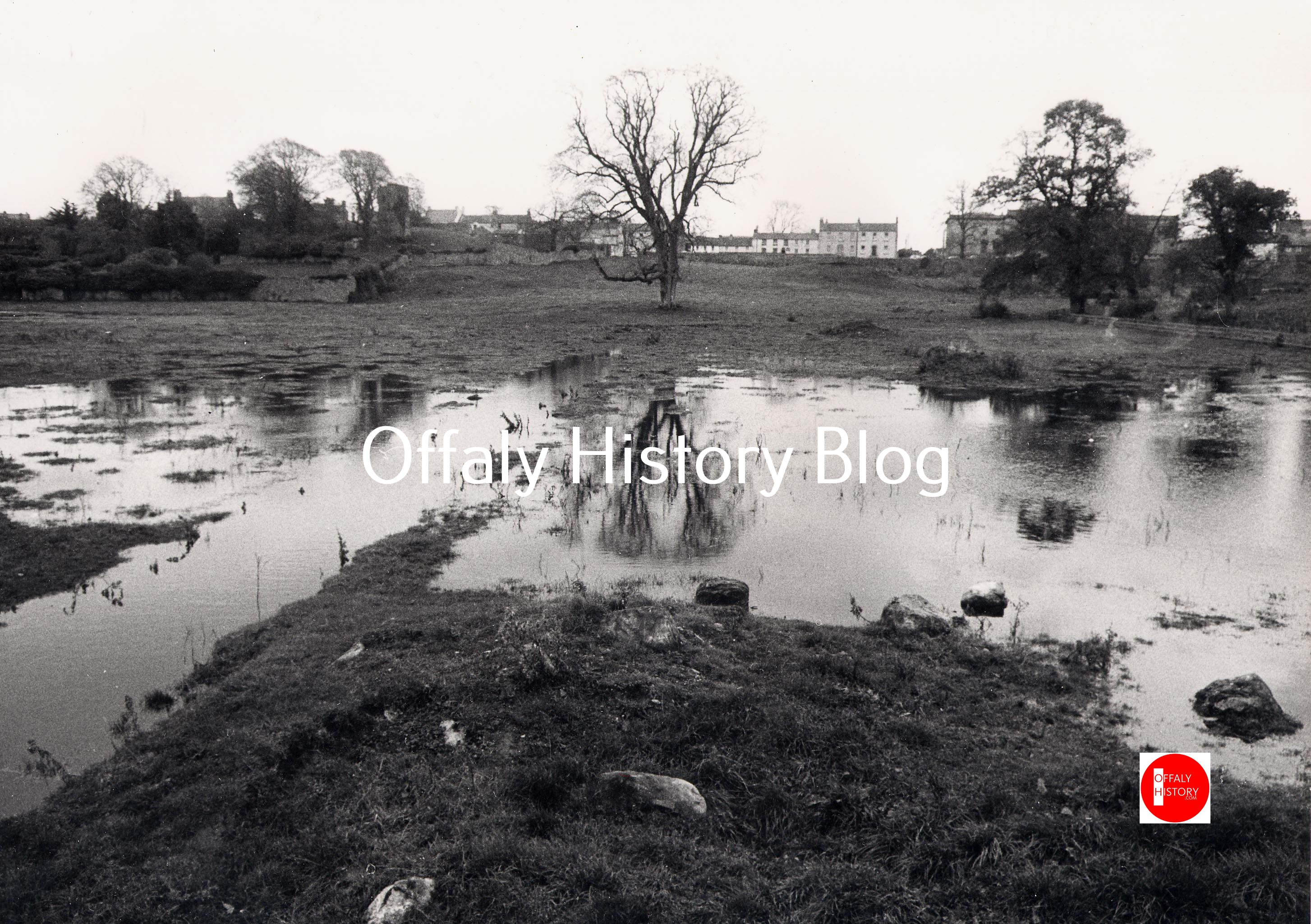
The second guided town walk on 18 July 2026 is alongside Tullamore River to the town park and Cormac Street. We start from Bridge House Hotel on Distillery Lane at 10 30 a.m. on Saturday 18 July and make our way through a part of the old Water Lane (now Main Street) taking the path along the river to Lloyd Town Park while reflecting on its historical features and change in the landscape of the area and the town of Tullamore since the 1700s. All are welcome and the tour is free. Michael Byrne is your guide for the morning. Richard Jack will talk about the town park and its trees.
In the park close to what is now the filling station can be seen the remains of a corn mill of c. 1800 and where Daniel E. Williams of Tullamore DEW fame started work as a young man in the mid-1860s. He lived nearby in the miller’s house (now demolished) until Dew Park was completed in 1900. Beside the corn mill was a flour mill demolished in the early 1990s to facilitate the Bridge Centre and new apartments. It was known as Cooke’s Mill and was said to be haunted by ‘old Ned Cooke’.
On the site of the filling station was Crow’s gazebo forming part of the gardens of the bow-fronted house in High Street. It was demolished in the late 1860s to facilitate expansion of B. Daly distillery as were most of the old houses in the old Water Lane. Among the whiskey stores here was the large Sally Grove warehouse famous for its whiskey maturing qualities.
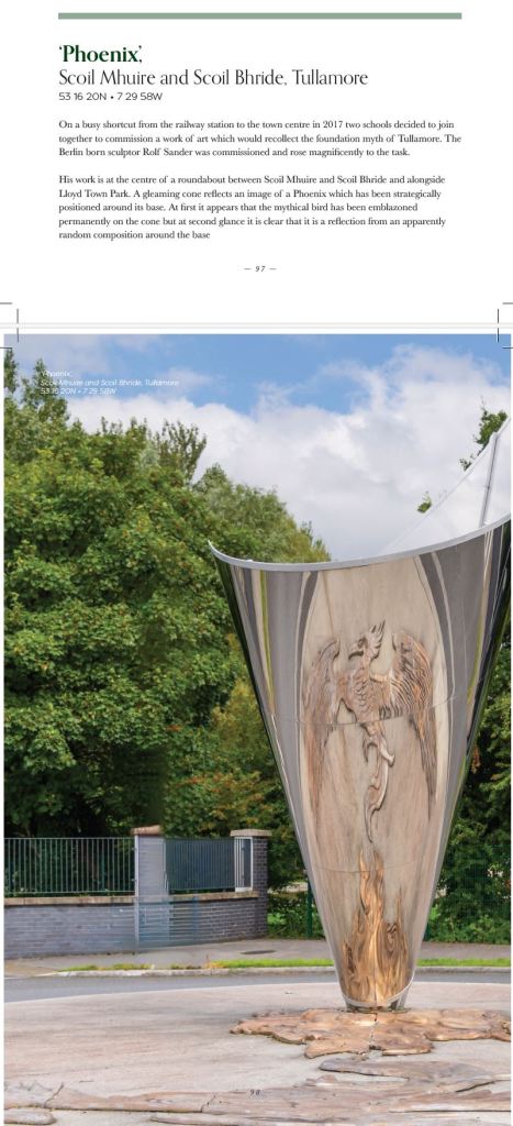
Rolf Sander’s Mythical Bird and the regeneration of Tullamore in the 1780s to 1820s.
Adjoining the park are Scoil Mhuire, Kilcruttin, 1957, a Sisters of Mercy primary school that was built for 440 pupils and had over 500 in the 1960s. It was extended in 2016–7 and has the attractive Phoenix sculpture worth seeing.
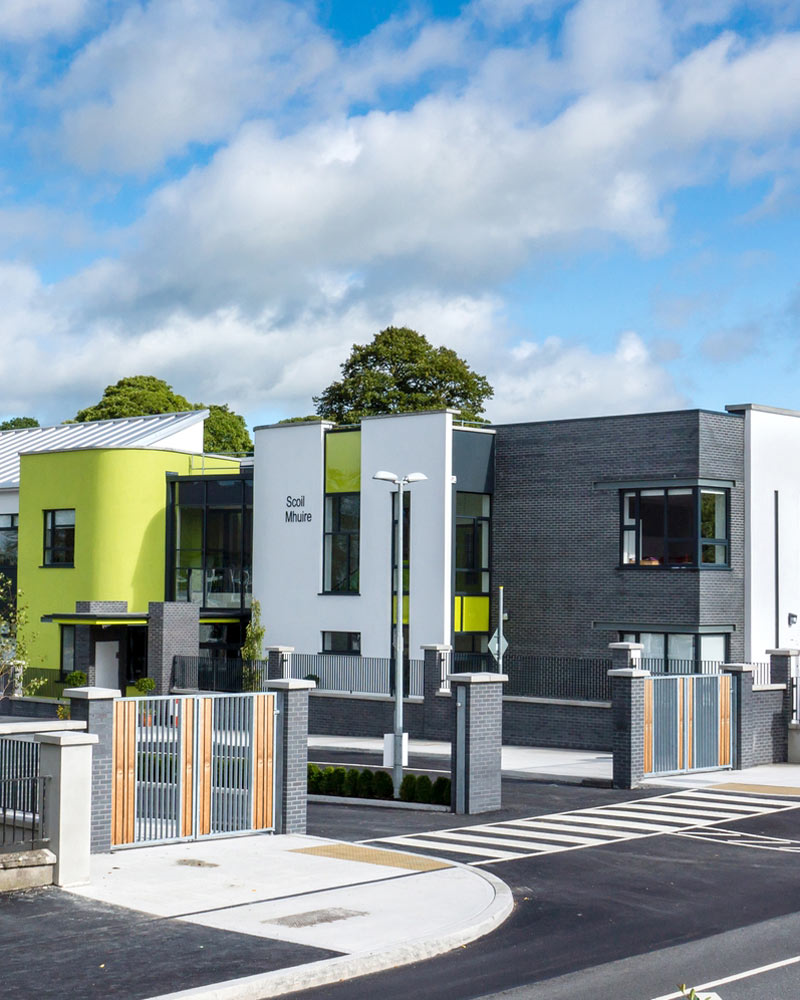
Scoil Bride Boys’ School, Kilcruttin, 1961 following on which the boys transferred from the old 1874–5 school at St Brigid’s Place, Tullamore. It was extended in 2016.
The new sculpture at Kilcruttin represented the phoenix bird and the regeneration of Tullamore after the balloon fire.
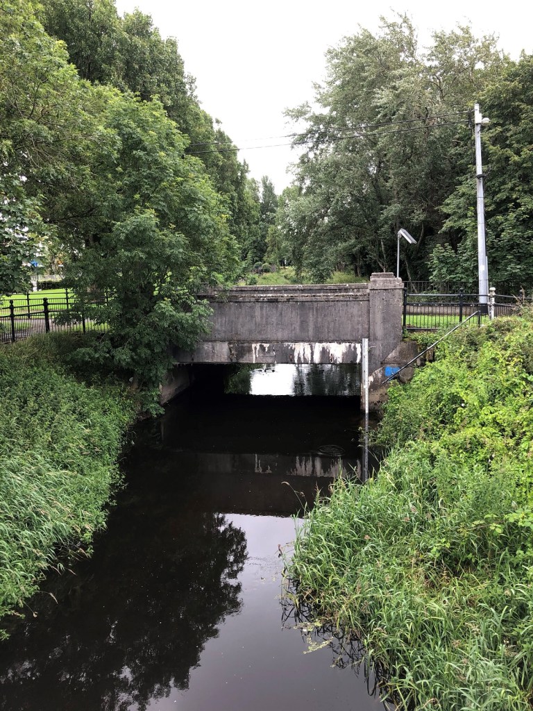
The 1938–9 bridge over the river at the foot of O’Molloy Street was erected to facilitate access to the new Salts Woollen Mill while the Kilcruttin Road from O’Molloy Street to Cormac Street was completed in 1939 and widened in the late 1970s as part of the Western Relief Road.
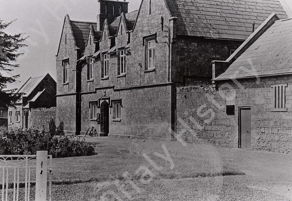
The park is in the townland of Kilcruttin and is bounded on the west by the Tullamore River and on the east by Cormac Street. The land was part of Lloyd’s farm since 1891, and Lloyd’s grocery was in nearby Cormac Street where the sports gear shop is now located. From the 1800s to the 1890s it was part of the Acres Hall holding with the big house (now the town hall) and the folly built on the old Kilcruttin Hill.

The town park is there because of a suggestion in 1982 from Junior Chamber that was taken up by the council. The work on the planned park in the 1980s was gradual as it was part of back-to-work schemes in that difficult decade. The field was owned by the nearby Lloyd family from the 1890s to the 1960s and it was decided to call it Lloyd Town Park in 2006. The park got an award winning €1 million revamp in 2007–9 and has been maintained successfully by the council since then. It is now one of the most popular amenities in Tullamore and is a great success story.
The land here was not built on mainly because it was low lying and from at least the 1750s, if not earlier, a quiet corner of it was used as a burial ground. Kilcruttin Cemetery was in use from the that time up to about 1892 when it was officially closed. The name Kilcruttin was recorded in 1574 and on the Ordnance Maps from 1838. The oldest recorded tombstone is 256 years old and dated to 1770. The cemetery was called the ‘burial place’ as early as 1752.

The original access lane and entrance to this cemetery is still to be seen between the terrace of ten houses built by the Acres Pierce Estate in 1879 and the yellow brick house near the railway station. It is the oldest cemetery in Tullamore town and was located on what was the outskirts of the town and in soft poor ground close to the Tullamore River. The river has been drained twice – first in 1850 and again in 1950. The cemetery has some very good monuments including the mausoleum to the Methodist merchant John Burgess, his wife Deborah, and four of their children who died in infancy. The epitaph describes John and Deborah Burgess as ‘consistent members of the Wesleyan Methodist Society for upwards of fifty years’.
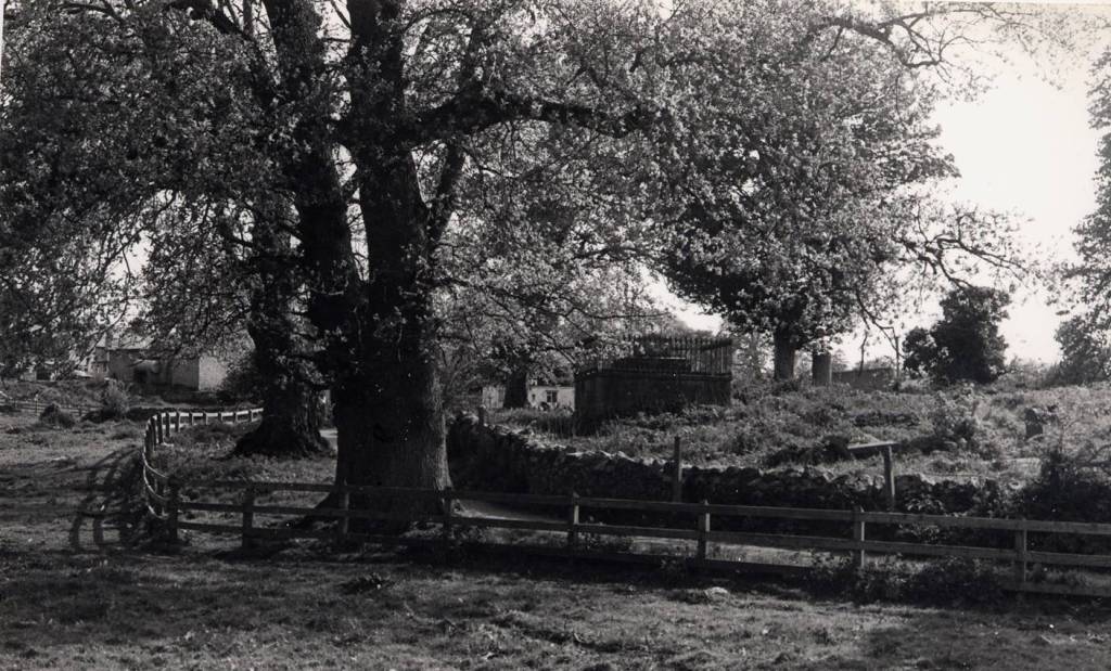
The memorial of 1808 to the German Baron Oldershausen of the King’s German Legion, the heroes of Waterloo, who were stationed in Tullamore in 1806–8. Out of Kilcruttin came no less than three new cemeteries, that for the very poor on Ardan Road opened in 1852 and ‘the Sleeping Ground’ for Protestants at Clonminch in the same year. Forty years later the new Catholic cemetery at Clonminch (in Spollanstown townland beside Collier’s Stream) was opened. Both cemeteries were managed on confessional lines unlike Birr where a public cemetery was opened in 1869.
How old is Kilcruttin? Was there a church at Kilcruttin and is it an early site? There is little or no evidence of any remains there at the time of the first ordnance survey map in 1838. Yet curiously Canon O’Hanlon included the place in his Lives of the Saints even providing an illustration of the ruins of a church. Was it conjectural or actual? It is surprising that it is not mentioned in the ordnance survey letters if any such historical traditions or remains survived. Most of the people buried in Kilcruttin were members of the Church of Ireland or Methodists. Catholics were generally buried at the older Catholic sites at Kilbride, Durrow or Lynally and only in Tullamore town when the Clonminch graveyard was opened in 1893. As noted the very poor who died in the workhouse were buried at Ardan where there are just two memorials. However, the better off Protestants were also buried at the old graveyards near the town because these graveyards became the property of the established church after the Reformation. For example, Lynally was the final resting place of Thomas Acres who built what is now the municipal office at Cormac Street.
1,000 poor and famine victims buried at Kilcruttin in 1848–52 Kilcruttin cemetery was officially closed in 1892. However, an attempt was made to close the place in the 1850s. In 1852 the then rector of Tullamore, the Rev. E. F. Berry, wrote to the board of guardians of the Tullamore union advising of the difficulties with Kilcruttin and the need to close it.
It is difficult to be exact concerning the local deathrate but at the height of the famine and fever it was probably ten to fifteen persons per week. The Patrick Gorman referred to in the Rev. E. F. Berry’s letter may have some connection with ‘Yellow George’ who carried corpses from Tullamore Workhouse on a dray.
Thomas Prittie (1833–1916) recalled the Famine years in 1915 and that it was not an uncommon thing to see as many as a dozen corpses at several intervals of the day, being carted to Kilcruttin for interment. The dead were buried in a deep trench at the back of boundary wall on the western side of the entrance gate, where a slab marks the resting-place of a well-known Tullamore family named Gunning, some members of which succumbed to the disease. In this trench the coffins were piled on top of each other daily for months. Men were kept busily engaged making coffins and digging trenches to receive the dead.
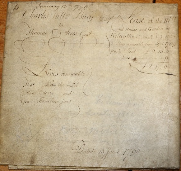
The hill of Kilcruttin, now overlooking the townpark was included in the lease from the town landlord, Charles William Bury to building speculator Thomas Acres in 1786. He was responsible for building most of Cormac Street by providing sites and building the terrace on the east side to accommodate army officers during the Napoleonic Wars, 1793–1815. The folly on the hill was built to commemorate the Wellington victories on the Iberian Peninsula. The tower was restored in 2020. Perhaps the stone with the carved names of Wellington’s victories will be found and that it will be opened to the public.
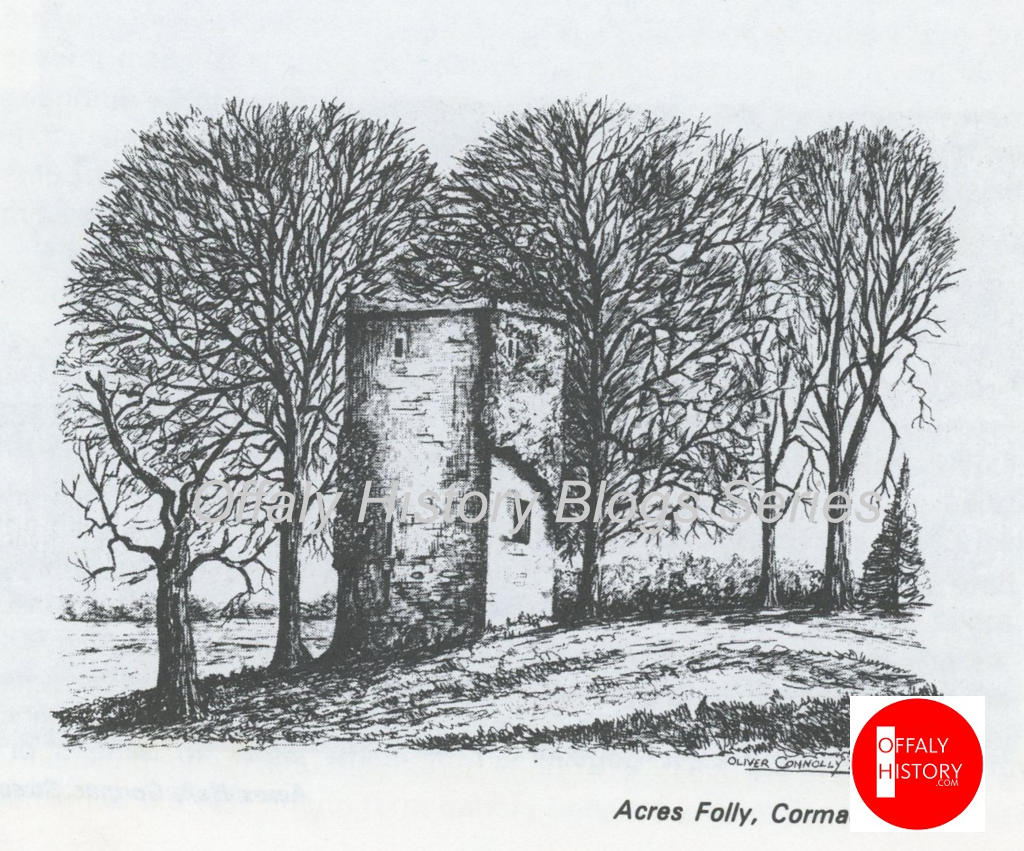
Kilcruttin Hill needs to be restored by the council as part of it was removed some years ago to facilitate additional car parking.
The view of Cormac Street E. from the park is excellent and shows off its best houses and buildings to great advantage.