
This week we look at the background to the Vallancey report on the Offaly towns carried out in 1771 to facilitate the construction of the new Grand Canal line from Dublin to the Shannon. Vallancey was then a young engineer, employed to report to the Commissioners of Inland Navigation and his findings were published in a little known and very scarce pamphlet, A Report on the Grand Canal or Southern Line (Dublin 1771).[2] This report is useful as a window on some of the north King’s County (hereafter generally referred to as Offaly) towns and villages and all the more so because of the scarcity of published accounts of the midland towns prior to 1800.[3] The report was published in the same year as that of John Trail who was at the time employed by Dublin Corporation.[4] Vallancey was writing with a mission. He was being paid to spin the story of the benefits that would come from inland navigation and to highlight the difficulties with road transport and its adverse impact on competition and pricing of commodities so as to bolster the arguments in favour of canal construction and satisfy those who were paying his consultancy fees.
Why not contribute to our series of blog articles on the Grand Canal in Offaly – info@offalyhistory.com.
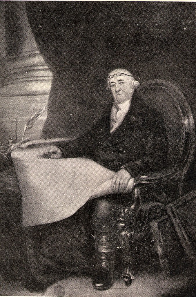
Vallancey was a British army engineer and it appears was posted to Carrickfergus in the early 1760s and in 1761 was appointed to Dublin as Major of Engineers (to his disappointment not Chief Engineer). Vallancey at this time was eager for work to support a growing family and, among other things, was acting as consultant on canal, harbour and bridge projects.[5] The patronage of Lord Townshend, appointed lord lieutenant in 1767 and said to be a friend of Vallancey from his Eton days, was availed of to the full.[6] Vallancey’s work on the Boyne Navigation was useful in advancing the project and for its comments on the local economy. Two reports had actually issued in 1771 on canal construction. The first was that prepared by Vallancey and the second by John Trail – the latter employed by Dublin Corporation. The line of the canal had been selected in 1755 with the adoption of the more southerly route from Dublin to the Shannon via Philipstown (Daingean) and Tullamore which had become known as the ‘Grand’ route as distinct from the ‘Royal’ or northern route. The project, had from 1751, been overseen by Commissioners but in 1772 a company was incorporated by statute to take over the construction of the canal. It was at this time that the new Company of Undertakers of the Grand Canal began to acquire land along the route at £6 (Ir) per acre or 23 years purchase.[7] We plan to look at land acquisition in later blogs.
What do we know of Tullamore and the Offaly towns prior to Vallancey’s visit to some of them and of their origins? How developed were they? Athlone has from the early modern period been the dominant town because of its strategic location and central place. But what about the Offaly towns?
Offaly towns 1550 to 1700
The present day urban centres in Offaly situated at Edenderry, Daingean, Portarlington, Tullamore, Birr and Banagher all grew out of the plantation policies of the 1550s to the 1620s. Smaller towns and villages such as Clara, Ferbane, Kilcormac and Shinrone are less clearly associated with the early plantations. Some of the towns derive from monastic sites i.e. Birr, Kilcormac, Ferbane, Killeigh, Kinnitty and Edenderry (Monasteroris). However, such monastic impetus needed sustenance over time. If the old monastic towns of Clonmacnoise and Durrow may have had populations in excess of 1,000 these centres were already in decline long before the dissolution of the monasteries in the sixteenth century.[8] Likewise, villages associated with monastic settlements such as Killeigh, Kilcormac and Kinnitty did not advance in the plantation period because of a deficiency of planter enthusiasm, absenteeism and divided ownership. The same may not be be said of Geashill and Ballyboy. The former was advancing under the ownership of the Digby family and the latter under that of William Petty from when he gained ownership from 1660.
Vallancey’s report is all the more interesting because it was written before the great boost to town growth which came in the period 1785 to 1815 and to a lesser extent up to the Famine years. As Louis Cullen has remarked: ‘The man-made features of the Irish landscape, urban and rural, were created within little more than a century before the 1840s and remained largely unchanged till the 1950s.’[9]
The towns of Daingean, Banagher and Birr are all towns associated with the plantation policies pursued from the late 1540s. Daingean, an O’Connor castle ‘builded in a grete maresse’ fell to Lord Leonard Grey in 1537 and, ten years later when Bellingham was on campaign in the south midlands, was refortified and called Fort Governor while a similar fortification was erected in Laois – Fort Protector. These forts, well behind the native Irish or enemy lines, were intended to protect the Pale counties and to hold territory that Anthony St Leger had remarked ‘is much easier won than kept’.[10] In the 1557 act the towns were renamed Philipstown and Maryborough. Lands were assigned to both centres and communications improved. Grey had cut passes into Offaly in 1538. Sidney did the same in O’Molloy’s country e.g. he cut a long pass from Ballycommon to Durrow in 1557, and in 1558 £1,800 was spent on the construction of a togher from Philipstown to Edenderry. In 1567 Philipstown and Maryborough were given market town status and in 1569 were made borough towns.[11]

Progress of Birr after 1620 and up to 1800s
In the 1622 survey of the plantation scheme it was reported that ‘Sir Laurence Parsons one of the undertakers there, is in good forwardness in the repairing and new building of the castle of Birr’. The way was open for Parsons to develop his town as only two of the nineteen undertakers in Ely O’Carroll were resident, but no work had begun by 1622. Perhaps this was because the government had other plans and, in fact a fort was provided at Banagher on the Shannon in MacCoghlan’s country of Garrycastle – in one writer’s opinion ‘the gate and chief passage into Connacht’.[12] As will be seen from the De Renzy Papers, the chief of the MacCoghlans, Sir John, was influential.[13] He had fought against O’Neill and in 1610 had obtained a fair and weekly market at Banagher and Cloghan. Notwithstanding his support for the government, one-third of the MacCoghlan lands were forfeited by 1622 and work commenced on the fort in 1624 and was completed by 1628 when Banagher was incorporated.[14] Pynnar’s map of Banagher fort of 1624 shows a rectangular fort with corner towers. Nearby were plots for 12 houses, but there is no evidence to show that those houses were built save one for Sir Arthur Blundell, one of the undertakers.[15] The free school provided for was not, it seems, established until 1806 – as Banagher Royal School.[16]

Urban development had been encouraged by public means at Daingean (Philipstown) and Banagher, but it was Birr, largely under private patronage, that became the most important urban settlement in Offaly in the seventeenth and eighteenth centuries.
Ireland in the late seventeenth century was a predominantly rural nation, even more so than England. In the midlands, towns such as Athlone possibly had as many as 3,000 people while Birr probably had a population in excess of 1,000. However, most of the midland centres were very small with populations well below 500.[17]
Despite the progress of Birr in the 17th and 18th centuries it was not deemed suitable for the extension of the Grand Canal to the Shannon and the line via the Brosna and Ferbane to Shannon Harbour was that favoured and completed in 1804.
More on the Grand Canal next week

[1] L.M. Cullen, ‘Economic development, 1691-1750’ in T.W. Moody and W.E. Vaughan (eds), A new history of Ireland, vol., iv (Oxford, 1986), p. 130.
[2] For an overview see Michael Byrne, ‘Economic development in Offaly’s towns and villages in the eighteenth century and the Vallancey survey of 1771’ in Offaly Heritage, iv (2006), pp 95-166.
[3] Few accounts are available before 1800 for a bibliography see John McVeagh, Irish travel writing: a bibliography ( Dublin, 1996).
[4] Delany refers to both pamphlets in Ruth Delany, The Grand Canal of Ireland, second ed. ( Dublin, 1995), p. 9. Black (1969) cites the Trail pamphlet at no 797, p. 45 as, John Trail, The report of J. Trail, engineer, concerning the practicability and expense of compleating the Grand Canal from Dublin to Tullamore in the King’s County, and making the Maiden and Brusna Rivers navigable from thence to the River Shannon, with collateral cuts to the Rivers Barrow and Boyne. Dublin, 1771. The document is technical and can be seen in the Department of Early Printed Books, Trinity College, Dublin.
[5] See Monica Nevin, ‘General Charles Vallancey 1725-1812’ in Jour of the Royal Soc. of Antiquaries, vol. 123 (1993), p. 22
[6] ibid., pp 26-27
[7] Ruth Delany, The Grand Canal of Ireland, second ed. ( Dublin 1995), pp 6-10. It would appear that land prices for the canal works to Tullamore were settled at inquisitions held at Daingean and Birr in 1791 and 1796 respectively. the conveyance of 19 March 1801 Charleville to Company of Undertakers of the Grand Canal Co. will be looked at in a later blog.
[8] O Corrain suggests that Durrow may have had a population of between 1,500 and 2,000 in the mid-eight century. See Donnchadh O Corrain, ‘Ireland c.800: aspects of society’ in Daibhi O Croinin (ed.), A new history of Ireland, vol. i (Oxford, 2005), p. 599. For a cautionary note on the concept of ‘monastic towns’ see Mary A. Valente, ‘Reassessing the monastic town’ in Irish Historical Studies, vol. xxxi, no. 121 (May, 1988), pp 1-18.
[9] L.M. Cullen, ‘Economic development, 1691-1750’ in T.W. Moody and W.E. Vaughan (eds), A new history of Ireland, vol., iv (Oxford, 1986), p. 130
[10] Bagwell, Tudors, vol. 1(1885, reprinted 1963), pp 206-207 and p. 213. See also Letters and Papers of Henry VIII (London, 1834), Council to Cromwell, 26 June, 1537, p. 443
[11] Michael Byrne, The development of Tullamore, 1700-1921, M. Litt thesis, University of Dublin, 1979, p. 8
[12] Ibid.,p. 15
[13] Rolf Loeber, ‘Civilization through plantation: the projects of Mathew De Renzi’ in Harman Murtagh (ed.), Irish Midland Studies: essays in commemoration of N. W. English, pp 121-135. See also Brian Mac Cuarta, ‘Mathew de Renzy’s letters on Irish affairs, 1613-1620’ in Analecta Hibernica (1987), no 34, pp 107-182.
[14] Ibid., 16 and see Analecta Hibernica , no. 34, pp 107-182.
[15] See a reproduction of one of the P.R.O. London maps in Michael Swift, Historical maps of Ireland (London, 1999), p. 48 and see reproductions of two 1620s maps in Loeber, loc. cit.
[16] See Michael Quane, ‘Banagher royal school’ in North Munster Antiquarian Journal, vol. x, no 2 (1967), pp 116-42.
[17] These estimates are conjectural based on the poll-tax returns

