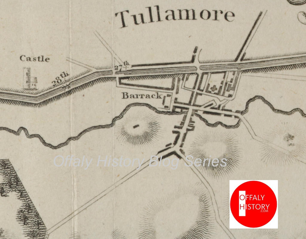
The now online full census of 1926 is a great boon for family and local history. Already, most of us have looked up the manuscript returns for 1901 and 1911, now available online. Birr is fortunate in having the original returns for the barony of Ballybritt including the towns of Birr and Kinnitty for 1821. Nothing like this survives for the rest of Offaly – that is the other eleven baronies. However, the return of the number of people living in the lanes and streets of Tullamore was published in 1821 and provides an interesting insight into population and housing over 200 years ago. In a few weeks we take a closer look at the streets of Tullamore in new publications on the street names and its Bridge Street and High Street.

Tullamore in 1838
The streets and lanes of both Tullamore and Birr were densely populated in 1821. It was not until the 1900s that we saw the development of new suburban housing for the working classes. Prior to that people were crammed into the lanes and courts behind the bigger houses and paying 6d. to 1s. per week rent with ‘the lease determinable every Friday’ in the case of Tay Lane among others.
The street names, number of houses in each street, and total population for each street will be of interest to those studying social and urban history. It is surprsing to see so many living in in Upper Barrack Street (now Kilbride Street) away from the town centre and the good freehold/long leasehold properties. This area was behind the Tullamore army barracks and in 1916 was disparagingly called ‘the barrack quarter’ by some of the more enthusiastic Sinn Féin supporters.
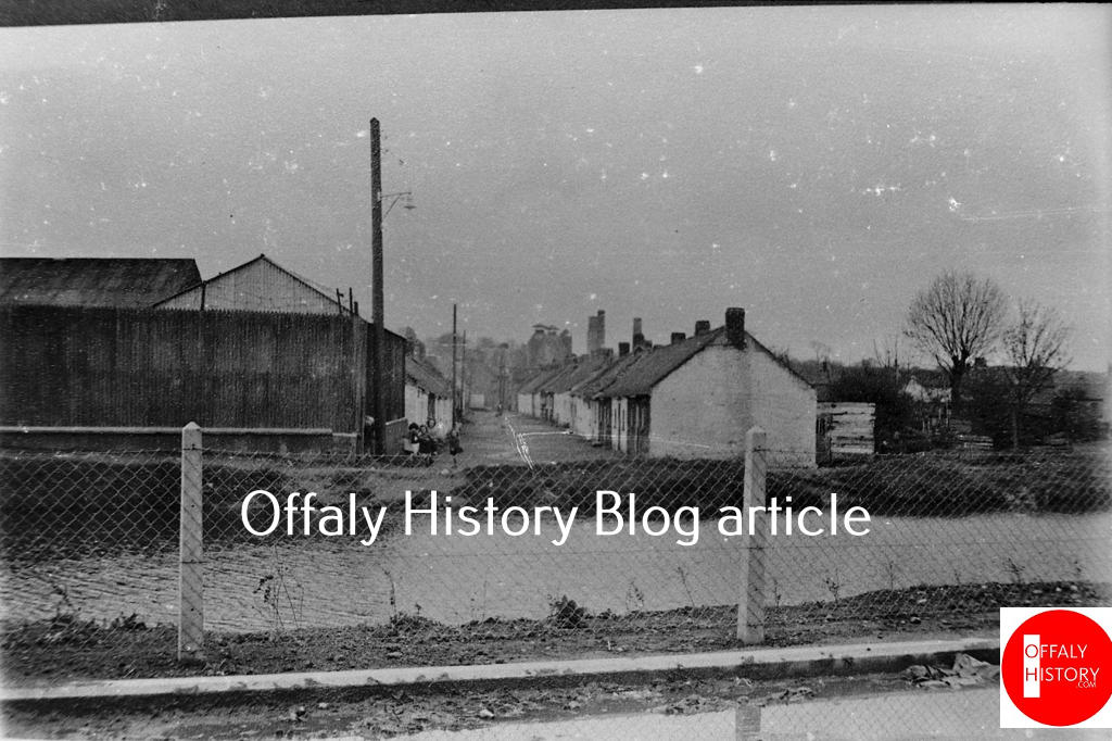
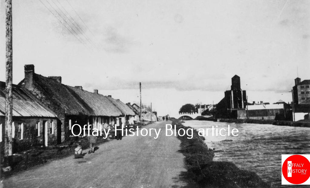
The houses on the main streets were almost all two-storey and slated, but those in the lanes were generally thatched and without sanitary facilities of any kind, save, at best, a ‘dry closet’ in the yard. It was only in 1895 that piped water was brought to Tullamore from Clonaslee and sewerage did not follow for many years. Most people relied on public pumps with carrying water a major chore each day. Some of the larger houses had their own private wells. The new canal from 1798 must have been a great help and may explain the housing in Clontarf Road and Puttaghan from the 1800s. Tullamore also had Water Lane located between the junction with Patick Street and the river beside the mill adjoining what is now the town park. Here water carriers would compete with malting, brewing and distilling.

The names of the streets and lanes set out in the the 1821 census report provide the first overview available of the street names of Tullamore. Some names went back to the development of the urban settlement after 1700 with good functional nomenclature in Barrack Street (now Patrick Street), Church Street, Market Place (now O’Connor Square) and Water Lane. The finest houses were in High Street and rising to the higher ground at the back of what was by 1821 Windmill Street (now Cormac Street), and Charleville Road, now Cormac Street The town’s windmills were out of action by the 1830s after almost 100 years of use.
The householders fronting the main streets in Tullamore had long gardens to the rear, a few acres of the town parks in Spollanstown, Cloncollog or Puttaghan and a turf bank. Those living in the lanes had none of these facilities.
The link between town and country is confirmed by names such as Pound Street (now Columcille Street) and the animal pound was located near what would become by 1803 the canal bridge beside Eugene’s pub. The first Catholic church of 1802 was in Chapel Lane and the first Methodist meeting house was in Swaddling Lane – now Brides Lane – to the rear of the Italian restaurants in Patrick Street. Swaddlers was a new derogatory term for followers of the Methodist John Wesley from the 1760s. Harbour Street was generally in use (as here in 1821) even though by the 1830s the landlord’s chosen name for the street was Charles Street – after Charles William Bury, first earl of Charleville.
Still Yard Lane was later Distillery Lane/ That of Pike, Molloy, Flanagan, Crow and Wheatley relate to owners of leaseholds in the lane properties. Wheelwright Lane was later called Offally Street.
On the accuracy of the census of 1821 Lee has suggested an underestimate of five percent. Others have drawn attention to boundary issues not settled until the country was fully mapped by 1846. The population figures by street for Tullamore look good in that Windmill Street S. and Charleville Road E. would be included in Spollanstown later, but not here looking at 37 houses in Windmill Street and 46 in Charleville Road. This latter figure may not have included any remaining army people in Wellington Barracks who could be in the 173-figure given for barracks.
The population of the lanes was high with 177 in Still Yard Lane, now Distillery Lane beside Bridge House Hotel; 700 in Upper Barrack Street, now Kilbride Street, and 489 in Rapparee Alley – Puttaghan Road; 133 in Swaddling Lane – now Brides Lane on Patrick Street N.; Chapel Lane with 261 and Wheelwright Lane (Offally Street) with 249. We can only regret the lack of the original returns to see who lived there, family size and social conditions. For this we have to wait to get a glimpse from the valuation records of the 1840s and 1850s and a better picture in 1901, 1911 and 1926.
| Table One: The Census of Ireland 1821 |
| Population of the Town of Tullamore |
| Houses inhabitants |
| High Street 84 543 |
| Windmill Street 37 157 |
| The Square 10 80 |
| Church Street 54 327 |
| Pound Street 82 467 |
| Barrack Street 34 302 |
| Upper Barrack Street 150 700 |
| Harbour Street 37 200 |
| Bury Quay 21 138 |
| White Hall 19 117 |
| Pikes Lane 15 55 |
| Still Yard Lane 13 177 |
| Molloy’s Lane 18 88 |
| Flanigan’s Lane 11 56 |
| Crow’s Lane 16 80 |
| Wheatley’s Lane 22 133 |
| Charleville Road 46 215 |
| Swadding Lane 24 133 |
| Fea Lane [Tea] 33 165 |
| Canal Side 29 143 |
| Chappel Lane 49 261 |
| Wheelright Lane 50 249 |
| Rap Alley 114 489 |
| Water Lane 31 173 |
| Total 999 5561 |
| [5457] |
The Barracks at the time of taking the account was occupied by the Enniskillen dragoon officers, non – commissioned officers, privates and their families. 173
We have checked the totals and they do not agree with ours (which are in the square brackets). This could be explained as printing or interpretation errors. The figures in the original newspaper are not easily decipherable, but the margin of error from the printed returns is not significant.
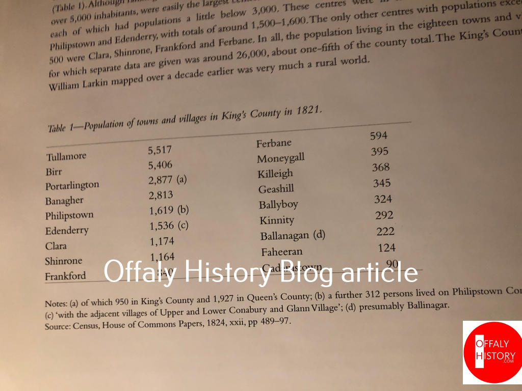
Table 2: The published abstracts of the 1821 Census for County Offaly contain the following for the population, no. of families and no. of houses in each town.
| Offaly Town | Persons M F /Total | Families No. of | Houses INH. UNINH. BUILDING |
| Birr | M – 2,531 F – 2,875 T – 5,406 | 1,200 | 974 67 1 |
| Tullamore | M – 2,540 F – 2,977 T – 5,517 | 1,360 | 955 43 – |
| Banagher | M – 1396 | 523 | 427 24 – |
| F 1417 | |||
| T 2813[1] | |||
| Edenderry | T 1536 | 270 |
Tullamore had 1, 360 families but only 955 houses. The population of Birr and Tullamore increased by about 800 to 6,300 in 1841 as did Birr while Banagher remained the same at 2,827 in 1841.